
December 2023
4 days in and still waking at 4am 🤦🏻♀️but I won’t let that stop me, perhaps just slow me down a little lol.
Boxing Day, or St Stephens Day as they call it in Ireland, was a beautiful morning to be heading back to the airport to pick up my rental car and head north. As always, I wanted to make sure I had plenty of time so went to get the 8.15 bus – which never came 🤦🏻♀️so it was a good job I was not in a hurry. I did just have to stand on the side of the road in 4c for an extra 40 minutes waiting for the next one!
Actually, its not entirely true that the bus did not turn up. There was an AirCoach parked up near the bus stop but no driver – perhaps someone had a big night the night before!
When the next bus came it said it was full – still no explanation as to what happened to the previous bus! Thankfully I managed to get one of the last seats and finally made it to the airport. But the fun was not yet over for the day. I joined a long slow queue for my rental car pick up, to be told when I finally made the front of that queue that I needed to go somewhere else and to go wait outside for the shuttle bus 🤦🏻♀️! And guess what – then join another queue!!!
Finally, I was in my car, and after a short amount of time getting use to it (remembering to change gears and to stop turning on the windscreen wipers instead of the indicators lol), I was glad to get out of the city, passing through some small towns and beautiful farmlands. Sadly, no photos as I am now driving.
I had not expected a border crossing when going from the Republic of Ireland to Northern Ireland, but I expected at least a sign!! But there was literally nothing, just a sudden and subtle change in speed signs from kilometres per hour to miles per hour! It was all rather odd, and it was clear that not everyone got the subtle change as they continued driving at 60kph and not 60mph – that is not such a subtle difference lol.
It was around 3.5 hours drive to my first stop of the day – Londonderry, or Derry as it seems is the preferred name. It is the only remaining completely walled city in Ireland sitting on the banks of the river Foyle. The walls were built in the early 1600’s as defenses and they were never breached! Still today it provides a walkway around the entire inner city.
As with the rest of Northern Ireland, the history of Derry is complex and it is considered one of the oldest continuously inhabited places in Ireland, dating back thousands of years. From the Tudor conquests in the early 1600’s to the Irish Rebellion later that century, the city became an important port for Irish emigrants leaving for the new world in the 18th and 19th centuries.
The Irish War of Independence between the Irish republican Army (IRA) and the British Forces ended with the partition of Northern Ireland in 1921, before and after which, sectarian violence raged. I will go in to this a little more in when I write about my time in Belfast where I took one of the political tours to learn more about the partition and later the Troubles. The result of the Partition of Ireland was that Derry suddenly became a border city.
The city and its port (one of the key reasons Britian wanted to maintain it during the partition) played an important role for the Allied navies as a base and jumping off point for shipping convoys between Europe and North America.
Now that is probably enough of a history – or perhaps too much? Unfortunately, given it was a holiday, I could not get a walking tour, so I had downloaded an online one. It was ok but an in person one would have been better.
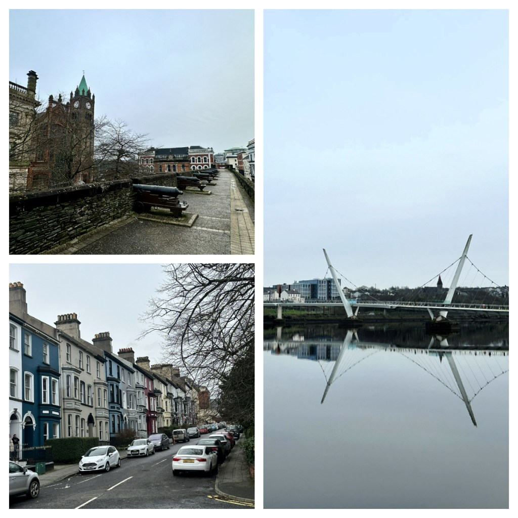
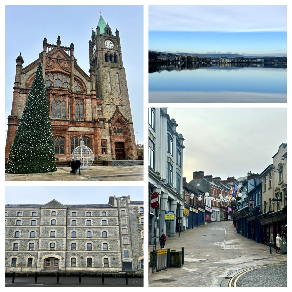
The walk took me passed the Guildhall and along the river Foyle, passed the Peace Bridge which opened in 2011. The guide talked about the importance of textile industry and shipping to the city (see the brief history above) with stops along the way to see monuments to the shipping industry, Manannan Mac Lyr, the Great Northern Sea God in Celtic mythology and those who left from here in search of a better life.
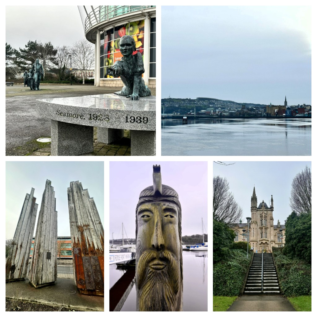


I continued up the hill, passed the some of the buildings of Ulster University and back down to the city walls and back to my car. As I drove out of the city, I passed the famous “Free Derry corner” in the Bogside neighbourhood. Between 1969 and 1972, this was a self-declared autonomous nationalist area (which they barricaded off from the security forces) and was the site of the Battle of Bogside in 1969. It was also the site of the 1972 riot when 14 unarmed civilians were killed by British paratroopers – the event known as Bloody Sunday.
By this time, it was almost 3pm and the darkness comes early here, particularly on these overcast days, so I hurried as quickly as the narrow country roads would allow to my next stop – the Dark Hedges. Described as an avenue of beech trees, it was made famous when it appeared in Game of Thrones. Firstly, I will say, it looks nothing like the images I had seen online, and I did hear some comments on the radio that they think it will disappear within the next 15 years if nothing is done to preserve it! Not sure I would have said it was worth the detour, but my FOMO (fear of missing out) would have got the best of me if I had not gone and seen it for myself lol.

It was really getting dark now as my final 30 minutes driving for the day took me along more narrow country lanes with no streetlights, definitely not my favourite driving conditions but I guess I had to be grateful that it wasn’t raining!
After a long, cold day (I don’t think it has got above 5 degrees all day) I had hoped to get something warm to eat in the local pub in the village of Articlave where I was staying. Unfortunately, even though they were open, they were not serving food so I headed straight to my AirBnB and enjoyed a bougee cold dinner of mozzarella and prosciutto which I had bought in Dublin. It was a comfortable house and nice room, and I had a great night’s sleep.
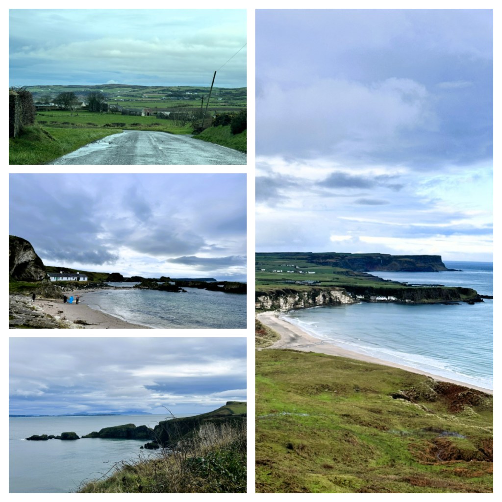
Over night it had rained and rained (I believe from Storm Gerrit who was ravaging the UK) and after fighting the household cats for my breakfast, I was back on the road, splashing through surface flooding to drive the Causeway Coastal Route – the coastal road between Derry and Belfast.
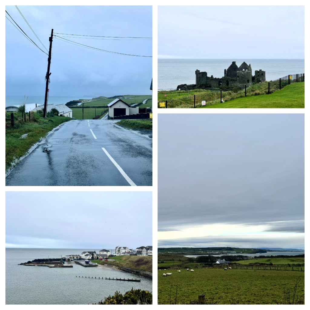
My first stop was at Dunluce Castle, a 16th/17th century castle built on the site of a 13th century fort. The castle has had a colourful passed, being the home of Scottish chieftains and Irish ‘royalty’ and has been subject to a number of sieges, Sadly, it was left to ruin in the late 1600s when the Earl of Antrim moved on. Unfortunately, the castle was closed so I could not explore, but you could still get a view of it from the car park.
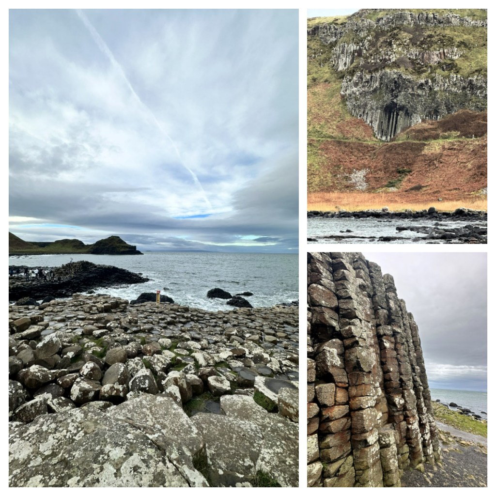
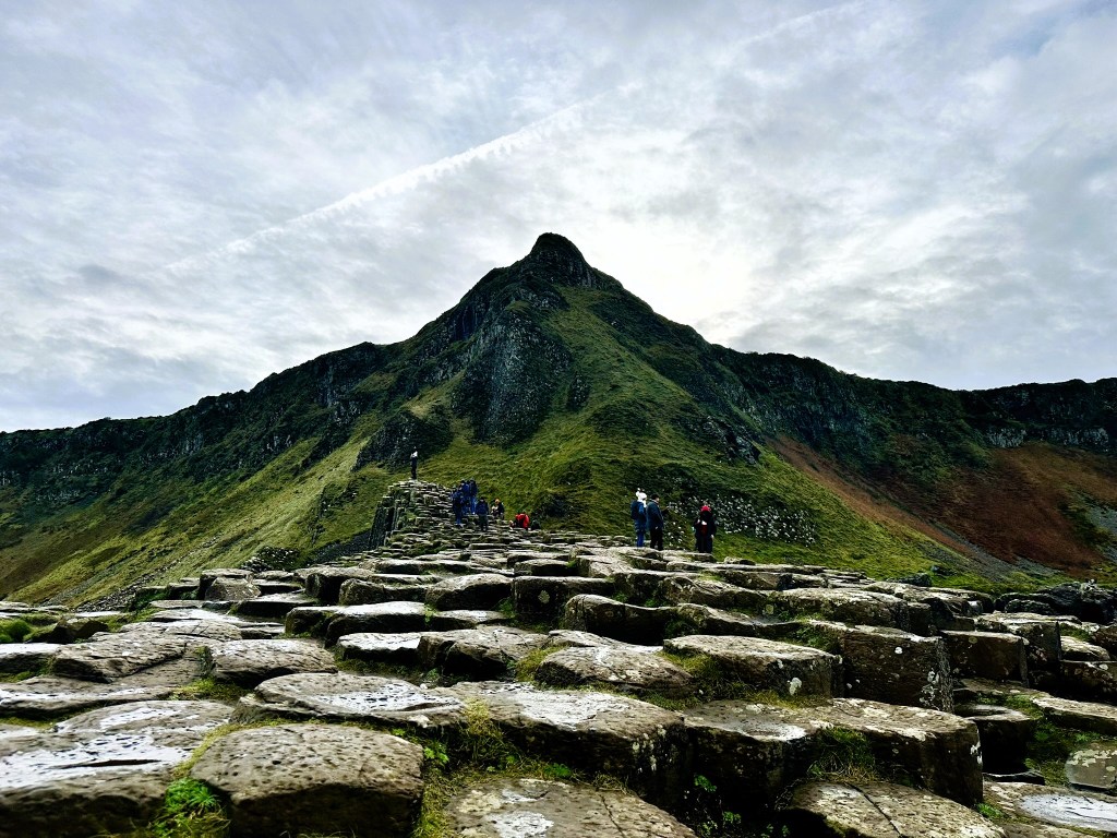
From here I took a quick detour through the cute seaside town of Portballintrae, before reaching one of the main sites for the day, the Giants Causeway, a UNESCO World Heritage site (Natural Landscape) which came to fame as its portrayal in Game of Thrones (I have never watched the show but wonder if I should give the number of filming sites I have been to!)
The guided tour that is part of your entrance fee starts in the information centre, and from here we walked down the road toward the causeway as our guide regaled us with information about the geology and the myth of the area.
Geologically speaking, the 40,000 black basalt columns, are thought to be around 60 million years old, and the result of tectonic plate movements and successive lava flows. There use to be over 60,000 columns but they were quarried in the early days and can be seen in buildings around the area, such as Dunluce Castle. The site was declared a UNESCO World Heritage Site in 1986 (the only one in Northern Ireland) and it is one of Northern Ireland’s most popular tourist sites. Thankfully be the off season it was not too busy (they sometimes get 7,000 people visit in a day).

Now, there is the geological stories of Giant’s Causeway, there is also the legend of the infamous Finn MacCool. The Irish take their mythology very seriously and much of it dates back to pre-Christian Ireland one of these is the mythical giant Finn.
When Finn’s beloved Ireland was threatened by the Scottish giant Benandonner, he tore up the Antrim landscape and threw its pieces into the sea, resulting in a pathway across for Scotland. When, Finn recognised just how strong Benandonner was, he made a hasty retreat back to Ireland where he disguised himself as a baby. When Benandonner arrived at Finn’s house, he saw the huge baby and was terrified to think how big Finn must be if this was his baby – it was now his turn to flee, destroying as much of the Giant’s Causeway as he could on his way back to Scotland. And of course, that is how it got its name.
From the Giant’s Causeway, I continued along the coast, taking a another short detour in to the picturesque town of Ballintoy Harbour, apparently another Game of Thrones filming location and stopping along the way at viewpoints (the beauty of doing this independently rather than with one of the many tours is that I can stop wherever I want!) until I reached the next stop on the route – Carrick-a-Rede.
Carrick-a-Rede is a rope bridge that links the mainland to the tiny island of Carrickarede. The rope bridge was first built in 1755 by Salmon fishermen who used the island as a base for the Salmon fishing season. Of course, the build has been rebuilt many times over the years and today the 2008 built bridge, meets today’s health and safety requirements. Sadly, due to the decline of the local salmon population (due mainly due to pollution and overfishing), 2002 saw the end of the salmon fishing industry in the area.

It was around a kilometre walk from the car park to the rope bridge, which is only around 20m long, but sits around 30ms above the exposed coastline. As it was the low season, it was fairly quiet, and I can only image how long you might have to wait to cross in the summer. As it was, it still took some time to get across, waiting for the group in front of me to take their photos/videos and then for the assistant to help someone across who had frozen just a few steps out on the bridge! 🥴
After the torrential rain of the night before, it had turned in to a beautiful day for my drive – a moody sky but no rain when I was doing my outdoor activities. I was very fortunate!
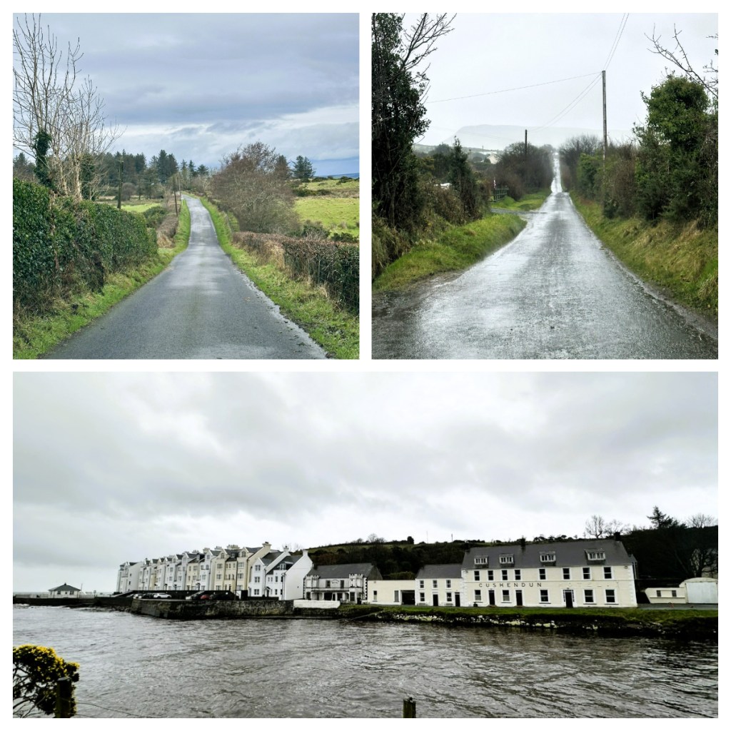
I took another detour down a very narrow windy road to follow a sign to Kinbane Castle. Built in 1547, what was a two story castle has been left for ruins after numerous sieges by the English and the raging weather. When I reached the car park and saw the steep narrow pathway down the side of the cliff to the castle – I decided to enjoy the stunning view from the top 🥴🥴.
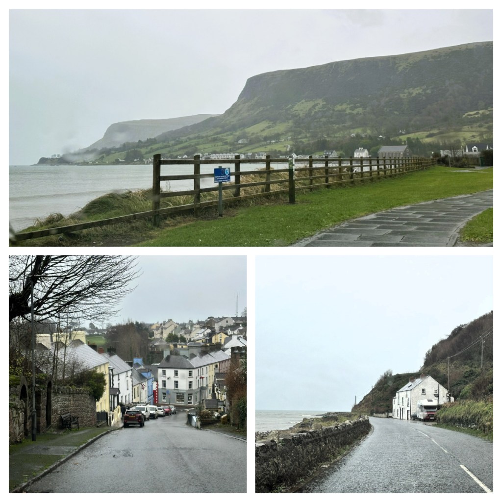
I had hoped to have a break at a café in the small town of Cushenden but unfortunately, as with many things, it was closed so after a quick photo stop, I continued. The weather had started to deteriorate by this point, and I continued to question some life choices as some of the roads google maps took me on where barely roads in my opinion 🥴. The dodgy road took me back to the coast and it continued right along the sea front. The narrow road was covered in debris from the storm overnight and still had some surface flooding. In fact, my final planned stop was literally washed out as the road was shut and the detour was another 20 minutes, so I decided to call it a day and head for the Belfast (still on some dodgy roads until I finally hit the motorway with some relief).
After a long but successful day, I made my way to the Airbnb I had booked in Belfast. Unfortunately, I was not keen on the area or the set up so I decided to book myself a hotel … the cost was worth a comfortable couple of nights, so I treated myself. I was exhausted after another beautiful, busy day so was happy to be having somewhere comfortable to rest and relax to recharge.
