November 2021
Another morning of no sunrise 🤦🏻♀️ but at least this time I did not even have to get out of bed to see it was not going to happen 👍🏻. It was a beautiful peaceful night, with the sounds and smells of the sea on my ‘door step’. That was until just after 6am when the traffic from the nearby road started building.
A little later in the morning I joined the traffic on the short 15 minute drive to the city of Gisborne. I should note that there is no mobile phone reception at the campground, great wifi, but no mobile reception. But drive just a couple of minutes over the hill to the next bay and the reception is back. Also just over the hill was a beautiful long beaches with lots of surfers on the water.

Not surprisingly, even in that short journey I stopped a couple of times, including a stop for brunch at Zephyr in the small beachside suburb of Wainui. It had been recommended by the campground and had a great chilled laid back vibe. The food and coffee were great too. I was surprised how many people were there (and not working) on a Thursday morning 🤔. The sun was just starting to push through and the beaches in the area were beautiful.
Gisborne, or Gizzy as it is affectionately know is a small city with a population of around 40,000. It is also know as Tairāwhiti, which means the light shines on the water .
The area was first populated by Polynesian voyagers over 700 years ago and subsequently Captain Cook when he landed with a party of men in 1769. Sadly, as with many landings of these early European visitors, it resulted in the death of a number of the already settled Māori. From these humble and somewhat tragic beginnings, the settlement of Turanga grew up on the banks of Tuanganui River, initially settled by European traders and whalers. The town was formally laid out in 1870 and the name was changed from Turanga to Gisborne (after the colonial secretary of the time), apparently to avoid confusion with Tauranga.
This first visit also lead to the Captain Cook calling the region Poverty Bay, as they had to leave with no provisions after the deaths of the local Māori – he wrote “Because it afforded us no one thing we wanted”.
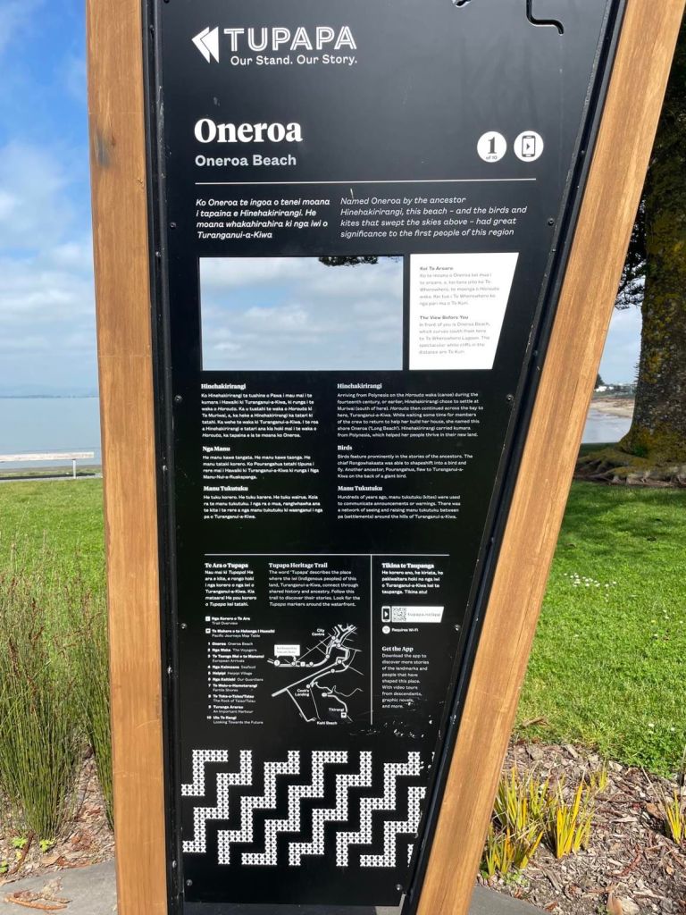
I walked along the Tupapa Heritage Trail. The physical information panels, along with the accompanying app gave me a great insight in to the history of the area. It was a lovely and informative walk, along the wide broadwalk that ran along the seaside and then down along the river. The beach was full of debris, showing the full force of the storms the week before.

As is normal for me when I walk, my mind wandered as I thought about what I was seeing …
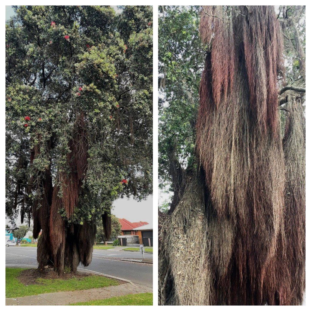
Did you know that some Pohutakawa trees have “beards”? These are actually matted clumps of aerial roots. Typically the appear in trees growing on banks and rocky cliffs where the “beards” can search crevices for additional soil and moisture (although in reality they rarely reach the ground). It is also believed that only some species or in fact hybrids grow these. It has certainly been common in many of the trees I have seen in the region.
I also started to consider if the fog/low cloud that had been around the last few days was actually “vog”. I had seen an article in the news about there being vog in the region. More often seen in Hawaii, vog is smog or haze caused by volcanic dust and gases. As I had seen further up the coast, Whakaari/White Island is always active and in fact, I had had a whiff of sulphur the day before when I started the Cook Cove walk🤔🤔🤔 Just some of the things I wonder about when I wander lol.
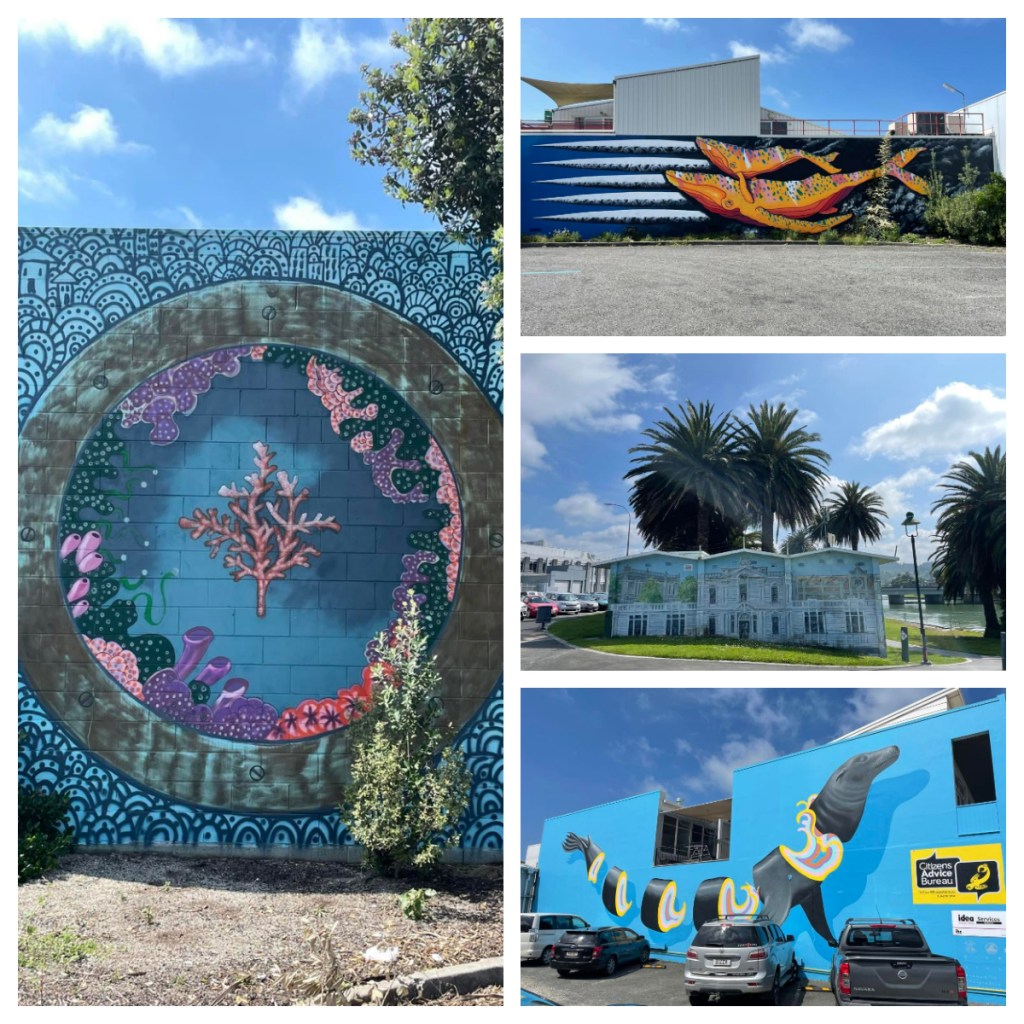
I actually combined the Tupapa walk with a Street Art walk (with a leaflet I had picked up at the Information Centre) and enjoyed looking for the beautiful pieces around the town centre, all created by local artists.


The last part of the Tupapa walk was across the river and I was not keen on such a long walk (across the river and back) so I drove to the other side. I had planned to walk up the small hill to the local view point, but could not find anywhere to park so kept driving around to the small bays around the coastline.
I did find parking on the way back towards town so I stopped and made the short walk up Kaiti Hill in Titirangi Reserve – more stairs that almost killed me 😂. Nice view though so probably worth the effort (and there was finally a Pohutakawa in bloom)!
The small parking area was right by Puhi Kai Iti/Cook Landing National Historic Reserve. A small reserve commemorating both the first landing of Cook in 1769 and the Horouta and Te Ikaroa-a-Rauru wakas. These stories are told through beautiful sculptures and interpretation panels. There were also 9 poles in remembrance of the 9 Māori killed by Cooks crew during that first landing. I had no idea this reserve was there and I was so glad I took the time to head across the river.


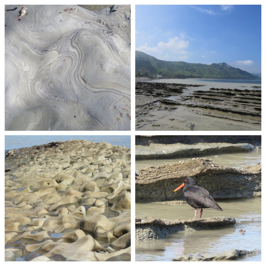
After a quick stop at the supermarket, I headed back towards my beautiful tent, stopping at Makorori Beach to eat lunch whilst watching the surfers in the bay. Back at camp, I spent the afternoon enjoying my waterfront view (and watching sea kayaks battling out through the channel and current) and exploring the very cool rock formations at low tide. Nature is a wonderful thing.