

(August 2020)
On my last trip to the West Coast of the South Island I headed south to the glaciers, on this trip (this time solo) I headed on the road less travelled – heading north to Karamea, the northern most town on the road north.
It was going to be a long driving day for me on my own, so I headed out early which isn’t always a great idea as I went through a couple of areas of thick fog before heading into the mountains and through Lewis Pass. I made sure I had a few stops to keep fresh, firstly in the small town of Reefton for some lunch and then again as I passed through Buller Gorge – made friends with a weka who clearly was after food (people must feed it the way it came running up to me 😔). My final stop was another quick one in Westport before the final 1.5 hour drive through tiny towns (as with many of the west coast towns, many were once booming mining towns) and windy narrow roads.


After a total of about 5.5 hours of driving, I reached Karamea (population 700) and checked in at my cute Air BnB cottage in time for a nap (driving is exhausting you know) before heading down to the beach to find a sunset spot. Back on the rugged west coast and I have the beaches to myself. Talk about social distancing at its best! Probably worth noting, New Zealand had had a community outbreak of COVID-19 a few days early. Thankfully (for me) it was in Auckland, but in response the city had quickly been moved back into Level 3 (of the NZ Covid response) and the rest of the country into Level 2. I was grateful I could still get away and had checked with the Air BnB hosts that they were ok with me still coming and to be honest, my whole trip was pretty much planned to be completely solo with little interaction anyway.


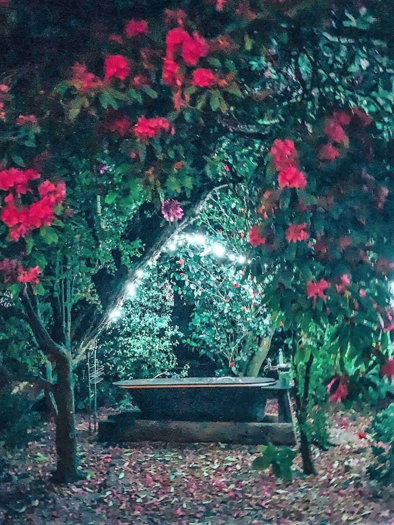
I had planned to end my day with a soak in my outdoor tub but unfortunately the lights around it were not working 😠 – I contacted the host and they had promised that they would be fixed for the next evening, as it was one of the main reasons for booking the accommodation. (It still looked pretty in the daylight without the lights.) FYI, I will travel for lots of reasons, outdoor hot tubs are one of them lol.

I thought the windy roads between Karamea and Westport were tough going, but they were a walk in the park compared to the road I had to take into the Ōpārara Basin in the Kahurangi National Park. The road was unsealed and one lane in many areas, oh and don’t forget all the blind corners! Thankfully, I only passed one car on the way in.
Kahurangi National Park is New Zealand’s second largest national park, and one of the newest, created in 1996. The area has massive importance due it its diverse flora and fauna, as well as it’s ancient geology. Incredibly its flora is the most diverse of any national park in the country!!
I came to the Ōpārara Basin to see some of the 25 million year old limestone caves and arches but was met by beautiful bird song as I set of on the short walk to the Moria Gate. The bush here was like a primeval lost world (being far enough north and low enough altitude to avoid the worst effects of the more recent ice ages) and the track had sections where hanging moss covered everything around the track and with the winter morning sunlight filtering through the trees it was stunning. I was the only person on the track, and I loved it!
There were weka running around on the track, completely unafraid but probably trying to suss out what they could steal from me 🥴. I have early childhood memories of thieving wekas (stealing shells we would leave outside) so they always bring a smile to my face. I then had a visit from my first South Island robin, I was so excited I high-fived myself (so sad I know but hey, there was no one else around).

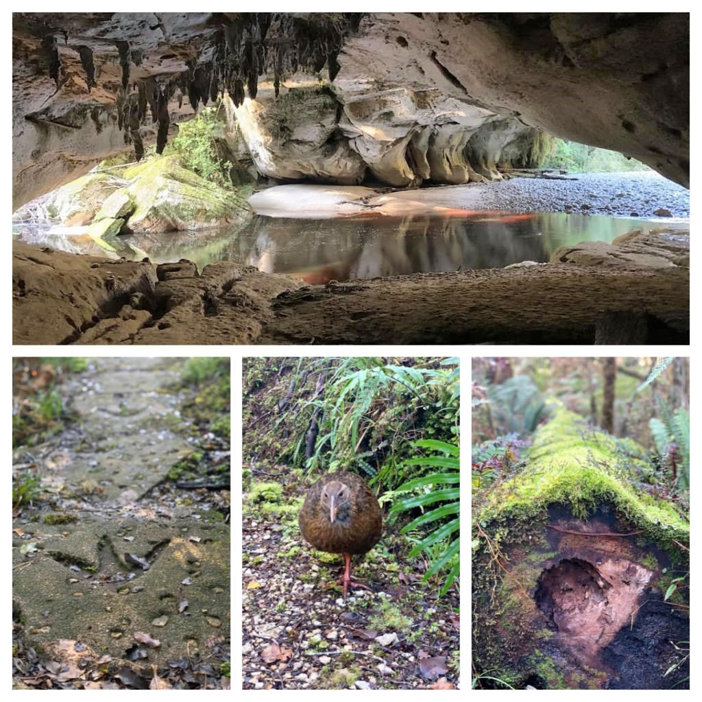
The Moria Gate arch was well worth the scramble through the cave to get under it – oddly named back in 1984 after the gate in the Lord of the Rings trilogy – I have not read the books so I can’t comment on the similarity lol. That aside, it was stunning, with tannin filled water – that is water that basically looks like tea from minerals leached out of the soil and stalactites hanging from the ceiling.

Back out on the tracking, they have cute Moa footprint stepping stones on part of the track. Moa used to live in the area, and you can see bones in some places (although I sadly did not spot any). Just in case you are not familiar with them, Moa are extinct cousins of Ostrich who used to roam New Zealand up until about 500 years ago. There were numerous species, the largest of which could get up to about 2 metres in height!!! I can only imagine what it would have been like to bump into one of those on a bush walk? lol
The walk to the Moria gate was only a short one but not surprisingly it took me much longer than it was supposed to as I keep stopping to listen to the birds and study the moss growing on the trees 😂. No problem, I had all morning.
The next spot on this short walk was the ‘Mirror Tarn’. Now I was not sure what a tarn is, but I found a spot by the river where there was an incredible reflection. There were no signs and it was not exactly on a track, more of a well-worn path – but nope 🤔 – it was not the Mirror Tarn which was further on the track but nowhere near as good as the first one – maybe still not enough sun?

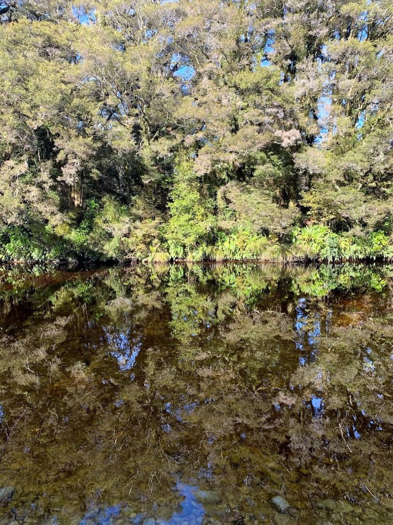

It was still nice, but I wish they had a bench or two at the nice spots so I could just sit for a bit and I needed to be careful of not trying to step out too far as the track just turned in to bog and then ‘tarn’ 🥴 (which turns out to be a small lake).
As I neared the end of the track a helicopter shattered the peace – they were bringing in rocks to extend the track, so you don’t have to walk along the road back to the car park. The workers seemed shocked to see me 😂.
Not surprisingly there was no phone reception in the area and in this scenario I use Maps.me. As long as you download the required maps when you do have Wi-Fi/reception, it has all the walking tracks as well as roads so I could see where I was at any time. I also used it a lot when travelling abroad (back when that was a thing) I did not have coverage.
The next track I took was to the Ōpārara arch. It was not such a good track – with some stairs, some muddy parts and some track maintenance going on. My map seemed to show a look out past the arch but there did not appear to be any marked path, so after making a couple of attempts to go further I gave up on the rocky, slippery track! I spoke to a couple of the track workers who said I had gone as far as there was to go.


The Ōpārara arch is much bigger that the Moria arch (200 metres deep, 49 meters wide and 37 metres high) but as you can only go in halfway, you can’t really see the full effect like the other one. It is reputed to be the largest limestone arch in Australasia so definitely worth the short walk, particularly when you are joined by a couple of cheeky robins – they always make everything worthwhile.
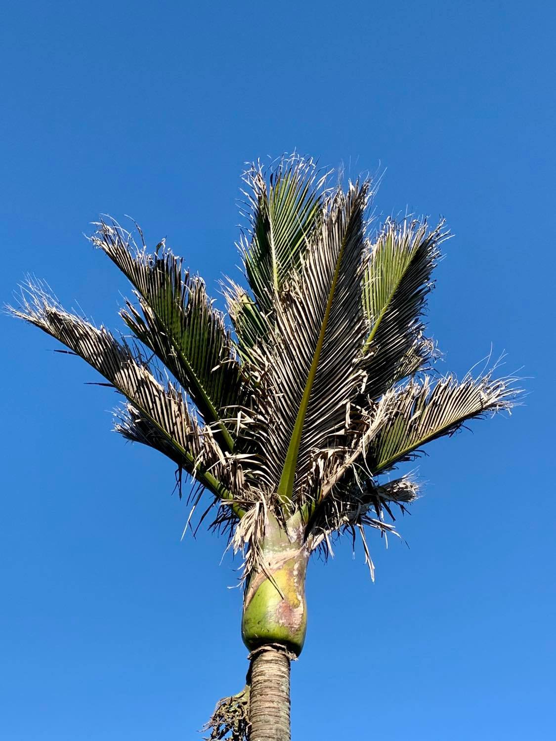
And so, from bush to beach and I headed to back to the sea and then headed north to the end of the road – as far north as you can drive on the West Coast. It was an amazing drive as the road turns in to a dirt track, lined by wonderful Nikau palms. At the end of the road is where you find the start of the Heaphy track, one of New Zealand’s great walks.

It was beautiful and warm by this time, despite being mid-winter and there were a few more people around (I mean like 5 people rather than the 2 I had seen in the morning lol) and about a gazillion sandflies 🤦🏻♀️.
I had decided to walk a short part of the Heaphy track (about an hour) to a beach called Scott’s Beach and after I had seen it from the lookout I could not get there fast enough – the 30 minutes seemed to take forever – I kept looking at my watch am asking myself was I there yet? lol
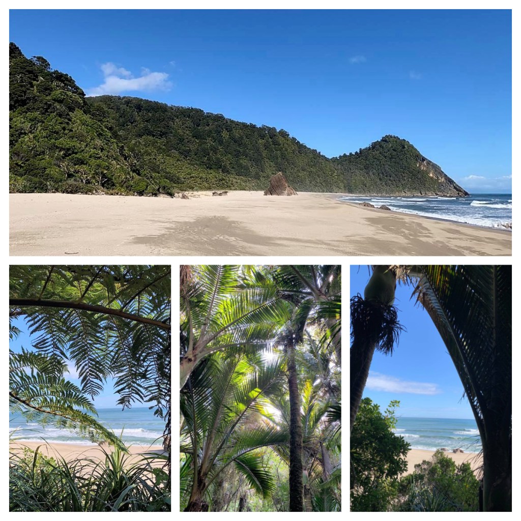
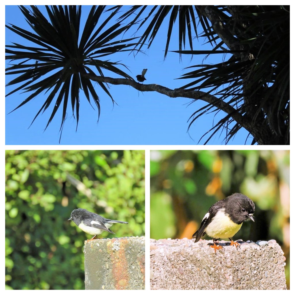
I spent a little time at in the picnic area near the beach, taking Miromiro (or Tomtit) photos and eating my scrogen (normally a mixture of nuts, dried fruit and small bits of chocolate to give some energy on hikes, though my was more just a bag of chocolate with a few nuts 😂)!! I sat there till the sandflies got the better of me and I walked back through the Nikau Palm walk – although you can find Nikau palms all over the place on the coast it real gives a real tropical feel and smell – I just love it.


Back at the car park/campground I sat at a bench to finish my lunch, closely watched by a weka – clearly the lack of mobile reception in the area means they had not received the COVID level changes and 2m social distancing requirements lol.
Public Service Announcement: As I was spending the day on my own, in areas of no mobile reception, I made sure I had all weather clothing, some snacks and that my partner knew exactly where I was going and when I expected to be back just in case I had an accident of some sort. Despite its beauty, the wilderness can also through you a curve ball when you least expect it, so it is important to be prepared for all eventualities.
I drove back to Karamea and stopped to check out a statue on the way into the town – it depicts Maori chief Te Maia ‘riding’ a Hōkioi or Haast Eagle, the biggest eagle that ever flew. They had a wingspan of up to 3 metres and preyed on Moa (which I discussed earlier) amongst other things (including, allegedly, small children). They became extinct around the same time as the Moa.

The Hōkioi is the spiritual guardian of the Karamea estuary and the statue is of Te Maia Kahurangi – the man-eagle riding his Hōkioi ‘brother’. In a nutshell, Te Maia ended up resting in a Hōkio nest, next to its egg, during one of his long hot walks. When the egg hatched, he helped raise it and they became ‘brothers’ and it learnt to fly with Te Maia on it’s back, regularly flying around the area.
Back at my cottage and the tub lights had been fixed and I managed to get a 30 minute soak before the rain came down! But believe me it was a magical 30 minutes under the lights and the beautiful flowers, listening to the Wekas calling in the distance.
The next morning and I was back on the road, heading back south towards Westport, Museum in Westport. It’s hard to believe the how busy all the small towns I had just driven through used to be!
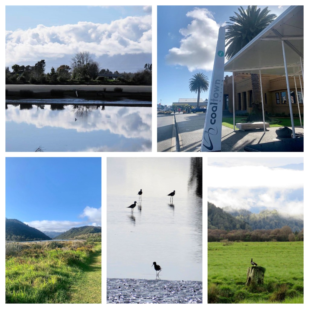
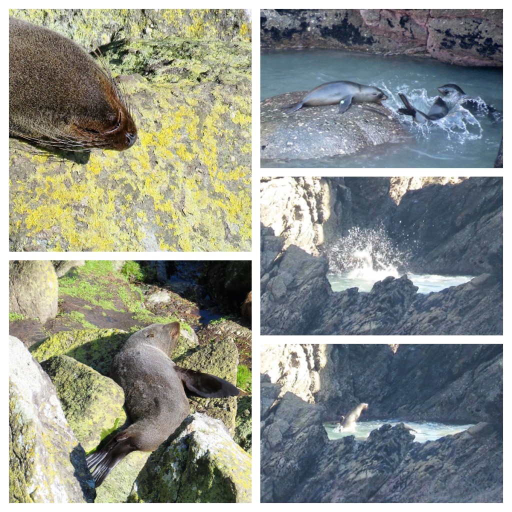
Just south of Westport and I made my way up to the Lighthouse at Cape Foulwind (named by Captain Cook due to the atrocious weather that obscured it from his view in 1770). There is an easy walk from the Lighthouse to the seal colony at Tauranga Bay, but I decided just to head up to the Lighthouse from one end and then drive to the other end and walk into the seal colony from there. It was a beautiful day and a beautiful track, and I was remaindered, yet again, what a beautiful country I am lucky enough to call home.
I spent some time watching a few seal pups playing in a small pool just below the track, as the adults lazed in the sun, but a fellow walker pointed out a group of young seals in a pool on a small offshore island and I am so glad she did. They were going crazy, jumping and diving and splashing about. It was just at the limit of my camera zoom so there are no good photos, but I could have watched them playing for hours.

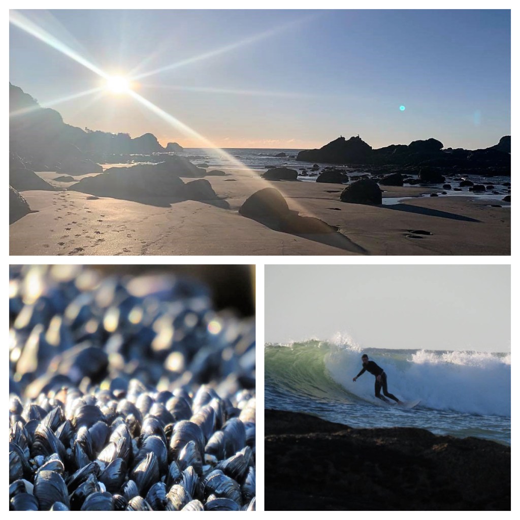
Of course, I could not watch them for hours as I had to drive a little further down the coast and check in to my next Air BnB cottage – and it was amazing. Just a small, but perfectly formed studio room with a view out to sea. I had a quick walk on the beach, stopping to watch a couple of surfers before returning to my room to enjoy the sunset from my deck with a glass of wine.

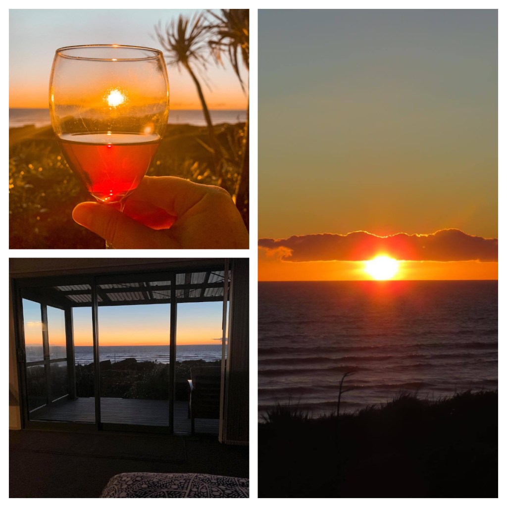

As the sun set, the sky filled with thousands of stars and the Milky way was clear. I had planned to try and take some star photos, but my camera was just not up for it. I had downloaded an app on my phone to try and take photos with that – the outcome was better than the camera but still not great lol. Despite the photography fail, it was amazing just sitting there in the darkness, listening to nature. The sea and the wekas calling (from somewhere very close). No light or noise pollution. (There are stars in this photo – honest lol)

The last day of my trip came around far too soon, and after a quick walk on the beach I was ready for the drive home. At the last minute (literally at the intersection) I decided to take the southern route home which would take me along the Great Ocean Road and through Arthur’s Pass. The route should have only taken me 10 minutes longer than the northern route, but with all the stops that was not the case 🤔😂
The diversion was definitely worth it as I got to stop at the Truman track. A short track just off the road which takes you down to an amazing hidden beach. Incredible rock formations and a small waterfall which was practically its own little ecosystem – oh and don’t forget the sandflies. It was hard work working through the thick lay of tiny stones, but it was worth the effort – particularly when I saw penguin tracks.


I made another quick stop at Punakaiki to see the famous Pancake Rocks without the bus loads of international tourists and then on through the mountains (passing some great reflections in the alpine lakes) and homeward bound.
