Greenland – you saved the best till almost last

Disko Bay & Ilulissat

September 2024

Our next stop was at Disko Bay, a large bay sitting above the Artic circle and we started on the island of Qeqertarsuaq (“Big Island”), also know as Disko Island.  The island is the largest island in Greenland, and has a population of around 850 people.  Once known as Godhavn or Good Harbour, it served as the political and economic capital of Northern Greenland, it’s economy being based around the whaling industry.  As the whaling industry collapsed, so did Qeqertarsuaq’s importance and the government functions were all moved to Nuuk.

This part of the country is now sea ice free all year round, this line used to be much further south, around Sisimiut.

Unlike the Greendland mainland, Qeqertarsuaq consists of volcanic rocks, mainly basalt which means the soil is much more furtile leading to the island being much more green and lush than the rest of the country.  It also provides some spectacular rock formations.

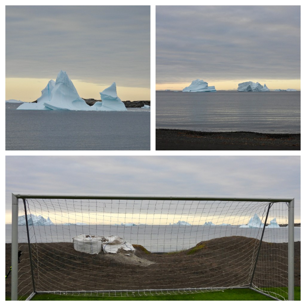
As we pulled in to the harbour of the small town I saw what I thought was hills/mountains in the background.  It was in fact icebergs, floating on the other side of the land 🤯.  So cool.

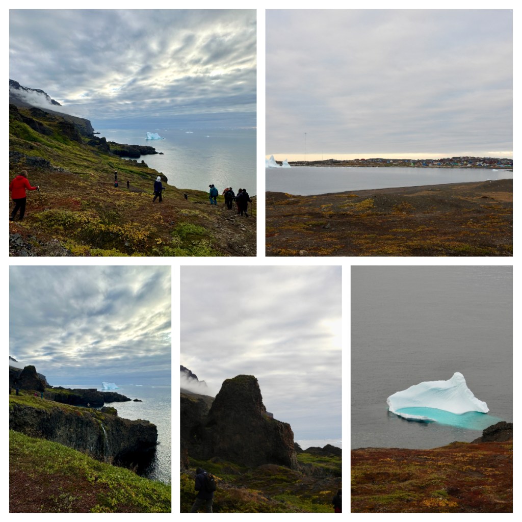
I had chosen to go on the long walk today, and for a change, it was fairly long.  We started by strolling through the small picturesque town and then out the other side, passed what can only be described as one of the coolest, if not the coolest football fields in the world.  Where else could you play a game of football and watch huge icebergs float by, just off the shore.

We then walked across a beautiful plateau and up in amongst the rock formations.  There was only one really steep part, and the rest was relatively easy, but WOW, what views.  From the high balsalt cliffs on one side, to the ocean and large icebergs on the other.  The landscape just blew me away I wished I could have more time.  As it was, I stayed out so long, I did not have time to look around the town and was actually in the last zodiac back to ship.  I must admit, the photos really do not do this place justice!

I decided to have lunch on Deck 8 today so I could enjoy the views of the icebergs as we sailed out of the harbour.  Finally a day where I felt like I earnt my lunch with a 10km walk!  The short journey took us around the side of the island to the area of Kuannit, where we had walked along in the morning. 

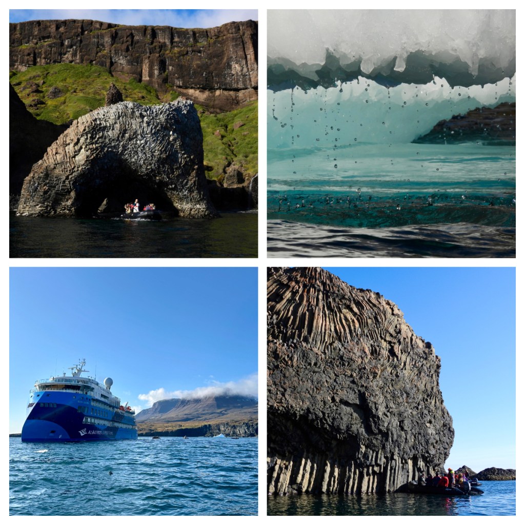
I had to wait until 3pm for my turn on the zodiacs this afternoon but it was worth the wait.  The landscape was spectacular as we zipped up the coastline and around (and in one case through) the icebergs.

As mentioned previously, Disko Island was formed differently, geologically speaking, than the rest of the country.   While the rest of Greenland is made up of really ancient rocks (billions of years old), Disko Island is relatively young, at only 60 million years old.  It was formed as the mainland was splitting apart from North America and is more similar to the volcanic rocks of Iceland.

There are lots of visible rock layers, including some red bands that are from lava flows which have become iron filled soil.  Where rock has eroded, basalt columns have been formed and the next lava flows fill in the gaps and cools to form the swirling patterns in the rock we see today.

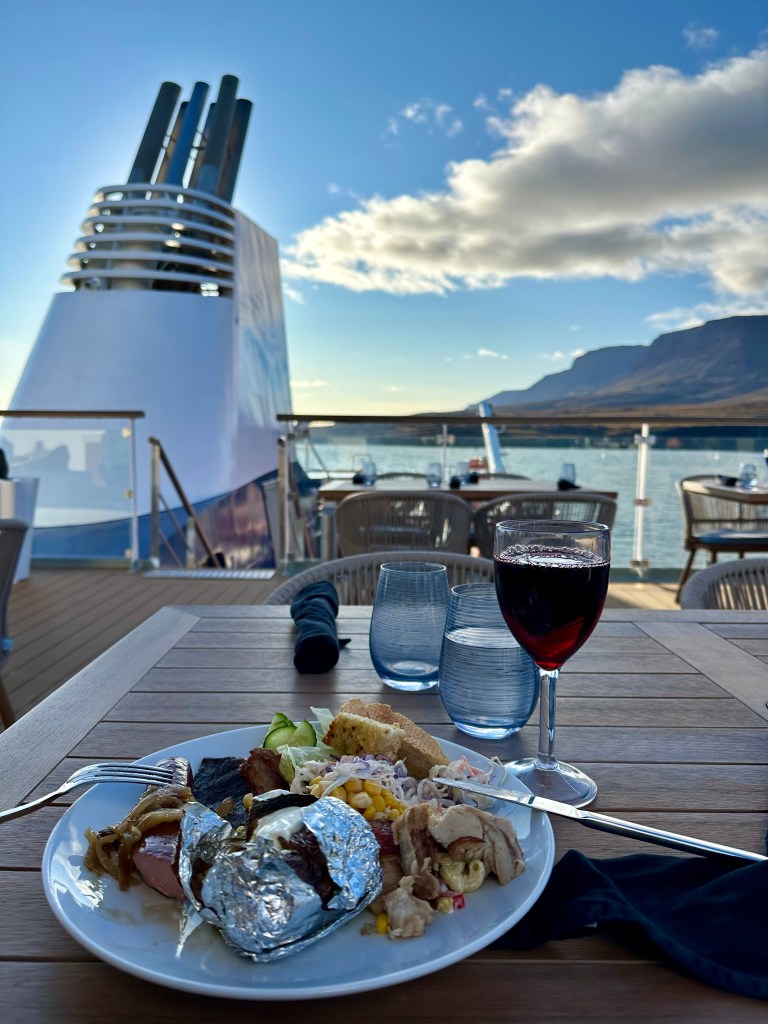
Back on the ship and I wish everyday was like today. To top it off, we had a BBQ dinner with mulled wine on the deck💚.  Greenland was definitely saving its best till last!  But wait, if I thought our day on Disko Island was amazing, the next day was possibly even better!

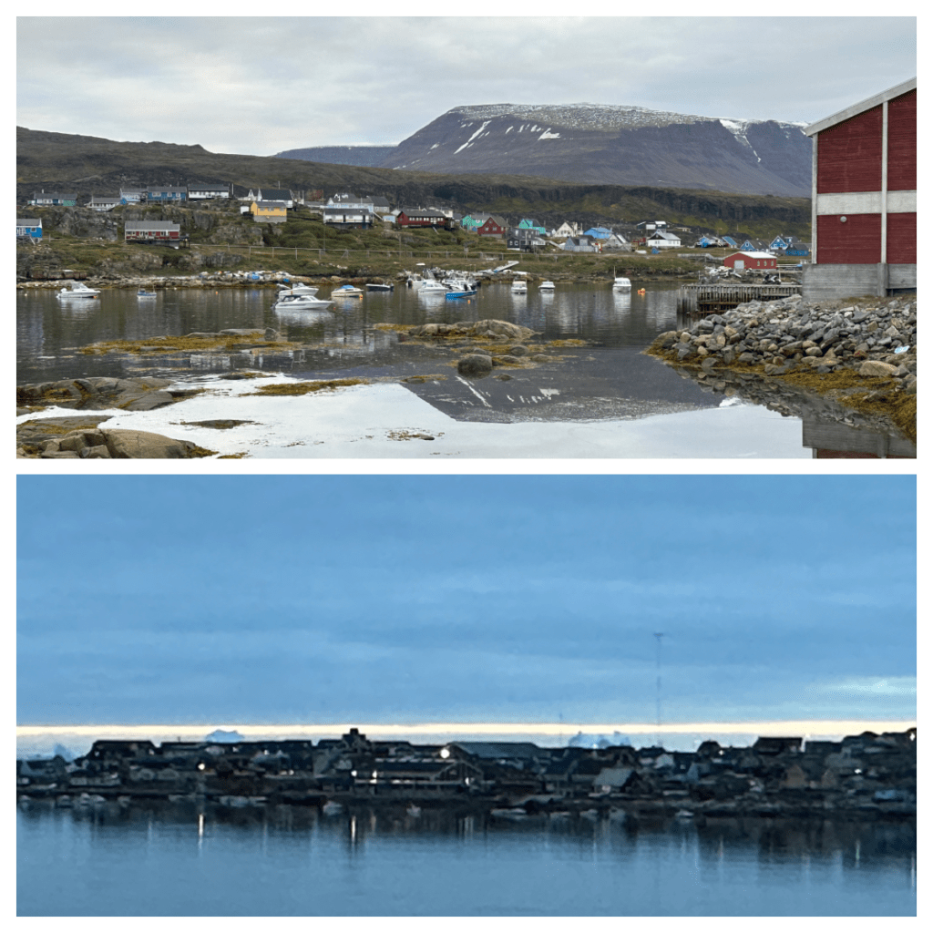
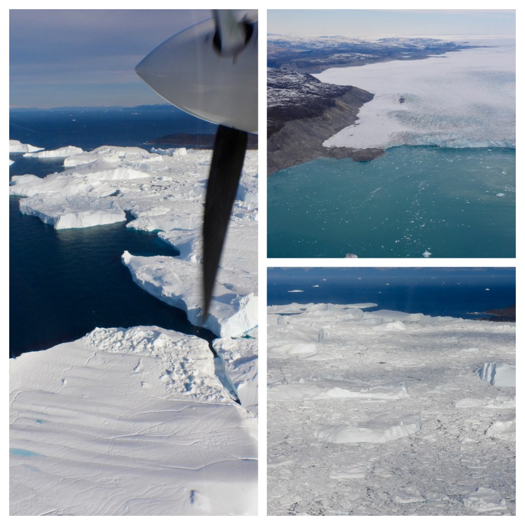
The next day saw us arrive offshore of Illulissat, 250km north of the Artic Circle, population around 4,500 and known as the Iceberg Capital of the World. In fact Illulissat is the Kalaallisut word for Icebergs!   The Illulissat Icefjord is the source of most icebergs in the North Atlantic and the most likely source of the iceberg that sunk the Titanic!

The Illulissat Icefjord is one of the few places the Greenlandic ice cap reaches the sea and has been on the UNESCO World Heritage List since 2004.   My plan for the day was to see it from the air, land and sea.

The Zodiac to shore was an assault on the senses as we arrived in to the harbour to the aroma of  fish and fat filling the air 🥴.  I am not a fan of the smells from the fish processing plant, but it has been the key industry here for 100’s of years.  Today, Tourism is catching up.

First up on my agenda for the day was a scenic flight over the icefjord and I was picked up, along with my 4 flight companions from the pier and taken out to the airport for our preflight briefing.  I must admit I was kicking myself for not coming out early for a walk around the town before my flight  … I think 10 days on the ship have made me lazy! 

We took off in our AirZafari Vulcanair Partenavia P68 airplane, with only 6 seats (including the pilot), everyone got a window seat, although my view was a little obscured by the propellor which appears in many of my photos lol.  The conditions were great, a little bumpy in the take off but smooth once we got in to the air. 

As we flew out of the airport and over the glaciers, our pilot gave us a few facts:

  • The Icefjord is 75km long from glacier wall to sea
  • It is 17km wide and the most productive glacier in the world

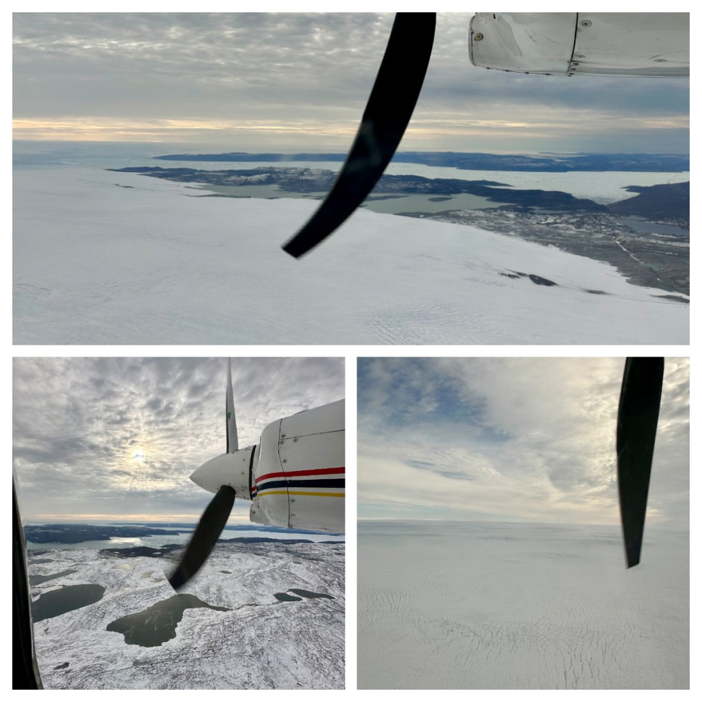
I could not stop taking photos – every time the light changed it was a different kind of beautiful 💚.   The flight was not cheap but it was an amazing way to see the glaciers and fjord full of ice and I have no regrets about splashing out on this.

After our short flight, we were dropped back in to town and I shared a taxi with a couple of my fellow fliers to the Icefjord Centre a short distance out of town.   I had to be back on the ship for 2pm for a boat trip so was a little concerned about being short of time to walk both ways. 

The Icefjord Centre is a stunning building, apparently shaped like a “twisted structure miming the wingspan of a snow owl”.  I am not sure I got that, but it certainly fitted in to the landscape that surrounded it.  Inside, houses an exhibition of the “tale of ice” but as I was limited for time I had to keep on the move. 

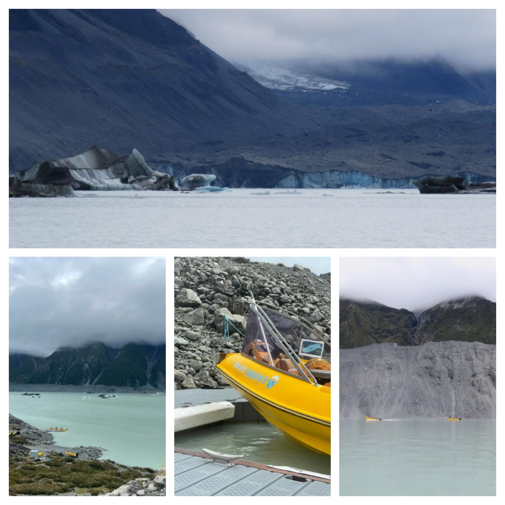
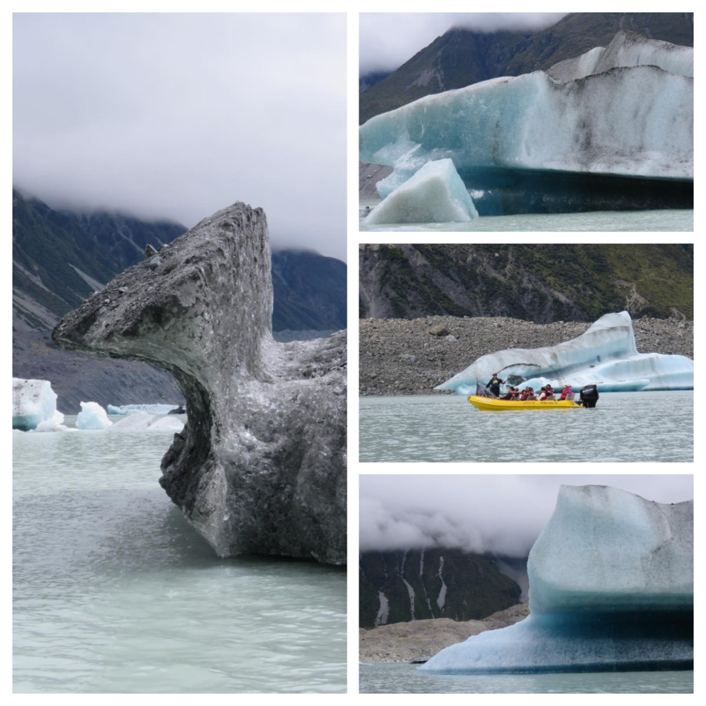
A boardwalk weaves it way down towards the sea and the stunning icefjord beyond.  Even from the centre, you can start to see the icebergs floating by, and every step closer just brings more spectacular views. 

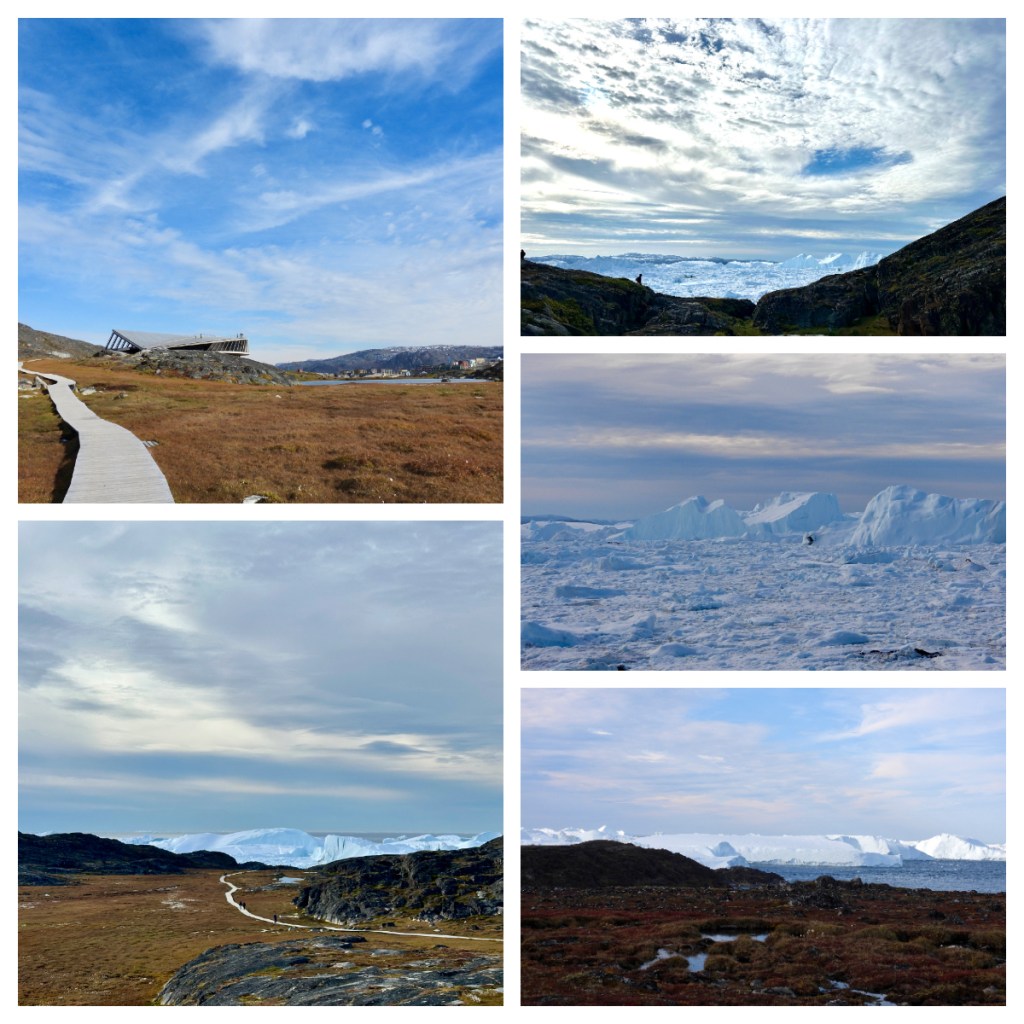
As with the flight, I took so many photos as every step gave me a different and equally impressive view.  The whole area was so well managed to protect the local flora while still providing the most amazing viewing opportunities of the towering icebergs.  Here we are seeing the icefjord at the point where it meets the sea and the pilot on the flight this morning had told us that the largest icebergs are so big they get stuck at the mouth of the fjord where it is shallower, and they sit there until they melt a little and can float free.  For this reason, some of the icebergs here are huge!

Unfortunately, as I was still rushing to get back in time for my boat trip, I could not loiter but I was pleased I go as far as I did and I still had a little time to walk down through town back to the pier.

I passed the dog kennels on the outskirts of town.  As with Canada, the working dogs are all kept together in an area outside of town, and it is also a way to keep them away from other breeds of dogs so not to contaminate their bloodline. Given that they are not far from the Icefjord centre, they could be heard load and clear!

Unfortunately, my trifecta of activities failed as I arrived back at the pier to hear that my boat ride had been cancelled due to the wave conditions. A real shame, but I was still thrilled to have seen the icefjord from air and foot.  After to speaking to someone who had been on one of the boat trips that did go out, I was grateful not to go as he told me it was so rough that they could not go outside the small cabin on the boat and people were throwing up!  Back on our stable ship, you would not have guessed it was that bad!

Another amazing day, and as we set sail south our evening briefing was interrupted as we passed the amazing icebergs – no one wanted to sit inside and listen when the views outside were so amazing!  💚

Mountains, lakes and stars

December 2021

This year’s annual Aunty & nephew Christmas road trip hit the road on the day after Christmas day.   My planning had been hampered somewhat by the closer of the New Zealand YHA youth hostels (another victim of the pandemic I assume).  I had booked to stay in youth hostels for the get away – 2 nights in Mt Cook Village and 2 nights at Lake Tekapo.  A month out from Christmas, it was a real scramble to try and find alternative accommodation and I could not afford 4 nights in hotels so settled for 2 nights camping and 2 nights in a hotel.  I had forgotten just how much extra stuff you need to take for camping!!

It was a lovely drive to our first stop at Mt Cook Village.  I had considered staying all 4 nights in at Lake Tekapo which was only just over an hours drive away, but I had envisioned waking up in the morning surrounded by the beautiful mountains and keas playing around me.

Mt Cook Village sits within Aoraki Mt Cook National Park, at the end of State Highway 80 and right at the foot of the tallest mountains in the Southern Alps.   There is a population of around 220 and all of those either work within the hospitality industry or in the national park itself.  You do have to be prepared as there are no shops here, just a couple of small cafes, a number of hotels/motels (many were closed as the country was still closed to tourists) and a Department of Conservation (DOC) campground. 

The clouds were building up as we drove down the shores of Lake Pukaki and in to the village and by the time we arrived at the White Horse Hill campsite it had started to spit with rain.  We quickly got our tents up (in a spot we had hoped was fairly sheltered) and as the rain was still light (and was forecast to get much heavier) we decided to take one of the many short walks in the area – the Kea Point Track.

The track meanders through subalpine grasslands and scrub and ends at a viewing deck with a lovely view to Mt Sefton, the Mueller Glacier Lake and the Mueller Glacier moraine wall. You can also normally see Aoraki/Mt Cook from this spot, but it was hiding behind the cloud.    The beautiful calm of the mountains was pierced by loud call of a couple of keas, circling high above.  (At least I can say I did see kea, even if it was from a distance).  Back towards camp the sun was still trying it’s best to push through (with varying success) but I did result to a lovely rainbow.

DOC camps are pretty basic – this one has no shower but a couple of small toilet blocks and a main block with a kitchen (bring your own camp stove)/dining room and bathroom.   With not much else to do in the rain, we spent some time in the kitchen, cooking our dinner – a camping favourite of what I call deconstructed nachos – basically baked beans (in this case a lovely smoky BBQ variety) eaten with corn chips and sprinkled with cheese, washed down with an enamel mug of wine – kiwi camping at its best.

It was a terrible night – strong winds and rain. Despite being in a relatively sheltered area, half the pegs were pulled out of the ground (the ground was pretty rocky and it had been hard to get the pegs out in the first place).  It was really a classic kiwi Christmas – torrential rain and 11c 🤦🏻‍♀️(of course you need to remember it is summer).

So, what do you do when you are camping at Mt Cook village in non stop rain??  Thankfully there is a great little museum (with beautiful stain glass windows) and at the Hermitage Hotel, there is the Sir Edmund Hillary Alpine Centre – another small museum and movie theatre where we enjoyed a couple of movies about the alpine search and rescue team and Sir Edmund Hillary and, most importantly, a café.

After a bad night in the tent, I had thought about trying to get a room for the night and asked at the hotel.  “Yes, we have a room they said, not too expensive – just $1000 a night 😂😂😂”.  No wonder they have a room, without international tourists who is paying this!!! We would just have to brave on more night with our $15 camping site.

Our second (and last) night camping was not as bad as the first, but I didn’t get my dream of opening the tent to a beautiful day in the mountains with kea playing … but at least the rain had stopped lol. 

As it was our last morning in the mountains, we had a 6am start to walk the Hooker Valley track.  Perhaps one of the most famous short walks in New Zealand, and if not, definitely one of the most Instafamous (i.e. famous on Instagram).  The morning was beautiful but moody, a little rain, a little cold but lovely.  

Our early start, the poor weather and the lack of tourists, all meant it was pretty quiet and we only past a few other people on our way to and from the end of the track at the Hooker Lake.  A beautiful glacier lake, at the foot of the Hooker Glacier (which we could just spot through the cloud at the end of the lake.  It was still so peaceful and beautiful, with small icebergs (broken off from the glacier) and the grey/blue glacier melt water.  Sadly we did miss the picture perfect view of Aoraki Mt Cook but I guess that is another reason to do the track again one day (I took some artistic license in the photo below lol).

Back at the campground (the Hooker Valley track starts at the camp ground) it was time to pack up the soaking wet tents before heading back to the Hermitage Hotel to meet our guide for our tour with Glacier Explorers.  

Glacier Explorers operate a unique tour to the Tasman Glacier Lake were we get on a boat to explore the glacier and it’s lake.  Interestingly, the Tasman Glacier lake is relatively new.  If you came here in the early 1970’s, there would have been no lake at all, but as the glacier receded, the melt water formed the lake up to the terminal moraine (which shows where the foot of the glacier was when the lake was formed). 

Sadly, due to the effects of global warming the lake is rapidly increasing in size as the glacier calves and melts.  In fact you can’t actually go to close to the glacier in the boats, in case a chunk of ice “calves” off the glacier and drops in to the lake. Depending on the size, these chunks of ice can then become icebergs floating in the lake for some time before they melt.  Some of the icebergs in the lake were huge!  Apparently it is one of the only lakes in the world that contains icebergs.

Probably worth mentioning that the Tasman Glacier is the biggest in New Zealand, stretching around 24kms long and with a depth of over 600m!!  It forms a vertical ice wall at one end of the lake – from the lake it towers around 30-40m high, it is crazy to think that the majority of the glacier depth is actually below the lake level – 100s of metres below.

Many of the icebergs were full of rock and sediment (which you also see on top of the low part of the glacier) and it was really interesting to learn about this incredible glacial landscape.  Every day on the lake is different as the icebergs move around the lake and twist and turn in the water.

Towards the end of our time on the water, the cloud finally cleared briefly and we saw a mountains around the glacier.  Thankfully the clearer sky stayed around long enough to see have a view of Aoraki Mt Cook from Mt Cook Village when we got back there – I was so happy to get to see her before we left.   For now, our time in Mt Cook Village was over and we headed back to Lake Tekapo and the joy of a hotel room for the next couple of nights.

The weather forecast was still not great, so we took advantage of some sun to walk around the peninsula and explore part of the area I had never been to before.   It had rained overnight and my shoes were soaked in the first 50 metres🤦🏻‍♀️ but it was a lovely walk, with many of those “instafamous” but pesky lupins in flower and looking pretty.

It was not easy to find the route with no real track and sometimes hard to find the markers even on the open farm land – and don’t forget to keep your eyes on the ground to watch out for sheep poo and rabbit holes.  Despite this, the views were beautiful to the north end of the lake and the mountains beyond who had popped out from behind clouds.  It truly was sooooo beautiful – the water was so blue it was hard to believe it was real.

Back in the car, we decided just to drive around a little, exploring the back roads and small dirt roads in the area.  We came across Lake Alexandria inlet, a small lake not far from Lake Tekapo with a few houses and a camp ground.  I was excited to find a crested grebe nesting site here.  Most of them were still sitting on eggs rather than cute chicks but it was still cool to see. 

I should probably mention, the Australasian crested grebe can be found in Australia and the South Island of New Zealand but in both countries are a vulnerable species so it is wonderful to see a breeding population.

From the inlet of Lake Alexandria, we then drove around to the other end of the lake where there was a small community of houses and again some camping areas.  It was so peaceful and despite being only 15C, it was sunny and felt much warmer.  It’s hard to believe that just 10-15 minutes drive from the tourist hub of Tekapo, is this small peaceful area.

Our last night was one of the highlights – late night star gazing at the Tekapo Hot Springs.  Tekapo is part of the Aoraki Mackenzie International Dark Sky reserve but in summer in New Zealand you need to stay up pretty late to make the best of the dark sky.  For us, this meant our Star Gazing experience started at midnight 🤦🏻‍♀️!! (There was an earlier session starting at 10pm but it was fully booked when I booked us in, so midnight it was.)

Despite it being a little cloudy, we started off looking through their big telescopes, with the resident astrologists but unfortunately the clouds continued to roll in and before long we had to abandon the reality of the telescopes for a some indoor virtual reality. We put on the headsets and settled in for around 30 minutes of a virtual reality session about the stars and the myths and legends around them. 

From there we got changed and headed into the hot pools.  They had some sort of floating hammocks so we could lie back in the hot pools, looking up to the wonder of the night skies.  Thankfully the clouds had cleared a little and our personal astrologers continued their stories.

It was a wonderful experience despite the very late night (we got back to the hotel just after 2am) and the cloud.  Something I would definitely recommend, and do again if I had the opportunity.

After a well deserved lie in, we had a couple of quick stops on the way back to Christchurch.  First at Burkes Pass, a small historic village at the foot of the pass over to Lake Tekapo and the rest of the Mackenzie region.  It was a well known pass to the Māori, and the European settlement was established in 1855.  Back then, it was considered the “last outpost of civilization”.

Many of the buildings of that time remain today, and there is a short heritage walk you can do to explore some of those early sites, including a small wooden church which is considered the oldest union church in the country (established in 1872).

Finally a stop at Fairlie – for a pie from the famous Fairlie Bakehouse.  There was a longish queue at the bakery (which is not unusual) but it was fast moving and we were soon well fed and on our way home after another great little kiwi road trip.