From spa town to Monastery

Armenia, April 2025

Now Ania was feeling better (almost as good as new) it was my turn to have an off day and I woke with a headache.  Normally when I get headaches like this I don’t get out of bed till midday, but today I had to push through!  As long as I take things slowly, I can normal survive!

We had spent the night in Jermuk, a mountain spa town with a population of around 4,000.  It was particularly popular during Soviet times for medical tourism, and people from all over the USSR would come to convalesce in the therapeutic mineral springs and enjoy the fresh mountain air.  They are trying to revive this legacy today in the hope it will become a modern tourism destination.

After a huge breakfast (a table set for just Ania and I) of which I hardly ate anything, we set out for a short walk around the area we were staying and to visit one of the most famous sites of the town – the Gallery of Waters.  As the names suggests, it is a gallery of different temperate spring waters, each has a pipe with water flowing into an urn below.  Apparently the different waters not only differ in temperature but also different mineral compositions and therefore different healing properties.  We sampled them all and they were all very metallic and not particularly tasty to drink (better than the one in Georgia though) and hopefully now any cancer or liver issues I may have had have been healed! Not my headache though!

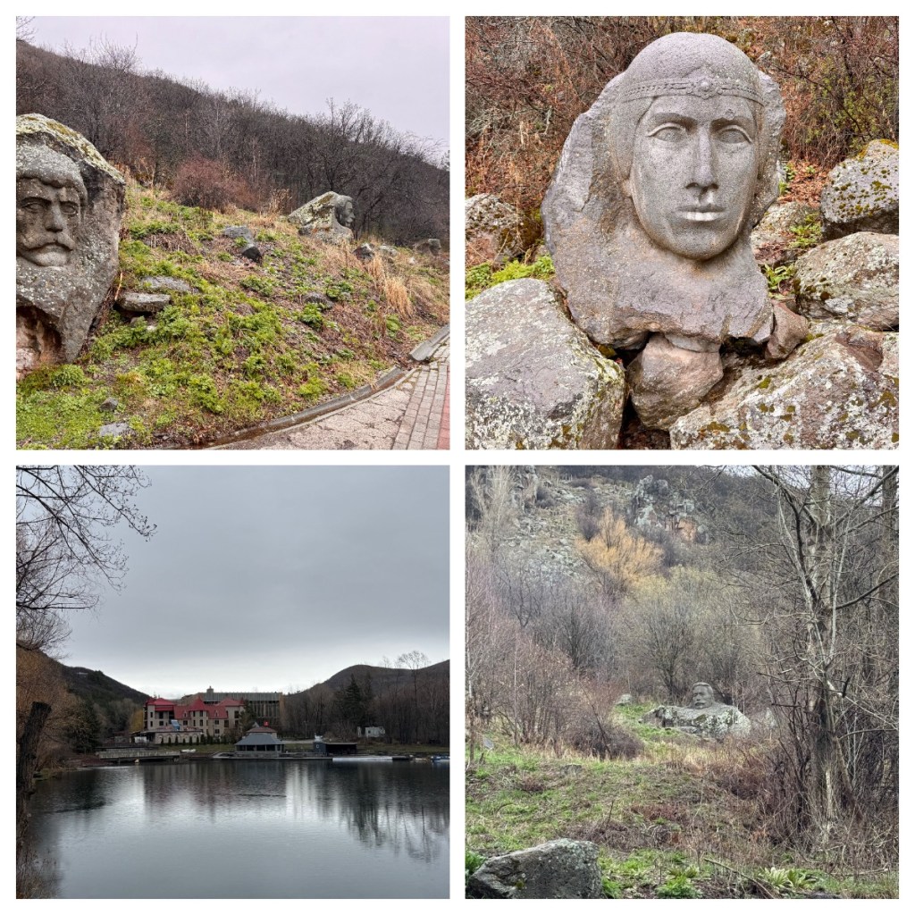
From the Gallery, we walked along the banks of the small man made lake (Sarnaghbyur Lake I believe) through the Hero’s Alley.  Along the tree lined path, there are large carved busts of the “Armenian faithful”.  The 6 men and one woman fought for Armenian independence during the Ottoman rule and protect villagers from the Turkish and Kurdish forces.

The final stop on our short walk, was an opportunity to explore the abandoned Palace of Culture (the building I could see from my room window).  Health and Safety is definitely not a priority here as we could easily wander into the building and pick our way through the broken glass and twisted metal!

The Palace of Culture was built in the 1970’s in a classic Soviet style and many towns in ex Soviet states have similar community centres as a symbol of artistic expression.  In it’s brief glory days, the complex included a swimming pool, a library, art galleries and exhibition halls and an 800 theatre hall!  Not surprisingly it was once a bustling community hub.

With the collapse of the Soviet Union, funding for the building stopped and so maintenance and operational money dried up and the building lost relevance and fell into disrepair. By the early 2000’s the building was abandoned and start crumbling into the abandoned relic we were exploring. 

Apparently, a local business man had purchased the building at some point with the  plan to restore it, but the project never got off the ground and there is currently no firm plan to restore the building to its former glory.    Instead it remains as a reminder of a bygone era and a site for adventurous explorers.

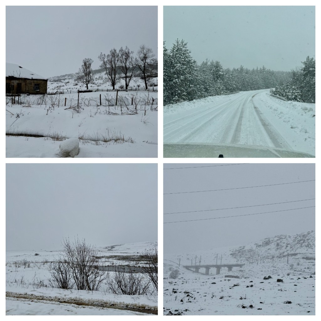
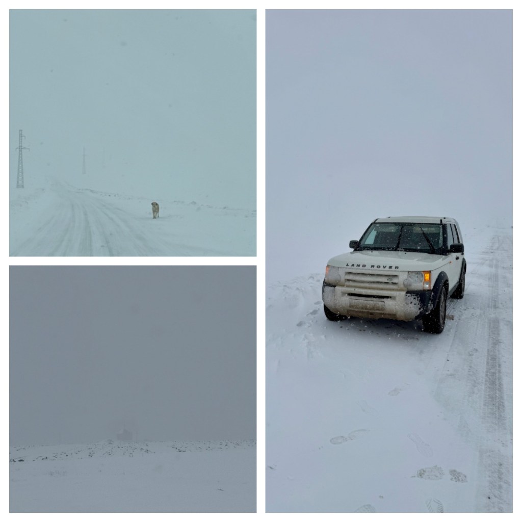
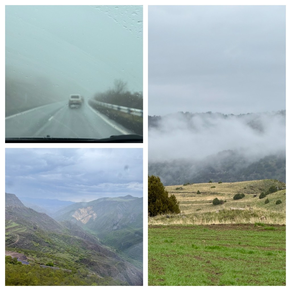
As we left Jermuk, we drove up into the clouds and it seemed that there would be no great views today.  As well as cloud, there was some wind and a little rain which did not bode well for our upcoming ‘flight’.  At least that is what they call a trip on the Wings of Tatev aerial tramway!  The tramway is the longest reversible cable way in the world (5752 m long) and it won the World’s Leading Cable Car award in 2021 (who knew that was a thing lol).

The journey takes 12 minutes to cross 320m above the gorge and the Vorotan River to the Tatev Monastery but it does not run if it the weather is bad so it was touch and go if it would be running.  Thankfully it was and one was about to leave just as we arrived so we had to run to catch it – running did not help my headache, nor did the rocking of the cable car in the wind but we made it across unscathed and slowly walking around the fresh air did wonders for my headache. (It we would have had to take to drive to the monastery!)

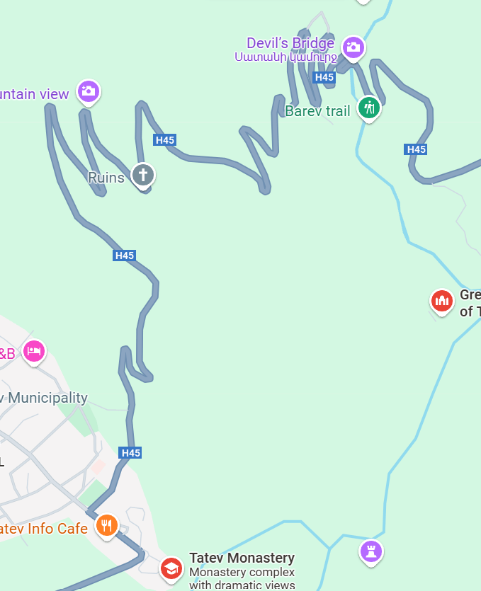
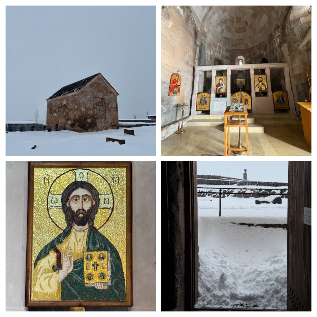
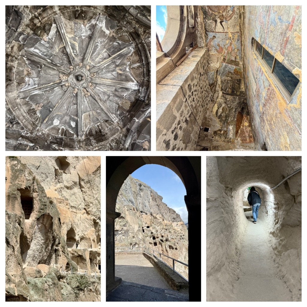
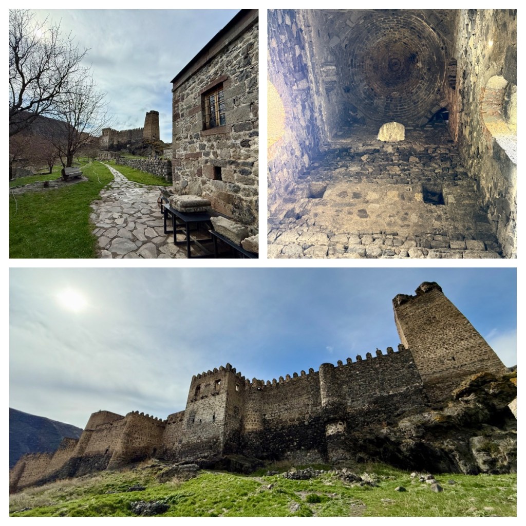
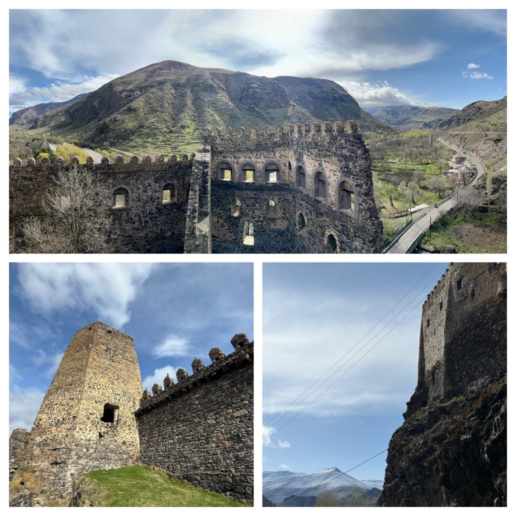
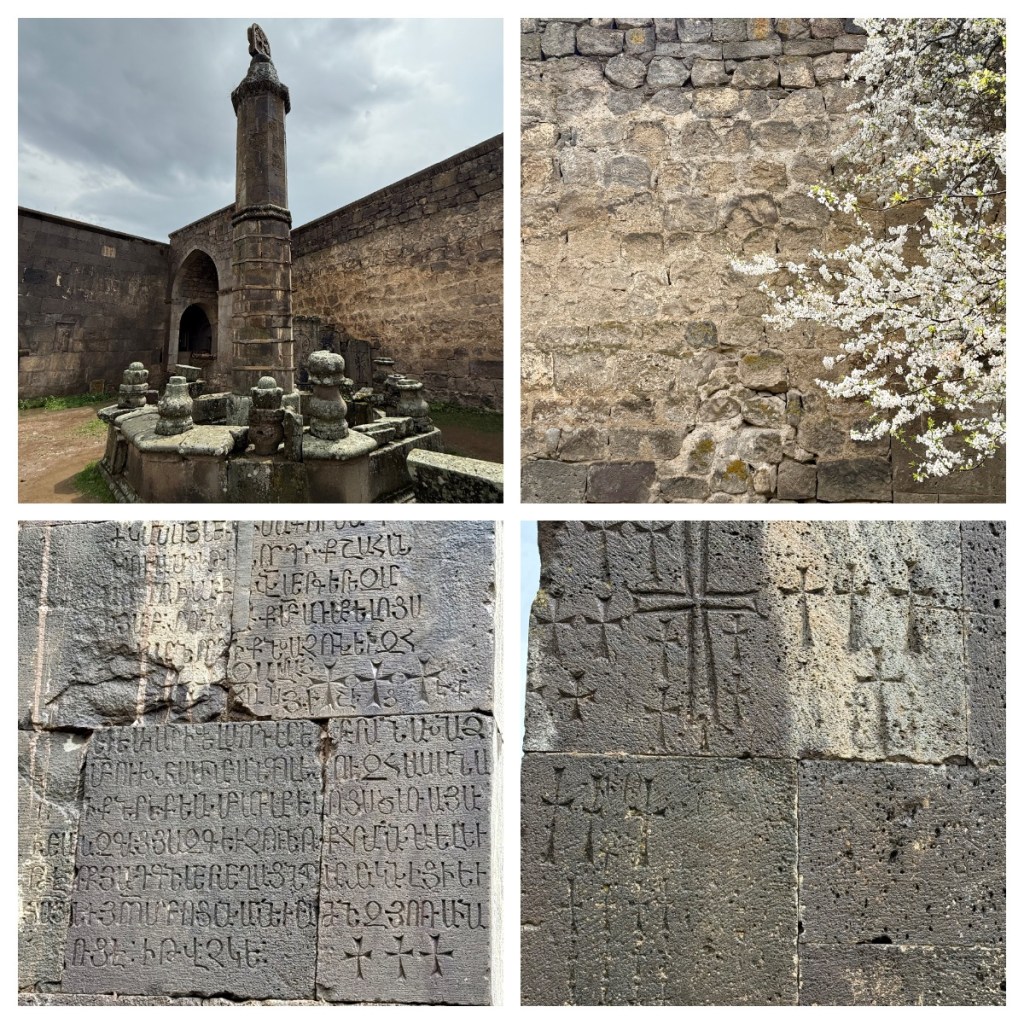
The Tatev Monastery is one of Armenia’s oldest and most important monasteries and is on the grounds of a pagan temple (there is still one column remaining from this era) and a 4th century church.  The current buildings were built between the 9th and 13th century and given it’s location (and of course before the tramline) it was almost cut off from the world and therefore very safe.   It was an important centre for education (spiritual and general) and over a thousand monks lived here in the 12th century! 

It is still an important site today, and despite the weather, there was a couple having wedding photos in the grounds! 

Apparently, the main Cathedral houses a number of important relics, including a piece of the cross, and relics of John the Baptist, Gregory the Illuminator and the Virgin Mary! 

We also visited the old oil press which houses the technology used to extract oil from seeds in the 13th century.  It looks like hard work!

We grabbed a kebah for lunch and again, people are so friendly, with sellers on small stalls wanting us to sample their products without accepting any money.  Even the guys who we bought the kebahs from gave us fruit (at least we had purchased something from them).  And of course more friendly stray dogs.  Apparently, some are old shepherd dogs (that protected livestock) and in retirement they are just left to roam!  Seems a sad fate, but as I have mentioned before, most of the stray dogs seems in fairly good condition and in very good spirits!

We jumped back on the cable car to cross back to our car before continuing on to the town of Goris where we were to spend the night.  Before checking in to our hotel we took a short walk around the town to see some of the cave complexs in the nearby hills.   We did not go close to them, but even from a distance you could see openings to caves that were actually lived in up until the 1960’s.  Today, some of them house farm animals!

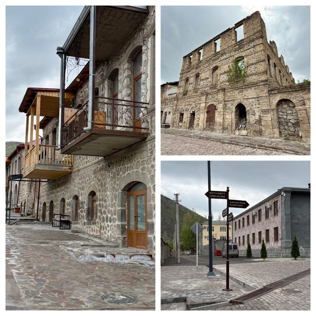
The older part of the city has had a lot of refurbishment of the two story buildings, many decorated with the local “barkash” style of plaster that is unique to Goris. As you can see from the map, Goris is very close to the disputed border with Azerbaijan and there Armenian army has a fairly big presence here.

I was grateful to have a shorter day today so I could recover from my headache and you, dear readers, may be grateful for a shorter blog lol.


Monasteries and myths

Georgia, April 2025

Today was Red Friday (as I explained in my previous blog) and Tazo’s family were near by, so he spent the morning with them, and we had some free time to explore the town of Kutaisi, one of oldest cities in the world having been continuously inhabited since 1,400BC.

With a population of around 135,000, Kutaisi is Georgia’s 4th largest city, and it was an important political centre in the Middle Ages and the capital of Georgia from the 8th century BCE to the 11th century. Not only that, it was actually the seat of the Parliament of Georgia from October 2012 to December 2018 in an effort to decentralise the Georgian government. The move was not particularly popular and in January 2019, it was moved back to Tbilisi.

One of the main sites of the city is the Colchis fountain, so that was our first stop.  It is basically on a roundabout, in amongst the business city traffic so it was good to go early when we could easily cross the road to get to it! 

The fountain itself celebrates the ancient Kingdom of Colchis and has 30 large copies of famous gold jewellery, discovered at nearby Vani archaeological site. The figures include animals and ancient Georgian figures, including the lion that features on the Bank of Georgia logo and Tamada.  Tamada is thought to be representative of the Georgian toastmaster tradition and the original little bronze statue dates back to the 7th century BC. 

According to Greek mythology, Jason and his Argonauts visited the city, sailing down the Rioni river from the Black Sea to claim the Golden Fleece – today the river certainly does not look like a large ship could sail down it!  As well as leaving with the gold, he also left with the King’s daughter Medea who became his wife!

From the fountain we wandered passed the Opera House and Theatre, down some of the beautiful tree lined boulevards and across one of the bridges to admire the view out to the snow-capped mountains.  The old part of town was lovely and it was nice to have some free time just to wander. 

Unfortunately our time was cut short as Ania, my travel companion, had a toothache and we needed to find a dentist for her.  Despite being a public holiday, we found a 24 hour dentist just around the corner form our hotel and she could just walk in and see someone (although she did have to call Tazo for some translation services lol).  Armed with some antibiotics and pain killers we went back to the hotel to check out and meet Tazo to continue our journey.

Before leaving Kutaisi, we visited a couple of local sites, just outside the city, the first being the Bagrati Cathedral.  Originally built in 1003 by King Bagrat III, it is a symbol of a united Georgia and of the city itself.  It was on the UNESCO World Heritage site list, but then removed as reconstruction work over the years did not meet with UNESCO standards to maintain the integrity of the original structure, most of which had been destroyed through battles and subsequent decay. 

It is still an active church today, and so we could not take any photos inside but the main thing of note was some priests doing some DIY and some relics, including a human skull!  Outside there was a beautiful view across the city and out to the mountains beyond.

I am also back on Lada watch, with some great examples of their longevity and sturdiness being seen around the city!!

As we drove along narrow, cobbled streets to our next destination, I noticed the above ground gas pipes, as previously seen in Kazakhstan.  In some places they run about 30 centimetres of the ground but then go up to around 2-3 metres to allow for vehicles to pass under them.  Most were installed during Soviet times, so not surprise you see them in other ex-Soviet countries.

The 8th century Motsameta monastery is not only beautiful, perched on a cliff overlooking the Tskaltsitela river, but it is also where Tazo was baptised so he was excited to show it to us.    The name means the “Place of Martyrs” which relates to two brothers of a noble family who organised a rebellion against the occupying Arabs.  When their rebellion failed, and they refused to convert to Islam, they were tortured, killed and their bodies thrown in the river.    Subsequently they were recognised as saints and their remnants are kept in the nearby Gelati monastery.

Apparently, there is a secret (or perhaps not so secret) tunnel between Gelati and Motsameta monasteries used during wars and the crypts of both are said to hold relics such as bones of saints, including the brothers.

The monastery was beautiful inside and out, with purple flowers growing out of the rocks outside and lovely murals on the inside.

We were then back on the road to travel the 220km back to Tbilisi, and for a while we did not see the Easter holiday traffic that Tazo had predicted – but then we did!  Thankfully it was all on the other side of the road, travelling away from Tbilisi and for some time it was at a complete stand still.  Thankfully there was hardly anyone travelling towards the city so we were grateful to be going that way!

As it had been a busy day (since Tazo had picked us up) we had not had time for lunch, so we stopped on the road side to buy some Nazuki, a delicious, warm spicy sweet bread – there were lots of road side stalls selling it, advertising it with signs of brown oval blobs!  The bread was not brown, but I guess it was oval shaped and it was definitely tasty! 

Nazuki dates back centuries and its name translates from Persian as “exquisite”.  Traditionally they are cooked in a tone oven (a clay tandoor oven where the bread is stuck to the side) and in this particular area (called Surami), is called Nazukebi, a 1 Km stretch of Nazuki sellers.  Apparently a lot of these were set up during period of great economic struggles, allowing people to support their families by baking and selling nazuki. 

Also along this stretch of motorway, we passed very close to the Russian occupied state of South Ossetia, and I mean really close.  Tazo pointed to a village not far aware and noted that it was occupied by Russians!  It is crazy to think that life goes on so close to the contentious “border”.

We arrived back in Tbilisi and Tazo dropped us back at our hotel just after 5pm and thankfully I had much nicer rooms than we did for our one night stay – I even had a little enclosed balcony.  This time we are here for 3 nights so it was time to do some washing and realign the packing.  As we have been constantly on the move, I tend to alternate the same two outfits (rather than unpack my bag) so it was good to remind myself what else I had packed and get those out to wear.

Ania was not feeling great so I went on the hunt for somewhere to have dinner and came across a lovely Italian restaurant.  I felt a little guilty having Italian food in Georgia but made up for it by having a glass of Georgian wine.🍷

Mountains high, valleys low

Georgia, April 2025


We woke to another day of cold rain, and due to the Easter holidays (where many things would be closed and traffic would be crazy), Tazo had managed to rearrange our itinerary, so instead of staying in Tbilisi for a few days, we were heading straight out again.

Today’s journey took us over the mountains of the Samtskhe-Javakheti region and we passed through beautiful mountain landscapes and small villages – neither were conducive to any good photos from a moving car …. in the rain!   But as we drove higher we started to started to see snow on cars coming from the direction we were going in!

In “Car Chats” today we talked about Georgia’s fight to retain its territory and independence.  Here, all men need to do 2 years military service and the last major skirmish, the Russo-Georgian war, was in 2008 when Russia took occupation of Abkhazia and South Ossetia.  Still today, Russia and 4 UN states recognise these areas as independent states, whilst Georgia and most other UN states recognise it was part of Georgia, and therefore the EU, and the UN now recognise the areas as “occupied territories”.  Despite that, Russian continues to build military bases in the regions, create borders along the boundaries of the disputed lands and refuse entry to any international monitoring missions.

Russia continues to claim that Abkhazia and South Ossetia are independent states and not occupied territories and citizens can have local passports (of Abkhazia and South Ossetia) but get Russian passports for international travel.   Still today, tensions still run high along these borders and a permanent and peaceful resolution does not appear close.

Up into the snow we drove and at almost 2000m above sea level it was actively snowing.  And it snowed and snowed, like serious snow!  Apparently, March had been a very warm month and most people had changed to their summer tires so this was not ideal and it was not long before we came upon a traffic jam.   Not sure if there had been an accident or if people had just decided they could not go any further, either way, the road was blocked!

Thankfully, Tazo had picked us up this morning in his Landrover, so we went off road to get past the jam (I enjoyed this very much lol).  If we had not been able to do this, we would never have reached our destination for the day!

As we continued on, we got into almost a complete white out and the glare was insane!  Who knew the first time I would need my sunglasses would be for the snow!    We had now gone beyond the areas where the roads had been cleared and/or driven on by other cars and it was not always obvious where the road actually was!!   Tazo was also very excited by the snow as in the winter they plough immediately so he doesn’t often see snow like this on the roads!

We were supposed to have a stop at Paravani Lake, Georgia’s largest lake which is apparently quite beautiful.  Not only could we barely see the lake, but we could also not see the road that takes you down to the lake so a visit to the small chapel and wooden cross on the lake shore was not an option lol.  

Today we learnt about Saint Nino, considered the “enlightener of Georgia”.    Born in Cappadocia in around 296 to an Orthodox Christian family, and after studying the Holy Scriptures in Jerusalem, the Virgin Mary visited her during a dream.  She gave her a cross made from vine branches and told her to spread Christianity across the region. 

Saint Nino was joined by a number of other women her pilgrimage but they were captured by Tsar Trdat III who killed all the others.  Nino managed to escape death and continued on to the shores of Paravani Lake to rest.

The lake and its surrounding landscapes left a profound impression on Nino, who found solace in its peace and beauty. She spent several days by the water, where the local inhabitants offered her food and shelter, allowing her to regain her strength before she set off for the capital city of Mtskheta where she was complete her mission of the conversion of the people from Zoroastrianism to Christianity.    She is still one of the most revered Saints in the Georgian Orthodox Church and a grape vine cross is a symbol of Georgian Christianity. 

We continued on passed small, abandoned looking towns (apparently many only live here in the summer), until we reached the small village of Foka (I have also seen this written as Poka) and the St Nino Monastery.  Tazo went ahead to drag the nuns out in the snow to open their shop and the church for us to look around, as we trudged through the snow (now about 15cm deep)!   Again another moment I was grateful for my waterproof shoes but all in all I did not pack, and most definitely did not dress, for snow! 

The shop was selling a huge range of hand made products, including chocolates, biscuits, jams, oils, cheese, hats, ceramics and jewellery and given that they had been forced to come out in the snow we felt obliged to buy a few bits (mainly chocolate lol).

The Church here was built in the 11th century out of perfect cut square stone blocks and contains old carvings and fresco remnants as well as some beautiful icon imagery.

Back on the road through more deserted towns, we spotted whites storks nesting on the top of power poles.  I bet they wish they had held off their migration and nest builing for a few more weeks as they did not appear to be particularly happy! 

As we travelled down, we arrived back into the rain, but by the time we got down into the valley, we finally saw the sun!  It was hard to imagine that less than 2 hours before we were in the snow.


After a quick photo stop at the 4th century Khertvisi Fortress (we will return for a visit a little later), we followed the Kura River (that runs through Tiblisi and also through Azerbaijan out to the Caspian sea) down the valley.  During the stone age, most people lived near the rivers, hence the numbers of fortresses and watch towers in the valleys along the rivers.  Even Alexander the Great apparently travelled down this valley on his march towards India. 

One of the sites we were most excited to visit in Georgia was the Vardzia Caves, one of a number of cave complexes in Georgia.  It is thought that the cave complex was built in a number of phases, starting in the second half of the 12th century, during the reign of King George III.

According to the legend, the King’s daughter, Tamara (who went on to become Queen Tamara) was playing in the caves as a child.  She lost sight of her Uncle and called out “Ak var dzia”  – “I am here uncle”.  The words var dzia echoed around the complex (which was under construction) and were heard by the King who decided it should be named this way. 

Before I move on, let’s take a moment to meet Queen Tamara, one of Georgia’s greatest medieval monarchs who ruled from 1184 to 1213 CE.  She was the first female ruler of Georgia and was referred to as the “King of Kings and Queen of Queens”.

Her father, King George III had no sons and was concerned about losing his power so named his daughter Tamara co-ruler at 18 years old in 1178.  By all accounts she was a badass who despite having to continually deal with resistance to her rule by clergy and noble men of the time, she went on to be responsible for Georgia’s greatest territorial expansion.

Back to Vardzia, the cave complex runs around 500m along the cliffs, is up to 19 tiers high and includes more than 250 rooms, 28 wine cellars and 3 churches.  There is also defences and irrigation systems including aqueducts and reserviors. After sustaining heavy damage in an earthquake in 1283, it was partially rebuilt before being mostly abandoned after the Ottoman invasion in the 16th century.

We took the free shuttle bus up to the first level of the caves and then had time to explore some of the caves, up and down stairs, some more like ladders.  I think we spent even more time admiring the beautiful views down the valleys and the blue skies which we had not seen for some time.

Back down at the car park we had some freshly squeezed pomegranate juice – it was very expensive (15 Gel or NZ$10 for a cup) and a little sour. I did enjoy it but would not rush to pay that price again.  That said it was probably tourist prices being a tourist site!  We also picked up some Georgian meat pies (I don’t seem to have made a note on the actual name) which were tasty and way better value than the juice!

We then head back up the value and stopped at Khertvisi Fortress. One of the oldest and well preserved fortresses in Georgia, it has sat on this hill since the 10-11th centuries overlooking what was the Silk Road.  As with most fortresses in Georgia, there are many tunnels underneath – in this case they run down to the river to allow for water collection and also communications, not forgetting an escape route in times of siege.

Over the years as the town of Khertvisi was destroyed by Mongols, captured by Turks and then by the Russians, the fortress continued to dominate and its position as a military garrison was restored.

It was another full day and one full of surprises (mostly weather related lol) and we were exhausted by the time we arrived in Akhaltsikhe (our stop for the night). We could only muster the energy to pop to the local supermarket for some instant noddles for dinner before heading to bed! 


Museums & Wine of Kakheti

Georgia, April 2025

We woke to a cold and rainy day but, at one point, the rain cleared a little and I could see out to the beautiful snow-capped mountains in the distance and I was definitely excited for the next few days. Bur our first full day in Georgia was to be spent exploring in and around Telavi and avoiding the rain where possible.

I will warn you, today was a crash course in a small part of Georgia’s long history … and now I am sharing that with you so enjoy if you like that kind of thing 👍🏻or just look at the pictures and move on lol.

We started the day at the Telavi History Museum, a complex the includes the only preserved royal palace in Georgia, a church and a bath house, along with a museum and art gallery.  The museum had a great collection of historical artefacts and information about the history of ceramics, architecture, coins, clothing and the importance of grapes and wine.  It was interesting to see how the country has incorporated parts of its history, including Mongol, Russian and European, into its culture.

We then moved on to the art collection, a private collection of Ketevan Iashvili, a female cosmetologist born in the area in 1883.  She had an interest in fine art and collected it throughout her life (sometimes she was apparently given art in lieu of payment for her services by wealthy customers).  In the 1970’s she donated her collection to the museum and some of it can be seen here today.

We then had to brave the weather and head outside to visit one of the most important parts of the museum complex, the Palace of King Erekle II (also known as King Heraclius II or the Little Kakhetian).  The much-loved King Erekle ruled Kakheti from 1744 to 1762, before uniting the regions of Kakheti and Kartli (upon the death of his father who was King of Kartli) and ruling both until his death in 1798.  He is considered one of the most important and powerful Georgian kings, modernising the Government, economy and military, but unfortunately, he was also part of the reason for its downfall.

He was known as a great diplomat, and in an attempt to keep his kingdom safe, he made a pact with Russia for protection, unfortunately it was not enough to save it from a Persian invasion in 1785. 

Construction on the palace started under King Archil II in the 17th century and what we see today was completed under King Erekle II, who turned a more simple palace (where he was born in 1720 and died, in the same room, in 1798) into a fortress with the construction of the 5m high walls. 

We had a local guide through the museum and the Palace and it was interesting to learn some more of the interesting facts about King Erekle and his palace. I have summarised what was a lot of information as best I can below:

  • The palace is a shadow of its former glory.  It used to be beautifully adorned with colourful walls and mosaic floors in a Persian style, all of which were destroyed by the Russians (Empire rather than USSR).  Unfortunately there are no images and very little written about how it looked so it cannot be restored. The Russians also used the great Audience Hall as horses stables as a further sign of disrespect.
  • King Erekle is considered the People’s King and form all accounts, he was liked by his people. He led from the front, literally, being 15 when he fought his first battle, and 75 when he fought his last.
  • A 17 year old Erekle was taken to Persia for 2 years.  He was a good diplomat and when he returned, ruling Persia allowed him to be King without giving up Christianity.  I should note that this part of Georgia was under Persian rule longer than the rest of the country, but they always remained Christian at heart.
  • Erekle was already King of Kakheti when his father, who was King of Kartli (the region where Tbilisi is) died, leaving Erkele to unite the two eastern Georgian kingdoms into a single state under his power.
  • After initially using the death of his Persian ally, Nader Shah, to his advantage by declaring independence, King Erekle then signed a protection agreement in 1783 with Russia (chosen because they were Christian).  Unfortunately, they did nothing to help when Persia did invade and in fact Russian troops went as far as to evacuate the area leading to a full invasion in 1795.  He went to his death in 1798 hoping that Russia would come to the rescue so Georgia could continue its existence, but unfortunately, just 3 years later, it was consumed into the Russian Empire.  
  • King Erekle had 3 wives (not at the same time) and a total of 28 children, most who died young or at birth. His last wife was a strong, intelligent woman whom he married when she was just 12 and she bore him 23 of his 28 children.  In the later years of his life, she had significant influence over his political decisions. She was not in favour of the agreement with Russia and was deported to St Petersburg in 1803 where she lived until her death.


In summary, he seems like he was a decent bloke, tried to do his best for his country and his people but was screwed over by his supposed mate!  In fact his dress sense denoted his diplomacy and he was often depicted wearing a Persian style hat, a European style cape and a blue sash to represent Russian. 

We did not explore much more because of the rain but could see the King’s personal Persian style bath house in the distance and churches in the grounds. One of the two churches actually dates back to the 9-10th centuries.  Much older than the palace itself.

We took a quick detour to see the impressive 900 year old Plane Tree that is all that remains of the forest that used to cover the area.  It is 46m tall and 12m in diameter and today, its health is closely monitored to ensure its ongoing survival.  It is apparently considered a symbol of Georgia’s strength and resilience and it might also be able to make dreams come true lol.

We headed slightly out of the city to our next stop at the Aleksandre Chavchavadze House Museum in Tsinandali.  Not surprisingly it was the home of Prince Aleksandre Chavchavadze.  Born in 1786 (to a noble father who was at one time ambassador to our friend King Erekle) he was Georgian poet, public benefactor and once colonel of the Russian Army and is considered the ‘father of Georgian romanticism”.  He inherited the house from his father and turned it into the cultural and intellectual centre of the country. 

We had to wait for a tour in English so we braved the rain to run to the large building behind the house, which today is a Radisson hotel and the home of the estate’s wine collection and museum.  Another of Chavchavadze’s claims to fame is that he was the first to bottle Georgian wine in a European style. 

We were taken through a locked door and down some stairs into the estate’s vast historic wine cellar where more than 16,000 bottles of his personal collection are stored.  We learnt about the 8,000 years of Georgian wine making history and saw some of the early artefacts they had collected, including pressing equipment and fragments of clay pots (used in the Georgian style of wine making) dating back to the 6th millennium BC!

There are detailed written records for the wine, and the earliest bottle of Aleksandre’s wine is from the 1841 vintage.  Unfortunately, the early wine is no longer drinkable. (I wonder who dared to open a bottle to try it to come to that conclusion?)

Back in the house with our English speaking guide, we were taken around the rooms (no photos allowed inside) and given commentary about the family and the historical pieces on display.  Not all the pieces belonged directly to the family but all were beautiful luxury items from collected from all over Europe and Russia.  It included the oldest grand piano in Georgia and carpets from Azerbaijan.

As the story goes, in July 1854, the troops of a Chechnyan Muslim leader attacked the estate (avenging the family’s support for Russia), pillaging the house and kidnapping his relatives (including his son’s wife, her sister and their children).  It was not until March 1855, after complex negotiations, they were returned in exchange for a ransom and an exchange of other prisoners.

Disillusioned with Russia’s control over Georgia, he ended up joining the failed Georgian rebellion against Russia in 1832 which resulted in him burning much of his poetry written between 1820 and 1832 in fears that it would be used against him, but he was still exiled, before returning to the Russian army at the request of the Tsar.

Following his death in 1846 (officially an accident, unofficially by the hands of Russian assassins) and that of his son David, the ransom loan had still not been repaid and the estate was given to the Russian Imperial family as a summer house.  Summer seemed very far away on our visit as I am not sure the rain let up for a minute!

Finally the moment we had been waiting for was upon us – wine tasting. For this we travelled the short distance to the Kvareli Wine Cave which apparently have the largest storage of Georgian wine, which is stored in more than 7kms of tunnels. The tunnels were originally built in the 1950’s by the USSR army, allegedly as a missile base or a bomb shelter, before being converted into a wine cellar.  Apparently at the time they were also building bomb shelters in Tbilisi, saying they were building a metro system!

After a traditional welcome song, we joined our wine guide to learn more about Georgian wine and the winery.  In 1995 they started cultivating grapes and building wine making facilities and the existing tunnels made a perfect storage facilities – maintaining a standard 12-14C and 70% humidity. 

This winery has a lot of award-winning wines (apparently over 200 gold medal winners) and have vineyards around the country, as they only use their own grapes to allow them to control the quality. 


We learnt about the Georgian wine making process which mainly varies from the European style in that it is fermented in large clay pots, known as a Qvevri, Kvevri or Ch’uri.  The pots are a special shape to allow for circulation and they push the skins and twigs to the bottom daily.  When the bubbles stop, they seal the pot and then it sits for the required length of time.  When ready, they traditionally use a scoop (made from a dry pumpkin skin) for the first sip, which is drunk from a clay bowl (it needs to be drunk in full and not sipped)!

We sampled a number of different wines and decided that we liked the semi-sweet ones, and I am a little embarrassed to say I preferred the European styles over the Georgian styles.

Back on the road, we had more great car chats with Tazo covering a multitude of topics – this is exactly what we wanted in a guide! 

A quick stop at a random road side restaurant for a late lunch of a tasty Georgian beef soup and more Khinkali (I think most meals with include these lol)  before arriving in to the Georgian capital of Tbilisi. By the time we got to our hotel, the rain had eased a little and I even saw the sun for a moment so popped out to get my first glimpse of this beautiful city (we will have more time to explore in on another day).  


The long route home – A quick stop in Iceland

Iceland

September 2024

Never one to shy away from making the most of a stopover, I has decided to take the opportunity to get off the charter flight in Iceland, rather than travel through to Denmark.  I said goodbye to everyone as I left the plane (there was only a handful of us disembarking there) and arriving in to Iceland was so easy.  There was no immigration and I didn’t even see any customs.  I just walked right through, bought a bus ticket and within about 30 minutes of getting off the plane I was heading in to the city of Reykjavik.   (The bus was definitely the best option but was not cheap, at around $45 one way, better than a taxi that apparently cost $200!)

Despite Reykjavik not being a large city (population around 120,000 with only 400,000 in the whole country), after two weeks in small isolated villages, it was really like being back in the big smoke with all the people, traffic and American takeaway chains etc!  The Airport Bus stopped at main bus station and then I took a small shuttle to the other stops in the centre of town (all included in the one price). I was pleased to see that the shuttle stop was just outside my guest house/hostel.

What a come down from my room on the ship 🥴. This is definitely back to reality with a bump but more like travel as normal – a crappy room in a large city 🥴.  Still the location was good and I was going to be out most of the time.   Once I dropped my bag my first task was to get some food and I found a nearby hotdog place (there seems to be a lot of hotdog places around).  I am not sure how Icelandic the ”Iceland hotdog” is, but it was good and I was hungry!

It had already been a long morning and I was ready for a quick nap before heading out to take a look around the city.  Unfortunately I was too late in the day for any of the city walking tours so I googled some walking maps to get a general idea of what to see and where it was. 

I started by walking up the “Rainbow Street”, or Skólavörðustígur (as it is more formally known) one of the city’s main streets which has been painted as a rainbow to celebrated the Rekjavik Pride movement.   The area is also well know for it’s colour houses, street art and art installations.

The top end of the street is dominated by the famous Hallgrímskirkja church.  At almost 75m tall, the church actually dominates the city skyline as it is among the tallest buildings in the country.  Completed in 1986, the Evangelical-Lutheran church’s unique design is an ode to the Icelandic landscape and was named after the 17th century clergyman Hallgrímur Pétursson.

From the church I headed back down to the sea, and to the  ‘Solfar’ or ‘Sun Voyager’ sculpture.  It is a beautiful sculpture on the seafront apparently represents “a dream boat and an ode to the sun” however I think I join with most and thinking it looks like a viking ship – makes sense given that we are in the land of the Vikings.

I continued along the sea front to the next architectural marvel – the Harpa, Reykjavik’s concert hall which is home to the Iceland Symphony Orchestra and the Icelandic Opera.  Completed in 2011, the glass façade of the building is made up of geometric shapes that represent the natural basalt columns you can see around the country, and the colour of these panels change with the light of the day. 

I wandered around the harbour, into the small Ingólfur Square and around to the City Pond – a rather large ‘pond’ near the city centre.  I walked through an area filled with tourist shops, tourist bars – English and Irish pubs etc. 🤦🏻‍♀️and a pizzeria thats marketing was based on getting a terrible review on TripAdvisor lol.

As I had a long day trip planned for the next day I tried to have an early night, but the down side of having some a central location is that it was very noisy with traffic and nearby bars and clubs!  So, after a terrible nights sleep, a terrible coffee from a local convenience store (no coffee shops open early enough) and a shower in sulphur smelling hot water I was ready for the day lol. 🥴 (Apparently the water in Iceland is so pure it can go through taps without processing – I am not so sure as it also had a slight sulphur taste to it!)

The pick up point for the tour (and as it appeared every other tour in the country) was right outside my door, and I was glad that the guide had sent through the vehicle details so I did not have to rush up to each vehicle that arrived and we were soon on our way out of the city.  I had been to Iceland before, many years ago, so choose to avoid the main touristy sites (which I had seen on my first trip) and the large bus tours and do a full day, small bus, south coast trip.  Its worth noting that this choice was influenced by a google screen saver for an Icelandic waterfall I saw a couple of weeks before my trip  lol.   I had really wanted to see puffins but unfortuantely they had already left for the  winter 😢, there is always next trip 🤣🤣.

Out Icelandic guide was called “Al” – kindly, Icelandic people always seem to anglize their names so of us who are linguistically challenged don’t have to try and butcher their actual name!  Al was great, and full of interesting information, starting with some general facts. 

Reykjavik, in the early 1900’s, was a small town focused on farming and fishing, but this all changed with WWII when the British built an airport (now the domestic airport, pretty much in the centre of the city) and then the Americans came bring more infrastructure and jobs.  After the war, the airport was ‘given’ back to the country and Reykjavik soon became the thriving metropolis we see today.

We headed out of the city on the ring road, which – not surprisingly, you can drive all the way around the country on it (if you have 6-7 days) and we learnt about the volcanic nature of the country.  Now everyone knows that Iceland is full of volcanoes and of course eruptions in Iceland have caused flights disruptions, not only in Iceland but around the world!  What I did not know was that they pump the hot geothermal water straight in to houses for hot water and heating – that will explain the sulphur smell in the shower!

Apparently the weather this summer has not been great and we were blessed with an almost perfect day for this little outing and the landscapes we passed through were beautiful, ranging from volcanos, remains of old eruptions and beautiful volcanic cliffs lined with waterfalls to lots of beautiful green fields with horses (the famous Icelandic horses) and very shaggy sheep.

A couple of fun factors about Iceland according to Al:

·       It’s unofficial motto is ‘it could be worse’ lol

·       Beer was illegal until 1989!  You also can’t by alcohol in the supermarket (so it is not too easily accessible), BUT you can get it on line and it will be delivered within the hour lol.

On the way to our first stop we passed the unimposing but infamous Eyjafjallajökull volcano, that caused all the travel issues back in 2010.  It was know as E15 in the international press as no one could pronounce the proper name 😝.  And finally our first stop, the google screensaver waterfall – Skógafoss.  With a drop of around 60m and a width of 25m, it is one of the largest waterfalls in Iceland and today we were so lucky to have perfect conditions for the waterfall spray to create a double rainbow.  I could have walked to the top, but by the time I finished taking photos from the bottom I didn’t have time 🤣.  It was stunning.

As we continued along the the south coast, we  passed more stunning landscapes of glaciers, towering cliffs and waterfalls until we arrived at the famous black sand beach – Reynisfjara.  It is famous for not only it’s black volcanic sand, but also for it’s tower basalt columns. Science tells us that these were formed by cooling lava and if you prefer a good local legend, they are actually two trolls turned in to stone as a curse.

As I previously mentioned, the puffins that nest here are already gone for the season but there were lots of Fulmars and gulls still hanging out on the cliffs surrounding the beach. 

The beach is also famous for “sneaker waves” and there are warnings posted everywhere to watch out of these deceptively powerful waves that surge up the beach from calm looking seas. 

Next we had a quick stop in the southernmost town in Iceland – Vik í Myrdal (more commonly know as Vik) to see the 1877 white, wooden church.  Interesting the church seats around 450 people, and there is only around 600 living in the town.

This was our turn around point and we headed back towards Rejavik but not without a couple of other stops.  First at the most unique glacier I have ever seen – Sólheimajökull.  The glacier and the icebergs in the glacier lake are actually striped, with layers of black volcanic ash through the ice!  As with glaciers around the world, the glacier has been receding at a fairly fast rate and the lake we see today at the foot of the glacier has only been created in the last 25 years.  That said, this glacier extends back around 14 km to the ice cap.

Our final stop for the trip was Seljalandsfoss, another iconic waterfall and this one we walk behind. Another 60m high waterfall but this one we could walk behind which was a little damp but fun.  By now the clouds had rolled in  now and the waterfall spray masked the rain that started to fall 😂 .  It was a long day but great way to spend my one day in Iceland.  I rounded it off my shouting myself Hard Rock Cafe for last dinner of the trip – not Icelandic but who I am going to kid thinking I am going to enjoy Icelandic fish – not me that’s for sure 🤣🤦🏻‍♀️.

I had called early in the day to book my pick up for the airport bus to be told my pick up would be at 3am 🥴 and I was so glad the stop is right outside the hotel!  The early bus meant I arrived at the airport at 4.20am and after using the self check in, I easily made my way through the airport until I was ‘detained’ my the immigration guy as he told me a long winded story about some random guy in the 1800s who moved to Hobart – not sure if he thought Hobart was part of NZ or that NZ was part of Australia 🤔. Thankfully, there was not a long queue behind me! It was nice to have another stamp in my passport as I haven’t officially  left Denmark, Canada or Greenland 🤣

As I boarded my first flight on the long trip home I was amused to hear Icelandic Air playing a Björk song as we boarded – classic 🤣. So that is it for my big trip for another year, now on to booking my big trip for 2025.  Something for all readers to look forward to 😜.

Greenland – final days

Itilleq and Kangerlusaaq

September 2024

Our final full day in Greenland was spent sailing south whilst we had couple of talks.  Firstly we were given a briefing about the disembarkation process for the following day and house keeping that needed to take place e.g. return boots, pay bills etc, followed by a talk on the Geology of Greenland.  This was followed by a session with Julien, the incredibly accomplished guide I have previously written about.  It was basically a Q&A entitled “everything you need to know about Greenland and more”.

He covered topics from the development of Greenland (mainly fishing in the north and farming in the south), I quote “no one is living in igloos wearing polar bear pants”🤣 He went on to say that education is a problem – most people just fish or have technical education and that boys work with their father or uncles so don’t see point of higher education. 

Most high school teachers are from Denmark and many children don’t speak Danish these days, as more and more are speaking  English.  For this, amongst other reasons, many fail at school and give up.  Most educated people in the country are women who stick it out at school longer than the boys.

We pulled into our last stop during lunch and I spotted the chef fishing for dinner 🤔 off the ship lol.

The afternoon was spent in the small town of Itilleq, located on a small island just of the coast of the mainland  –  population around 100!   The island has no fresh water, so they have a facility for desalination of the sea water and as with all Greenlandic towns, there are no roads to get here, and in fact the closest airfield (for planes) is in Sisimiut, 45 km away across the sea.  The town does however have a helipad for on-demand air services and emergencies.

The main trade in the settlement is fishing and hunting, with a fish factory being the main employer in the settlement. There is one store in the town – the local Pilersuisoq store.

It was a quaint town surrounded by beautiful mountains and after some time to wandered around we had an opportunity to go into one of the locals house’s for tea.  The house had a 70s vibe decor and it was not dissimilar to houses in Fiji with colours, décor and religious icons.

Our hosts did not speak English well, but we had one of our guides with us who had lived in Greenland as a child.  She explained that after World War II, the Danish government started 5 companies including Royal Greenland (the fishing company), Royal Artic Line (shipping), Air Greenland (transportation) and Pilersuisoq (a chain of general stores).  Apparently, these companies must operate in all towns, even if they run at a loss.  By law, Air Greenland must operate flights, even if the planes are empty.  If this is the support currently given by the Danish government, I am not sure if Greenland will ever want, or be able to sustain true independence?

As all the village kids played in the Jacuzzi on the ship, ‘crowds’ gathered on shore for the all important football game between the town and the ship.  Even the local fish factory closed early so the workers could play!  All players welcome, any age, any size and any number of people were on each team lol!  It was a lot of fun and a great way to end the day and the trip.

After our final dinner, it was time to finish up packing as our large bags had to be left outside our room before 11pm.  As annoying as that was, it meant that it was taken up to the lecture room for the morning where we would be joined by check in staff from the airport who would then whisk our bags away to the airplane later the next morning. 

I must admit I felt a little like a fish out of water on this trip with 95% of passengers not having English as a first language, hardly any other solo travellers – in fact I think there was actually only 1 other travelling on their own, and 4 travelling with a parent. Anywhere I sat for dinner threw out the dynamics of any of the tables as they were all set for 2,4, 6 or 8.  That said, it did work in my favour a lot as it meant I got my own room when I had paid to share.

On top of that, most of the other passengers were Danish couples in their 60-70-80s (clearly a marketing thing) so it was not easy to get involved in conversations!  Despite all of that, I met some lovely people and the ship and trip has been amazing.  And lets be honest, if I was not comfortable with my own company, I would not travel solo!   Next time, however, my next expedition cruise will be more wildlife focused 🥴

Our last evening saw us sailing south in to the mist, just how we had set off a couple of weeks earlier when we arrived and the final morning was bitter sweet.  As I mentioned above, our flight check in was done on the ship and it was then time to jump into the zodiacs and leave the ship for the last time.  Can I just say I won’t miss my waterproof pants 🤣!

Back in Kangerlussaq, I had booked to do a tour of the ‘city’ (I had booked all the extras in advance, not wanting to miss anything lol).  I am not sure if I would have booked this tour now,  but there is nothing else much to do there while waiting for the plane so I was happy to have something to do.    

We jumped in to a big bus and headed out of town on Greenland’s longest road which starts at the harbour where we got out of the zodiacs.  This is actually 14 km from the ‘town’ as the silt build up from the melting glaciers means this is as far as the large ships can get to town.  At low tide, a small channel needs to be dredged to allow the zodiacs to get to shore!

From the town, it is a further 36km to the ice cap (which we had driven on our first day) making the road 50km in total.  Apparently, part of the gravel road was built by Volkswagen in the late 90’s as a venue for car endurance testing.  They had planned to extend the road on to the icesheet itself, but the plans were abandoned in 2005 and it is now mainly used for tourism.

We did see a couple of Artic hares on side of road (👍🏻👍🏻 yay for some wildlife) but I did not have my camera on this trip so no great photo 🥴,  but I saw it and I was happy!

We drove back through the town towards the airport and to be honest we didn’t learn too much more as the driver was from Denmark and had only been here for 2 months!  Anyway, the little excursion killed some time and we were dropped back at the airport for our plane.  

The trip had some ups and downs but overall it was amazing and it is no surprise that I would love to come back to explore other parts of the country or experience it at a different time of year. 

I had visited this year as I had suspected that the new airport being built in Nuuk would result in direct flights from American – making these remote places more accessible is great I am sure for the country itself, however it makes it a little less adventurous for me, not to mention it being overrun with Americans who are only there because it is ‘easy”!  My suspicions came true this week when direct flights were announced for Summer next year!  Greenland will never be quite the same again.

Greenland – you saved the best till almost last

Disko Bay & Ilulissat

September 2024

Our next stop was at Disko Bay, a large bay sitting above the Artic circle and we started on the island of Qeqertarsuaq (“Big Island”), also know as Disko Island.  The island is the largest island in Greenland, and has a population of around 850 people.  Once known as Godhavn or Good Harbour, it served as the political and economic capital of Northern Greenland, it’s economy being based around the whaling industry.  As the whaling industry collapsed, so did Qeqertarsuaq’s importance and the government functions were all moved to Nuuk.

This part of the country is now sea ice free all year round, this line used to be much further south, around Sisimiut.

Unlike the Greendland mainland, Qeqertarsuaq consists of volcanic rocks, mainly basalt which means the soil is much more furtile leading to the island being much more green and lush than the rest of the country.  It also provides some spectacular rock formations.

As we pulled in to the harbour of the small town I saw what I thought was hills/mountains in the background.  It was in fact icebergs, floating on the other side of the land 🤯.  So cool.

I had chosen to go on the long walk today, and for a change, it was fairly long.  We started by strolling through the small picturesque town and then out the other side, passed what can only be described as one of the coolest, if not the coolest football fields in the world.  Where else could you play a game of football and watch huge icebergs float by, just off the shore.

We then walked across a beautiful plateau and up in amongst the rock formations.  There was only one really steep part, and the rest was relatively easy, but WOW, what views.  From the high balsalt cliffs on one side, to the ocean and large icebergs on the other.  The landscape just blew me away I wished I could have more time.  As it was, I stayed out so long, I did not have time to look around the town and was actually in the last zodiac back to ship.  I must admit, the photos really do not do this place justice!

I decided to have lunch on Deck 8 today so I could enjoy the views of the icebergs as we sailed out of the harbour.  Finally a day where I felt like I earnt my lunch with a 10km walk!  The short journey took us around the side of the island to the area of Kuannit, where we had walked along in the morning. 

I had to wait until 3pm for my turn on the zodiacs this afternoon but it was worth the wait.  The landscape was spectacular as we zipped up the coastline and around (and in one case through) the icebergs.

As mentioned previously, Disko Island was formed differently, geologically speaking, than the rest of the country.   While the rest of Greenland is made up of really ancient rocks (billions of years old), Disko Island is relatively young, at only 60 million years old.  It was formed as the mainland was splitting apart from North America and is more similar to the volcanic rocks of Iceland.

There are lots of visible rock layers, including some red bands that are from lava flows which have become iron filled soil.  Where rock has eroded, basalt columns have been formed and the next lava flows fill in the gaps and cools to form the swirling patterns in the rock we see today.

Back on the ship and I wish everyday was like today. To top it off, we had a BBQ dinner with mulled wine on the deck💚.  Greenland was definitely saving its best till last!  But wait, if I thought our day on Disko Island was amazing, the next day was possibly even better!

The next day saw us arrive offshore of Illulissat, 250km north of the Artic Circle, population around 4,500 and known as the Iceberg Capital of the World. In fact Illulissat is the Kalaallisut word for Icebergs!   The Illulissat Icefjord is the source of most icebergs in the North Atlantic and the most likely source of the iceberg that sunk the Titanic!

The Illulissat Icefjord is one of the few places the Greenlandic ice cap reaches the sea and has been on the UNESCO World Heritage List since 2004.   My plan for the day was to see it from the air, land and sea.

The Zodiac to shore was an assault on the senses as we arrived in to the harbour to the aroma of  fish and fat filling the air 🥴.  I am not a fan of the smells from the fish processing plant, but it has been the key industry here for 100’s of years.  Today, Tourism is catching up.

First up on my agenda for the day was a scenic flight over the icefjord and I was picked up, along with my 4 flight companions from the pier and taken out to the airport for our preflight briefing.  I must admit I was kicking myself for not coming out early for a walk around the town before my flight  … I think 10 days on the ship have made me lazy! 

We took off in our AirZafari Vulcanair Partenavia P68 airplane, with only 6 seats (including the pilot), everyone got a window seat, although my view was a little obscured by the propellor which appears in many of my photos lol.  The conditions were great, a little bumpy in the take off but smooth once we got in to the air. 

As we flew out of the airport and over the glaciers, our pilot gave us a few facts:

  • The Icefjord is 75km long from glacier wall to sea
  • It is 17km wide and the most productive glacier in the world

I could not stop taking photos – every time the light changed it was a different kind of beautiful 💚.   The flight was not cheap but it was an amazing way to see the glaciers and fjord full of ice and I have no regrets about splashing out on this.

After our short flight, we were dropped back in to town and I shared a taxi with a couple of my fellow fliers to the Icefjord Centre a short distance out of town.   I had to be back on the ship for 2pm for a boat trip so was a little concerned about being short of time to walk both ways. 

The Icefjord Centre is a stunning building, apparently shaped like a “twisted structure miming the wingspan of a snow owl”.  I am not sure I got that, but it certainly fitted in to the landscape that surrounded it.  Inside, houses an exhibition of the “tale of ice” but as I was limited for time I had to keep on the move. 

A boardwalk weaves it way down towards the sea and the stunning icefjord beyond.  Even from the centre, you can start to see the icebergs floating by, and every step closer just brings more spectacular views. 

As with the flight, I took so many photos as every step gave me a different and equally impressive view.  The whole area was so well managed to protect the local flora while still providing the most amazing viewing opportunities of the towering icebergs.  Here we are seeing the icefjord at the point where it meets the sea and the pilot on the flight this morning had told us that the largest icebergs are so big they get stuck at the mouth of the fjord where it is shallower, and they sit there until they melt a little and can float free.  For this reason, some of the icebergs here are huge!

Unfortunately, as I was still rushing to get back in time for my boat trip, I could not loiter but I was pleased I go as far as I did and I still had a little time to walk down through town back to the pier.

I passed the dog kennels on the outskirts of town.  As with Canada, the working dogs are all kept together in an area outside of town, and it is also a way to keep them away from other breeds of dogs so not to contaminate their bloodline. Given that they are not far from the Icefjord centre, they could be heard load and clear!

Unfortunately, my trifecta of activities failed as I arrived back at the pier to hear that my boat ride had been cancelled due to the wave conditions. A real shame, but I was still thrilled to have seen the icefjord from air and foot.  After to speaking to someone who had been on one of the boat trips that did go out, I was grateful not to go as he told me it was so rough that they could not go outside the small cabin on the boat and people were throwing up!  Back on our stable ship, you would not have guessed it was that bad!

Another amazing day, and as we set sail south our evening briefing was interrupted as we passed the amazing icebergs – no one wanted to sit inside and listen when the views outside were so amazing!  💚

Back to Greenland

Davis Strait and Sisimiut, Greenland

August/September 2024

After our day in Pangnirtung, we started our trip back across the sea to Greenland which of course meant time changes again – 1 hour the first night and 2 hours the second.  As there was not much to do on the sea day (thankfully there are only 2 full days at sea on this trip, one of the reasons I chose it) I thought I would do a little ship tour as I watch the icebergs float by in the distance. 

The Ocean Albatros is just over one year old and definitely the nicest expedition ship I have been on.  She is Polar code 6 and Ice class 1A rated ship, with an x-bow Infinity class which apparently provides high stability – I can certain say that although the weather was never particularly bad, sailing was generally very smooth.  She also uses dynamic positioning which means they don’t often need to use an anchor to stay in place, and, she is powered by low energy consumption engines which are designed to reduce emissions. 

My room (one of 94) is great (better than some hotel rooms I have had) and having it to myself is a dream.  I am on level 4 of the 8 story ship.  The mud room is on level 3 – the area where we put on our waterproof gear and life jacket and get in the zodiacs.

Level 5 is the main congregation space with the lecture room, bar, small library, main reception and the restaurant.  A great thing about this ship is that the lectures are broadcast on the TV in the rooms, so if I don’t feel like going to the lecture room, I can still watch them.

Breakfast and lunch are buffets and dinner is ala carte with free wine or beer.  The wait staff are very attentive when it comes to filling up our wine glasses but it is often difficult to get a water refill 🥴.

Level 7 has the main outside area, including lots of nice chairs (which are often too wet to sit on lol), a small pool (which has been empty on this trip) and 2 small hot tubs which seem to get used a lot!  This level also has a small gym and a spa – neither of which have used 🤪.

Level 8 has another small restaurant which serves the same buffet breakfast and lunch but without the queue, the observation lounge which is a great place to relax with a view and some more outside deck area.

During today’s voyage we had talks on Whales and Greenlandic hunting.   All of the expedition staff have varied and interesting backgrounds, but one is truly exceptional.  A French man who was a professional action sports athlete (including BASE jumping, ice climbing, paragliding etc) as well as being a commercial helicopter pilot, and then settled in a small Northern Greenlandic village with a Greenlandic wife and for the last 17 years has lived the life of a traditional hunter and fisherman, leading expeditions on the ice cap in his free time.

I learnt that basically, Inuit can hunt anything, including whales and dolphins, polar bear, seal and things that hunting for most in the world is banned.  They use everything, food for humans and dogs, skins used for clothing etc.  All things have quotas etc to manage the populations and much of the hunting must be done traditionally e.g. narwhal can only be killed from a kayak with a harpoon, and it is forbidden or use speedboat. 

For some things like musk ox, there is a lottery to see if you can hunt them that year and the Ministry of Hunting and Fishing set quotas and provide licenses.  Commercial hunters need to complete forms confirming their hunts the previous year to get their license for the next season.   Mostly all hunters respect the rules.

Now I know most of the other people don’t speak the same language as me (pun intended) when they all cheered that we don’t need to go to shore in zodiacs tomorrow – that is my favourite part 🥴!

Back in Greenland, our first stop was the town of Sisimiut, meaning “the people living in a place where there are fox dens”.  With a population of around 5,500, it is the second largest town in Greenland, after Nuuk. 

The area was initial settled around 4,500 years ago, and like much of Greenland, it has seen settlements by the Saqqaq culture, Dorset culture and the Thule people, whom much of today’s people descend from.  As it is Greenland’s northernmost year round ice free port, it is one of the main shipping based for western Greenland. 

I opted to do another walk today and the walk took us to Tele Hill, not surprisingly the site of the telecommunication towers for the town.  (I must admit I did take a couple of photos of the towers to bring back to my colleagues who are currently designing and working on site builds for similar towers in New Zealand lol.)

It was a fairly easy walk and the views back to town were stunning, the water beautifully clear and the route was dotted with historic ruins of house and other buildings, dating back to the 1600’s.  I must admit you did have to use some imagination to see the footprints of some of them. 🥴 Thankfully there were good interpretation panels dotted around the sites, helping with the identification.

Near the telecom towers, the visible rock piles are unexamined graves – because they are unexamined, it is impossible to know just how old they are, but they are considered to be later than the likely Saqqaq culture settlement that dates back to 2300-1200BC which was also on the site.   

As we wandered back towards town, we learnt about the historic use of colours that are part of the traditional Greenlandic towns. Yellow indicated a doctor’s house or a hospital.  Red is reserved for big churches, museums, schools and other cultural centres.  Blue was for fisherman and black for prisons and police stations.  These are not so strictly adhered to today and sometimes houses are painted in the colour of paint that came on the last ship!

Despite saying above that church’s are red, Sisimiut has a blue church (although it does have a red roof) – the Bethel Church.  Built in 1775, it is built on rock so as not to sink into the permafrost (a never ending problem) and is the oldest church in the country. 

After a lovely morning walk, I headed back to the ship for lunch before heading out again, this time to the town where I found a lovely little café with good internet.  I enjoyed a half decent coffee whilst catching up from news from around the world, but I passed on the minke whale in soy sauce the café also sold! 🥴

It was then my groups turn to enjoy some of the activities the town had put on for us.  One of the most popular was the Greenlandic sled dog puppies or Kalaallit Qimmia. A large breed of huskie that is a national icon and important part of the Greenland identity.  The breed are descendants of dogs brought to Greenland by the immigrating Inuits and even today, provide an important role in the life of Greenlanders.  And let’s be honest, all puppies are adorable!

Couple of fun facts about Greenlandic Sled dogs …  Firstly, they have a double coat which consists of a dense undercoat and a rough outer coat which provides the insulation needed to live in the Artic (where temperatures can drop to below -50C).  And secondly, they are known for their stamina and strength and they can travel for long distances without tiring.  Apparently, they are the only animal that outrun humans over long distances because of they way they burn protein without glycogen/carbs!

Next was an introduction to the Greenlandic language – which proved to be a major challenge for me but it was really interesting and the ‘teacher’ made it fun.  Greenlandic is similar to all Artic and Inuit languages and for a long time it was only an oral language until missionaries wrote it down (in particularly for bible translations). 

Some Greenlandic words are very long, and one word actually forms an entire sentence e.g the Greenlandic word for harbour, literally translates to “place where the skin boats are”.  Did you know we used some Greenlandic words (perhaps the same in other Inuit languages) in English.  Kayak, Igloo and Anorak are three that have Greenlandic origins.

A few of the other challenging ‘basics’ of the language are; all t’s are pronounced d’s, k = g and rl and ll have a sound I can not say or spell 🤣🥴.  To round off our lesson we have to sing a song (it was to the tune of Silent Night) in Greenlandic – no sure we were particularly successful lol but it was fun.

Next up was authentic local food tasting and not surprisingly I did not try much. Unadventurous maybe, but I don’t like fish at the best of times so I can’t see that raw whale is going to work for me (I know not technical fish).  Delights included Cod (dried and flaked), mattak (raw whale skin and blubber), raw seal, Capelin (a local fish that looks like a little sardine served whole), dried whale and the famous Greenlandic shrimp (a deep-sea shrimp, or prawn depending on who you talk to, is a huge export via Royal Greenland).  I did succumb and tried the dry whale, it tasted like a very fatty biltong.  The kind of fat that you just can not get out of your mouth 🥴.

Back on the ship, we were treated to a demonstration of kayaking by a Greenlandic kayak champion.  He was rolling under water and paddling upside down🤣.  He must have been freezing but I guess he is used to it as these are the skills kids learn to keep them safe when hunting and fishing from kayaks.

Today I chatted to some new people on the hike.  I noticed an Australian accent for the first time –  turns out he has been living in Sweden for 50 years so it is probably just the first time I have heard him speak English.  I also chatted with a lovely Danish lady named Greta.  He husband apparently has Covid and they have both been isolating in their cabin.  She has now been allowed out but her husband is still unwell and confined 🥴! It was a win for me as I really enjoyed our conversation.

Journey to Greenland

Kangerlussaug, Greenland

August 2024

Having exhausted myself yesterday, I had a pretty good sleep for an early start for the first day of my expedition cruise.   It started with a walk to the Metro station, Metro to the airport and then joining a very long line to check in the charter flight to Kangerlussauq in Greenland.  Thankfully, I managed to find a Rep for the company running the trip to confirm I was in the right line!  Apparently, the majority of the people on the trip are Danish and I did not hear anyone around me speaking in English – I did second guess myself for a minute and had to double check that I had booked an English speaking trip … thankfully I had!

The ease of my arrival the day before had lulled me into a false sense of security.  It took almost 1.5 hours to check in and check in only opened 2 hours before departure!  There was then a huge queue for security. Thankfully, as it was a charter flight and the fact that I knew there were others still in the queue behind me, I didn’t panic too much – I was just hoping for time to go to the toilet and get something to eat!  Still, I had to run to the gate which was already saying closed (though I did manage to get a cold coffee from a vending machine) before boarding the plane.

I also didn’t need to worry so much about hand luggage weight (the predeparture paperwork said you could only take 5kg for hand luggage) as they did not even weigh it!  Once I got on the plane and saw how much hand luggage some others had, I really had nothing to worry about! If they had weighed them, we would never have got off the ground 🤣.  As it was, we were only 45 minutes late taking off.

Boarding the plane also just confirmed my initial view that everyone on this trip are OLD!  Does that mean I am old 🤔 I don’t think so 🤪.   In fact, I think I drag the average age down by at least 10 years!  I later found out that the company had run a big marketing campaign in a newsletter for an old peoples society in Denmark – it clearly was effective as I would say probably 85% of passengers were Danish people over 65!

To me, Greenland has always been a mythical place. When I made my first trip to England at the age of 8, my mum woke me on the flight between the UK and the USA to see the wonderful sight of the vast, ice covered island.  It became a place you fly over and admired from 38,000 feet above if the weather is in your favour.  So I was excited to get my first glimpse of Greenland – icebergs in the ocean, glaciers flowing down and snow/ice as far at the eye can see.  Just 🤩.

The cloud cover them rolled in until we came out on the western side of the country, now with the view of braided rivers and bright blue glacial lakes – just like home 🤣. I hadn’t even got off the plane and the unique beauty of the landscape was blowing my mind.

Before I get too far in to the trip, let me regal you with a few facts about Greenland.  Greenland is the world’s largest island at just over 2 million km2 and with a population of just over 56,000 makes it the least densely populated country in the world, although probably not technically a country as it is a self-governing autonomous territory of the King of Denmark.  80% of the island is covered in the Greenland ice sheet and what remains is pristine Artic tundra , where the subsoil is permafrost (i.e. permanently frozen) which causes challenges in many ways which I am sure I will touch on in future blogs.

There are only 20 towns in Greenland, 7 of which have populations of less than 1,000 and as there are no roads between towns, you can only travel between them by boat, airplane or helicopter, depending on where you want to go!

We touched down in Kangerlussuaq in the west of Greenland and despite this currently being the main airport in Greenland there were no arrival formalities.  The airport appears to be home to a couple of Hercules and an odd NASA plane called POLAR 6, that has equipment to take photos through the ice cap.  We went straight from the plane to a bus for a pre-booked excursion which I had complete forgotten about, I couldn’t even remember what it was 🤣.

Kangerlussuaq is the current gateway to Greenland and the airport and town was built by the Americans as a stopover point for the American Airforce during the Second World War due to the stable weather in the area. At that time, the town had a population of thousands (mostly American).  In the 1970’s, the town was sold to the Danish Government for US$1, as is where is, and today the town has a population of around 550 people most of whom are involved in work at the airport.  There is currently a new airport being built in Nuuk (the capital) and once that opens, the future of Kangerlussuaq is uncertain. 

Despite being advertised as an English cruise, it seems my fears of all the Danes at check in was coming true as the initial commentary in our bus was in Danish.  Thankfully there were some German’s on my bus who spoke up and asked that they also speak in English.  We had to remind the again when we reached the BBQ spot as all the information was given in Danish!  I hope this is not a ongoing issue!

The BBQ spot was on the shore of Lake Ferguson, where the town gets its fresh water and it was clearly the only place that caters for all the cruises that pass through to pick up passengers as there was a group waiting for pick up when we arrived and another group dropped off as we were finished.  That said, they are good at what they do and the BBQ lunch was tasty and consisted of lots of meats and salads, including musk ox (tastes like beef) and reindeer sausages (which tasted like sausages 😝).

This was also my first taste of the Greenlandic mosquitos or maybe they were midgets or whatever the little bitey buggers they were.  Of course, all my anti mosquito stuff was in my backpack on its way to the ship!

After a discussion with a couple of the Germans, I suggested to one of the guides that they make one of the buses English speaking so we don’t miss out like some did on the way up.  I am not sure why I need to be making these suggestions as I would have thought they could have worked that out for themselves and yes, it seems like I am going to be THAT passenger 😂 as I am not prepared to miss out on information.  As it turns out, they probably didn’t think about having one bus in English as they were too busy working out why a group that came up in 3 buses could now not fit in the 2 buses they had 🤔 .  Finally, a 3rd bus turned up and we drove back through the town, into the low cloud and rain.  Thankfully it was a balmy 9C – apparently it had been a fairly cool summer this year!

For this part of the trip our driver was a Greenlandic guy called Adam.  Whilst driving the large, all terrain bus on the narrow, windy dirt roads with one hand, he held a microphone with the other hand and gave us commentary.   Although it was in English, I really only managed to catch snippets of what he said.  Some of what I did pick up (I think) is detailed below.

Naturally, Artic tundra tends to be treeless due to the underlying permafrost, but in this area they have been experimenting with planting trees from other countries in the area, including New Zealand. I must admit, some of the area was reminiscent of our sub Alpine and Alpine areas in New Zealand.

Musk Ox were introduced here from the eastern side of the country.  They have thrived here as they are much better suited to the less snowy conditions of this area as they cannot walk in deep snow. The current musk ox population of over 30,000 all come from 27 introduced animals.  Reindeer on the other hand thrive everywhere and have hooves designed to spread out like snow shoes.  Both are hunted and often the hunters bury the bodies in the permafrost to keep until they need them.

As I mentioned above, there are no roads between towns and cities, and so, the road we were driving on is the longest road in Greenland at a staggering 50kms long!  It’s dirt and basically only 1 lane!  It took us through the almost ‘green’ landscapes to the UNESCO World Heritage area of Aasivissuit-Nipisat, a cultural landscape that is the traditional hunting ground of the local Inuit. 

From here we could see across to what remains of the retreating Reindeer Glacier (no reindeers in sight).  The landscapes on the drive were amazing, but please do excuse the crappy photos taken through the rain streaked windows of the bus!  Apparently from next year, this area will become a National Park.

The Glacier was impressive despite the rain but we only had around 15 minutes there as it was already 4pm and we had to head back down the longest road in the country, in to a zodiac and out to the ship, moored in the fjord, just beyond the town. 

Now, things got really good … Firstly, I recognised one of the guides from my Indonesian trip a couple of years ago and it was nice to see some I knew in the sea of non-English speaking faces.  Secondly, my old waterproof pants passed the waterproof test after a rogue wave swept over the side of the zodiac on the way out to the ship and last but not least, I had my room to myself!  When booking, I had the option to a have small single room with a window, or for the same price, share a larger room with a balcony.   I had gone with the later, but as it turns out I got this amazing room all to myself – this really made my day and you can look forward to many balcony view photos 😂. This is by far the nicest expedition cruise ship I have been on!

We only had time for a short briefing and emergency drill before a buffet dinner and bed as we set sail into the mist.

The Wild West (& West End)

Galway, Ireland & London, England

Dec 2023/January 2024

After a full Irish breakfast (pretty similar to a full English breakfast but perhaps with Irish Soda bread) I met up with my friend Suzanne to drive from Dublin in the east to Galway in the west – a nice 3 hour drive through the countryside.

Galway grew up around a fortification built in 1124, today, despite being the 4th largest city in the Republic of Ireland, Galway only has a population of around 86,000. It is a very popular tourist destination due to its strong artistic and musical traditions, its lively atmosphere, great food and nearby dramatic landscapes.   

By the time we had arrived it was already midafternoon, so after checking to our hotel we headed out for something to eat.  There was a small Christmas fair in the central square and lots of beautiful Christmas lights around small old town and the light rain was not going to put us off exploring – in fact it was a great excuse to check out Tig Choili.  Touted as the home of traditional music it did not disappoint as they had a live trad music session going on as we arrived.  The small bar was packed with people and atmosphere.

As it started to get dark, the lights came on and the puddles were filled with reflections (we all know I love a good reflection) and, as it was New Years Eve (did I mention it was New Years Eve?)  there was a programme of buskers set up around the old town.  We spent time wandering around the different stages enjoying the music – ranging from drumming, soul to trad.  (If you are on Instagram, check out the reel I did about the evening).  It was a great event.

We headed back to the hotel to get changed and before going back out to Monroes, a popular live music venue who were hosting Kíla, a popular Irish folk music group.  We had planned to stay here till midnight, but a friend of Suzanne’s who lived on the nearby Aran Islands was in town as asked us to join him at a small French restaurant across the road.  We did and it was fabulous – they were obviously hosting a 1920’s themed New Years eve dinner and we sat on the side, enjoying champagne and singing around the piano.  It was a great way to top of the evening and ring in the new year.

The hotel breakfast the next morning included another full Irish (it would be rude not to) before we decided to walk the 3km out to the Salthill Promenade.  Unfortunately, the rain really got us this time, setting in about 10 minutes into our walk … but we preserved and fully made it out to meet up with some other friends of Suzanne’s who were out here for a traditional New Years Day swim!! Ah, these Irish are a funny lot lol. 

After a chat over coffee, it was time to hit the road again, this time to Clifden, the so-called capital of County Connemara.  The morning rain continued as we drove the 1 hour 20 minute drive through some surface flooding and sheep on the road – made me feel right at home lol. 

Despite its size (population around 2,500) it is the economic capital of the area and is the base for some of the best sites around this part of the west coast.  After a lovely dinner and a couple of drinks, we settled for an early night.

January 2nd, we set out to explore the area.  It was still overcast with a little rain, but we were not going to let us stop us.  First stop was the beautiful Kylemore Castle.  We were lucky enough to have a break in the weather and managed to get a moody version of that icon reflection view but decided to start in the Victorian walled garden as we were unsure how long the weather would hold! 

But first some history … Mitchell Henry, a wealthy doctor from London, built Kylemore Castle in 1868 for his wife Margaret after they feel in love with the area on their honeymoon in the 1840s.  The castle took 100 men 4 years to build and had 33 bedrooms, 4 bathrooms (which is a crazy ratio in today’s world), 4 sitting rooms, a ball room and of course rooms for all the servants.

When his beloved Margaret died in 1874 (of a fever she contracted in Egypt), Mitchell spent less and less time at Kylemore.  He did however build a Gothic chapel and mausoleum which holds the bodies of Margaret and Mitchell.

In 1903 the estate was sold to the Duke and Duchess of Manchester who lived there for a few years before having to sell it to repay gambling debts!! 

In 1920 the site was purchased by Irish Benedictine nuns after they had to flee their original location of Ypres in Belgium because of the war.  They ran a farm on the site and opened a school in 1923 which attracted the children of nobility from around the world as boarders (including an Indian princess and even Madonna tried to get her daughter in) and local girls as day students (for whom it is free).  Sadly, the school was forced to close in 2010 due to lack of students. 

Back to our visit … we caught the shuttle bus the short distance to the gardens and enjoyed a strolled around it, learning abouts its history from its informative panels.  The 6 acre garden was created along with the castle in the late 1800s.  In its heyday, it had 21 glasshouses and 40 gardeners!! 

After many years of neglect, the nuns brought the gardens back to life and feed the nuns and the students from the school from the produce grown here, but it was not until 1995 when a group of historical restoration consultants, garden archaeologists and architects were brought together to bring the gardens back to their former glory.

After a short walk around the gardens, we caught the shuttle bus back to the reception area and took a short walk to the castle to join a history tour.  Our guide was so enthusiastic about the castle and it’s story, and it was fascinating learning more about the castle in a more personal way. 

We learnt about the fantasy fairytale exterior design and all the modern trappings it was built with inside including electric lights, gas heating and indoor plumbing.  In fact, it was one of the first private homes to have self-sufficient electricity from an onsite hydroelectric turbine.

Kylemore was great, but we had more to see before it got dark, so we moved on for a brief lunch stop in Letterfrack, a village founded by the Quakers in the mid-19th century, before continuing down narrow country lanes, through beautiful moody landscapes to Claddaghduff, the ‘jumping’ off point to reach the tidal island of Omey Island.  The island is said to have been one of the last lingering strongholds for pagans, before the monastery, Feichin’s Church was built in the 7th century. Subsequently it has supported some successful farms over the years.  Currently, the population is listed as 5!

At low tide, you can walk across the sand to the island, and in fact you can even drive!  Despite being there at low tide, there was still a few fairly wet spots and although my shoes were waterproof, I didn’t want them covered in saltwater so decided to wander around the foreshore while Suzanne went over to the island to explore.   My choice did not disappoint as I enjoyed just strolling around the beautiful wild beach and was awarded by a stunning rainbow. 🌈

Back in Clifden, now the New Year rush is over, many of the bars, restaurants and even hotels were closing up until February or March.  Thankfully we had one more night to have a couple of drinks in a couple of the local pubs, ending up in the bar by the hotel where there was live music and then to the hotel lobby where there was a piano player – actually the same guy who was playing the piano in the bar we ended up in on New Year’s Eve – small world lol.

On our final morning away, Suzanne was not feeling well, so I got up and despite the rain, I headed out for a morning walk through the town and down to the waterfront.  Clifden is not a big town, but it was nice to stretch the legs before we headed back to Dublin, via a quick stop at Ireland’s oldest pub – Sean’s Bar in Athlone.  Established in 900AD!  I admit I do love the Irish pub atmosphere – dark, cosy, warm fire – nothing like it in the winter.

As well as Suzanne starting not to feel well, Ania, who I was supposed to stay with back in Dublin, tested positive for covid (Covid – disrupting plans since 2020)!  Despite feeling sick, Suzanne kindly offered a bed in her place for the night and it definitely an early night all around! 

Next morning I headed just around the corner to the airport bus stop.  It only ran from this area every 2 hours, so I went super early.  It was a lovely morning for my last trip through the city and I was lucky enough to get an earlier flight to London for my last couple of nights.

I caught the tube into the city to my hotel in Piccadilly – it was called a cocoon room, and it was true to its name in size, but it was clean, comfortable and in a great location, so I was happy.  By this point I felt like I was fighting to keep those Irish germs at bay and as the day went on, it became clear I was losing the battle.  After a quick nap I managed to head out in the torrential rain to see the Christmas lights, enjoy a bite at Pizza Express (an old favourite) and see Six – The Musical.   The musical was great fun and despite not feeling the best, the evening reminded me just how much I love London. 

The next morning, I managed to make it out for a walk around some of the central tourist attractions – around Trafalgar Square and down Pall Mall, just in time to catch the procession for the changing of the guard.  It was incredible to see how many people come to watch the regular event.  Just a great bit of English pomp and ceremony. 

In the afternoon I made my way out to the west of the city to visit an old friend and it was wonderful to catch up her, but I did have to have an early night and sadly felt even worse the next morning.  All final day activities were cancelled due to this unwanted Irish souvenir, and I had to book a day room in hotel at airport were I basically slept all day, until it was time to head to the airport for my flights home.

Despite the Irish germs, it was a great trip exploring new places and catching up with friends.