A wildlife weekend

Otago Peninsula, May 2023

I have been somewhat absent over the last few months … lots of excuses but let’s not go there lol.   So, this is bit of a throw back to May 2023 when I joined my friend Harriet on a wonderful weekend exploring the Otago Peninsula.  I am not sure many people realise what a special place this area is, and most of the amazing wildlife experiences are just a short drive from the city of Dunedin.  

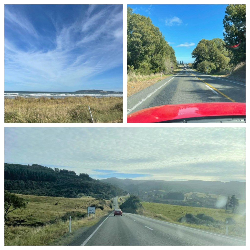
Given this was a wildlife weekend, we had decided to stay in the small seaside town of Brighton, just a 10-15 drive from the city.  We had a beautiful Airbnb with a view of the river, just a few minutes’ walk from the beach.  With this beauty and isolation comes no wifi, no TV and even no phone reception in the house!  😱.  No really stress though, we lit the fire and cracked open a bottle of wine.

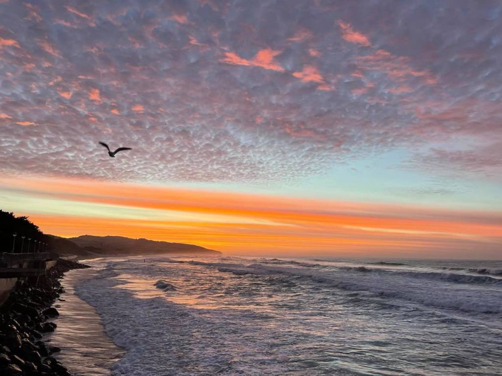
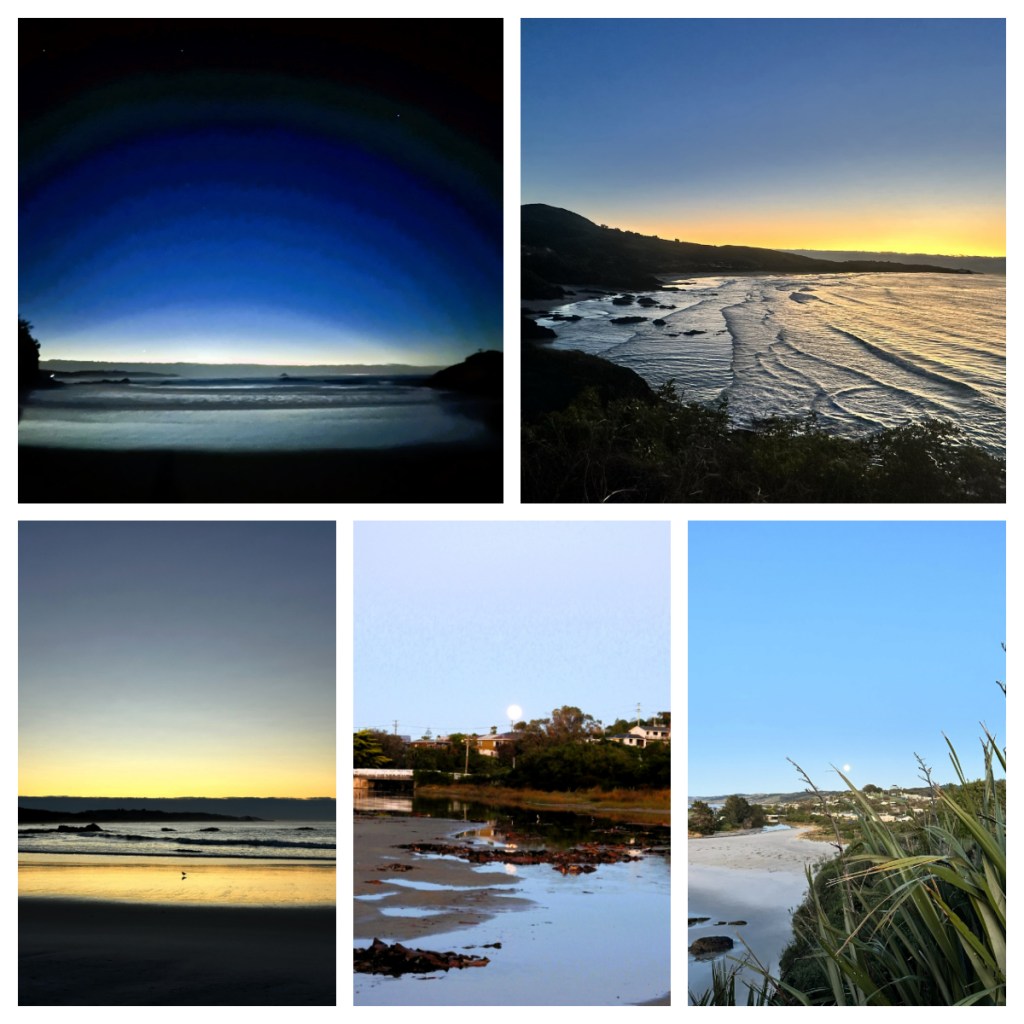
Harriet and I are both early risers, so we were up early on our first morning and headed out on a lovely walk down to see the sunrise.  Unfortunately, there was cloud along the horizon so no real sunrise (and it did not help that there was another peninsular in the way to see it even if it was clear).  To make up for that, there was also a huge full moon still on its down – it was a lovely way to start the day. 

On the way back to the house, we picked up a coffee and breakfast from the cute Brighton Beach Cafe before returning home to enjoy on our veranda watching the bellbirds and tui in the garden.

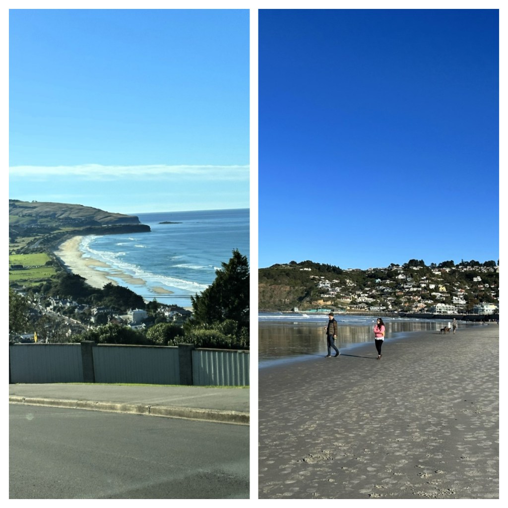
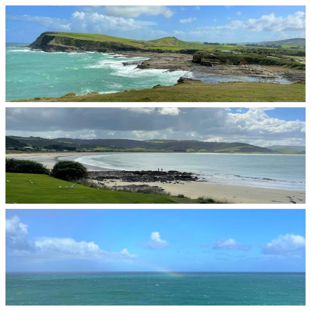
Ready for an exciting day, our first stop was in the lovely seaside suburb of St Clair where we enjoyed another coffee and another beach walk before the beautiful drive around the peninsula to Taiaroa Head and the Royal Albatross Centre. (A should note, the whole area is full of the beautiful beaches!)

Taiaroa Head is one of only two mainland breeding colonies of the Northern Royal Albatross in the world and the Royal Albatross Centre does a great job of walking you through the story of these magnificent bird and their conservation efforts to ensure the future of the species. 

From the main information centre, it is a short walk up to the Observatory where you get a ‘birds’ eye’ view (pun intended) of the birds.  At this time of year, we were lucky enough to see 7-8 fluffy chunky chicks, approximately 3 months old and already 10kg!!  These chicks will be here till around September when they fledge and set off on their 5 years OE (overseas experience) by which time they are ready to look for mate and settle down back on Taiaroa Heads during the breeding season. 


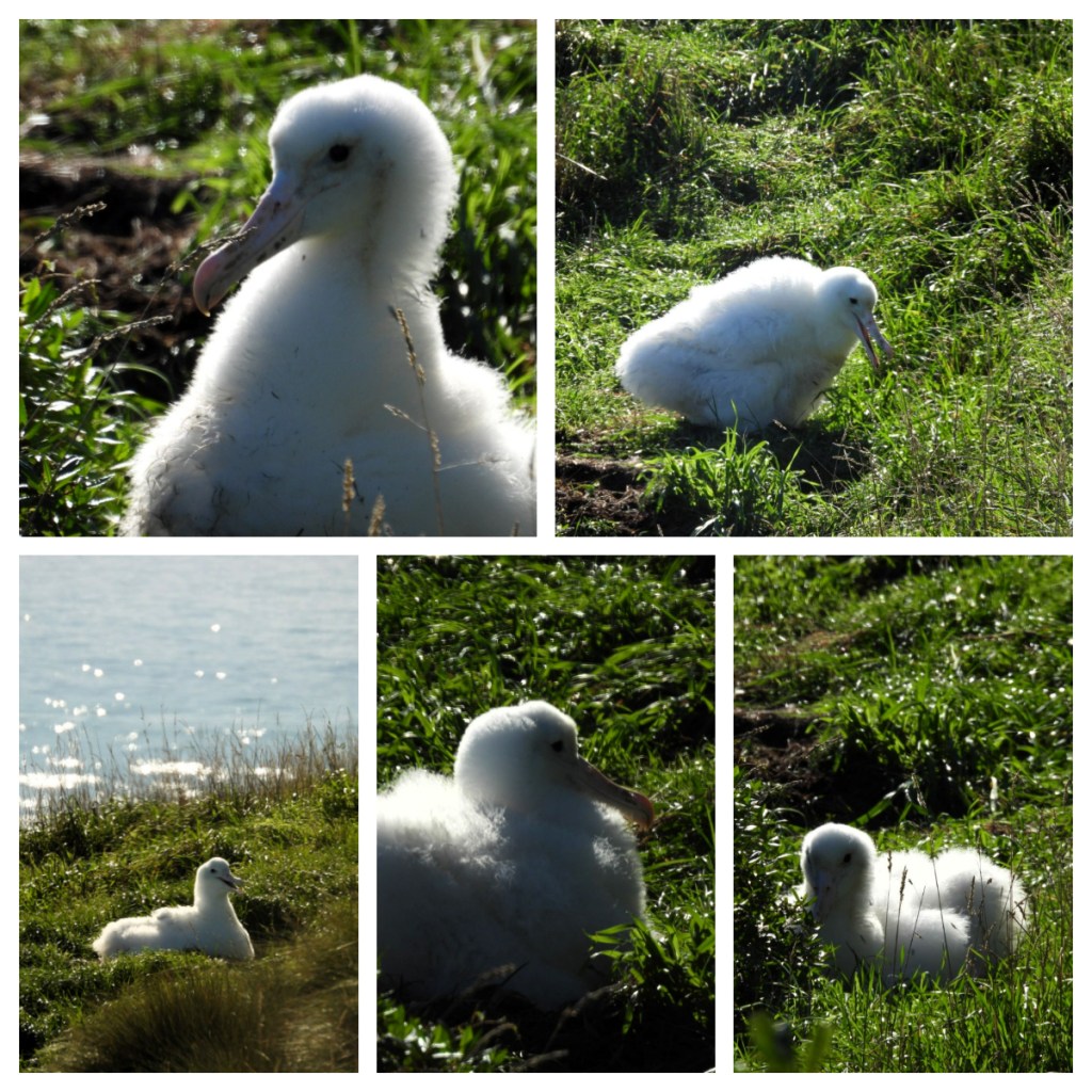
These Albatross mate for life, and after a number of years ‘dating’, at around 8-10 years old they only see each other once every two years for breeding and chick raising.   To ensure their breeding success, the staff at the centre remove the eggs when laid and replace them with dummy eggs.  They then hatch the chicks in an incubator before replacing the hatched chick back in the nest when it is dry and stable. Apparently, the parents don’t seem to notice, or perhaps they don’t mind??

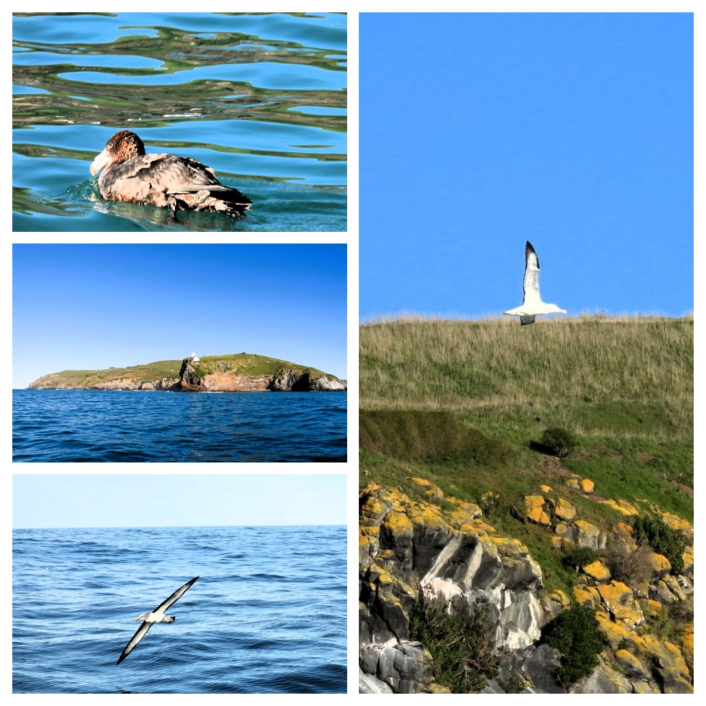
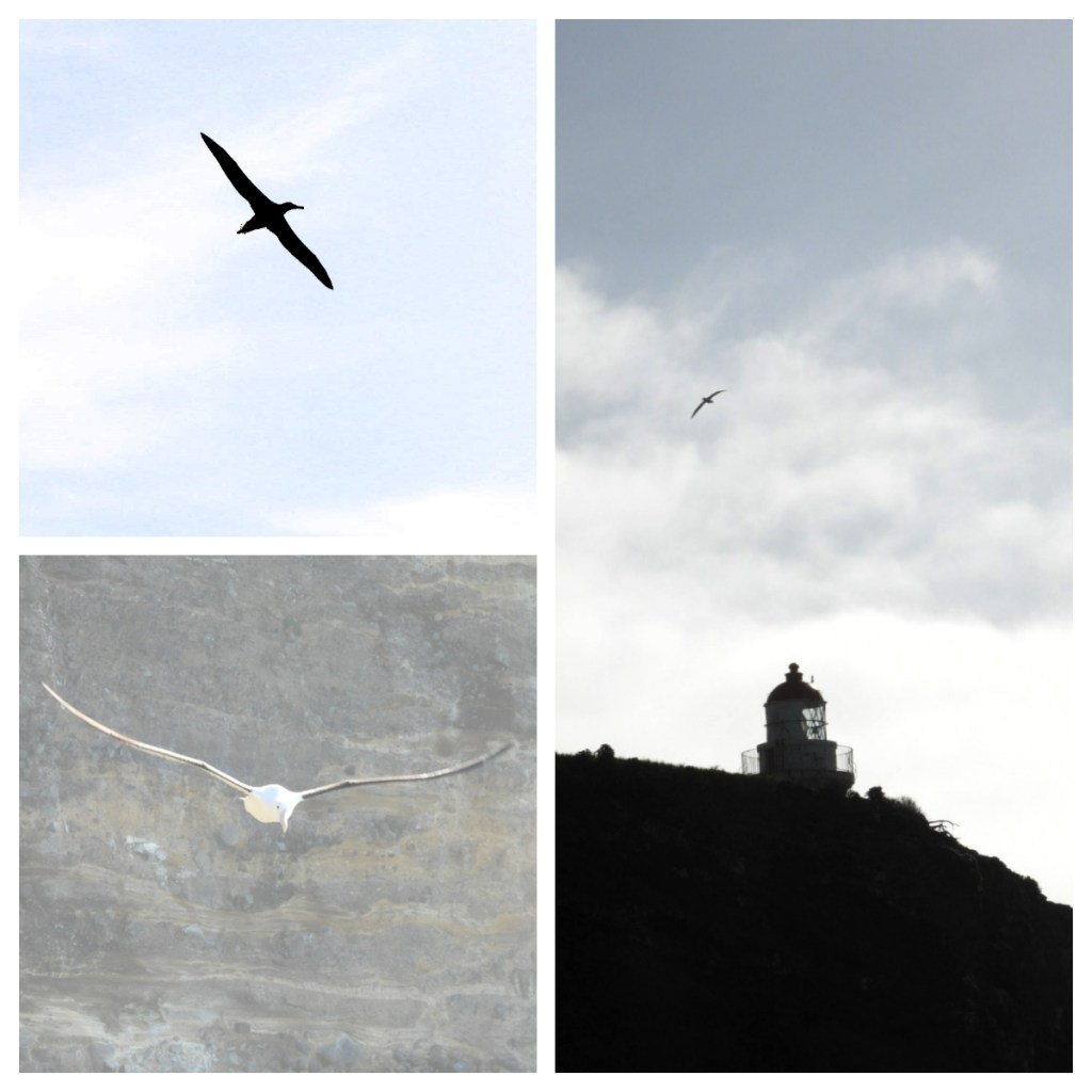
We were also lucky enough to see one adult out at sea, soaring in the wind currents on its 3m wingspan

From the Royal Albatross Centre, we travelled a short distance back towards town, to board the Monarch Wildlife Cruise.  The boat followed along the harbour channel, enjoying the sites of the beautiful Aramoana Beach to our left and the World War II gun emplacement and bunkers along the coastline on our right.  We continued out through the heads and out to open ocean, spotting wildlife on the way, including giant Petrels, Albatross (whose chicks we had just visited) and Otago shags.  Also spotting the Taiaroa Head Light house, the first lighthouse built in the South Island in 1864.

The 2 metre swells out in the ocean made for some fun sailing and I must admit I was rather happy when we turned around and headed back to calmer seas.

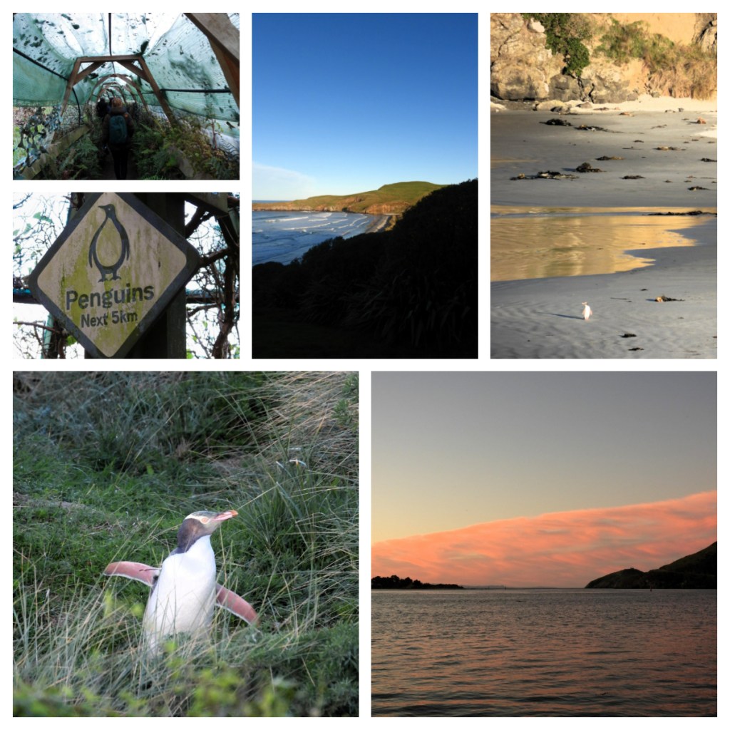
Our final stop for the day was Penguin Place (we had purchased a “triple crown combo” that included all 3 sites).  This is the home of the Yellow-Eyed Penguin Trust who focus on the conservation of the Yellow-Eyed penguin.  Known as Hoiho (noise shouter) in Māori, they are endemic to New Zealand and are the rarest penguins in the world.   Despite conservation efforts, the population is still in decline due to risk on land (where the penguins breed, nest and moult) and at sea where they feed. 

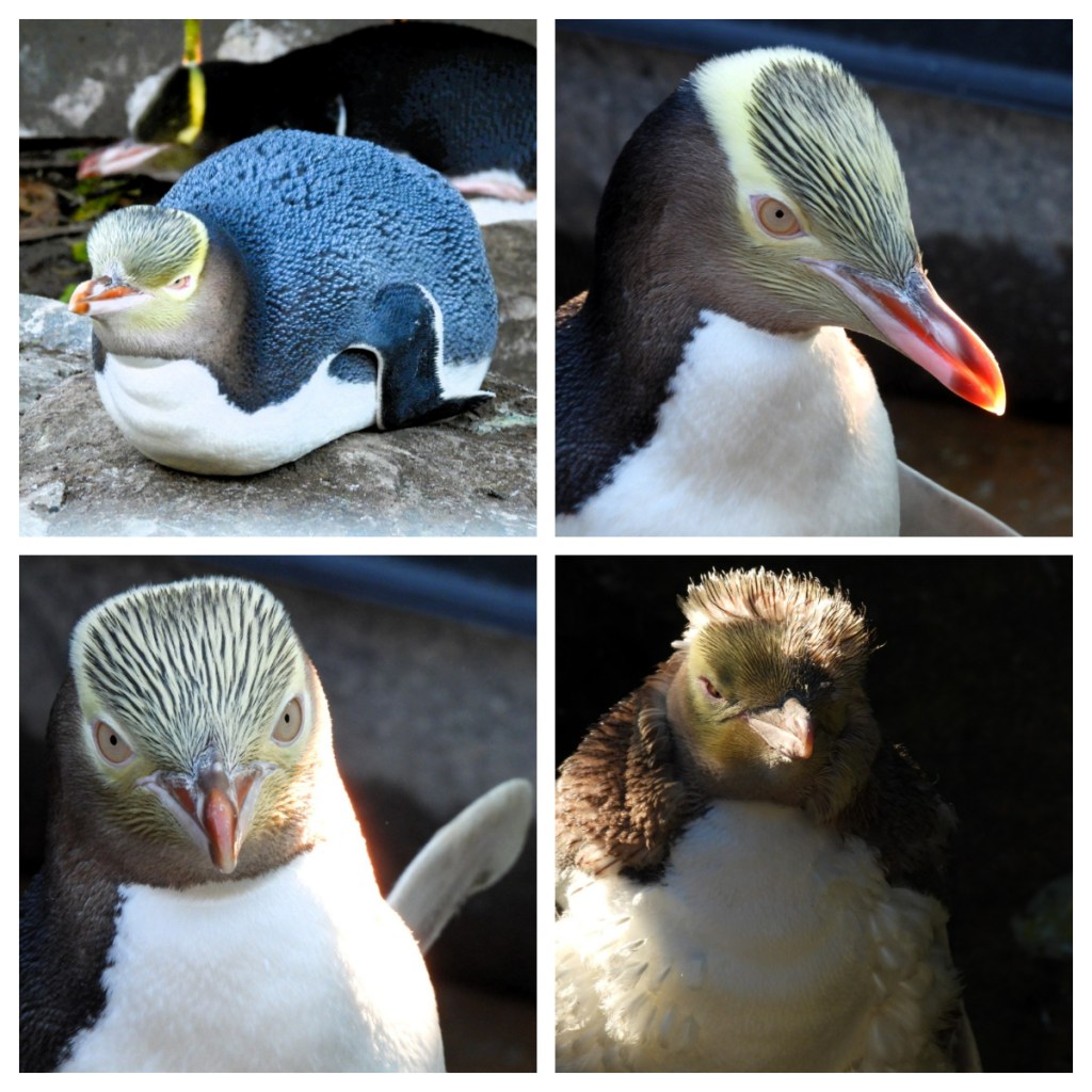
After a brief introduction to the penguins and the work of the trust, we visited the rehab centre where they were currently nursing 37 sick or injured birds back to health before they can be released back to the wild.  It was a great opportunity to get a close up look at these rare beauties.

We then took a 5 minute bus right down to the reserve where we walked through the incredible trench systems down to the viewing hides in the hope that we would catch a penguin or two making their way from the sea to their nest.  Unlike other penguin species, Hoiho are not particularly social so tend to come in one by one, rather than in ‘rafts’ like their other penguin cousins.  We were lucky enough to see a couple come in, as well as a beautiful sunset. 

The guided tours fund 100% of the conservation efforts here and it well worth a visit. 

After a long but successful wildlife spotting day, we had an early night in anticipation of another day of wildlife wonders.

We were very excited to meet up with Rod, who was one of the naturalists on our Indonesia and Papua New Guinea trip last year and as he is an Otago Peninsula local, we had reached out to see if he was free to meet up.  On Saturday, we had enjoyed a tourists view of the peninsula, and on Sunday we set off with Rod on a ‘locals’ tour 😂.

We started in a small private conservation area where Rod told us the story of the Jewelled Geckos and the antipoaching work being done.  These patterned bright green geckos are rare, and have been the subject of illegal poaching, most from overseas poachers.  Rod regaled us of crazy stories of the length’s poachers go to get these geckos, stories worthy of the CSI shows I love to watch!  I had no idea.

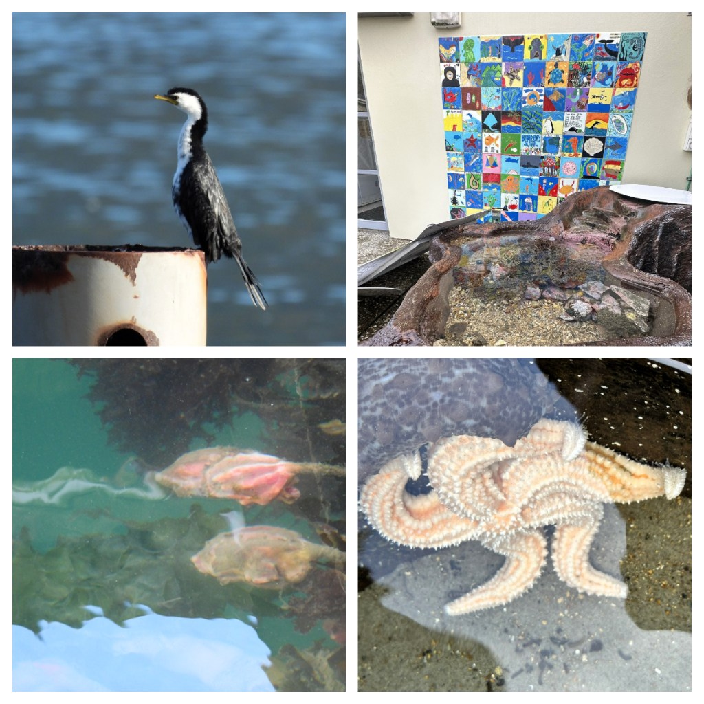
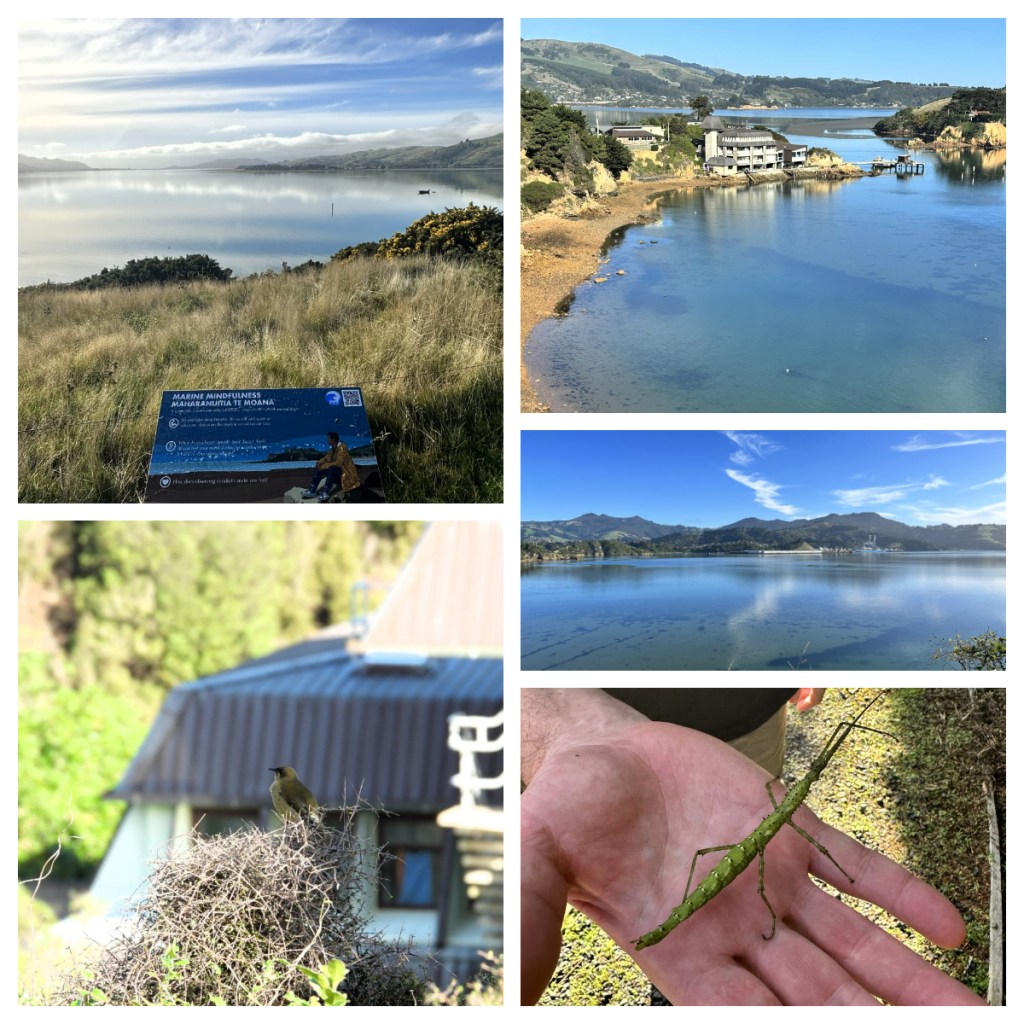
Next stop was the Otago University Portobello Marine lab facilities.  Apparently this is New Zealand’s oldest marine research facility and is still highly regarded for its facilities and the research that takes place.  Unfortunately, we could not go inside, but it was interesting to see all the tanks etc set up outside and the beautiful views from it’s wharf as Rod pointed out the little shags resting near by and all the sea tulips we could see in the water.

Right by the lab is the Portobello Peninsula Coastal bush, a lovely nature reserve that takes you out to the end of the Portobello peninsula.  It had beautiful views and was teeming with life, much of which we would not have seen if we had not been with Rod, including a prickly stick insect and a native lowland grasshopper.  The area also had some great new interpretive panels (created by a friend of Rod’s) that guides you to think about the nature around you.

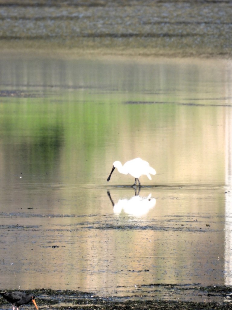
Back in the car, we followed the road that the skirts around the coastline (the tide was out now, and the wetlands were providing fruitful feeding grounds for a number of Royal Spoonbills).  Our next stop as at the beautiful Ōtākou Māori Memorial Methodist Church.  The current building (opened in 1941) replaces an original weatherboard church which was built on the same spot in 1865 which burnt down.  Today, even the ‘carvings’ are set in concrete to protect it for the future. 

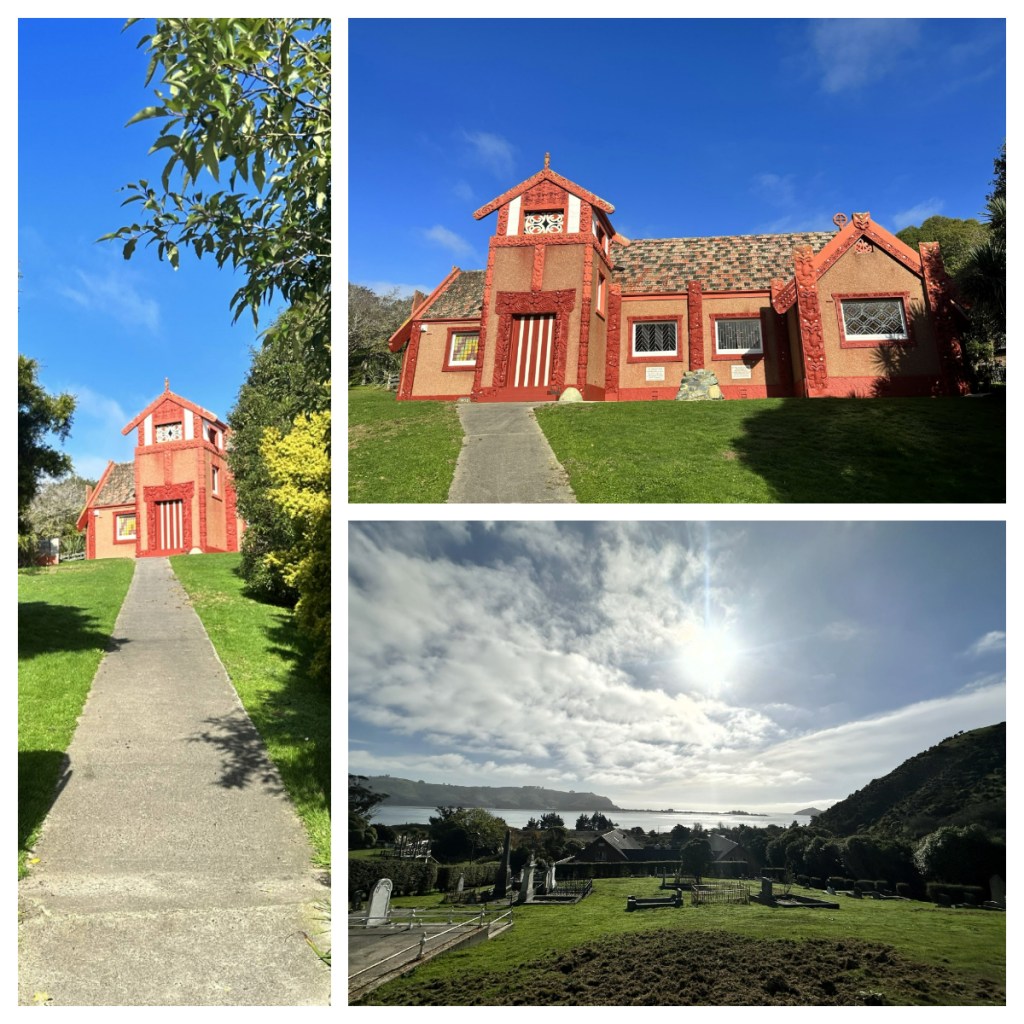
The nearby cemetery, which boosted a great view, is the resting place of all but one of the Chiefs who signed the Treaty of Waitangi and the Otago Deed of Sale.  In fact, this was one of the earliest Māori settlements in the area and the name Otago, is an Anglicisation of Ōtākou.

From here we headed to the end of the peninsula at Taiaroa Head, where we had visited the albatross the day before.  Today there were four Albatross soaring around the peninsula.  It was amazing just to stand near one of the viewing arounds and watch them, sometimes running low right over our heads. 

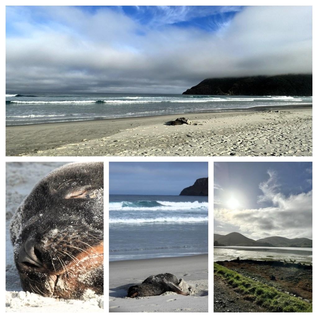
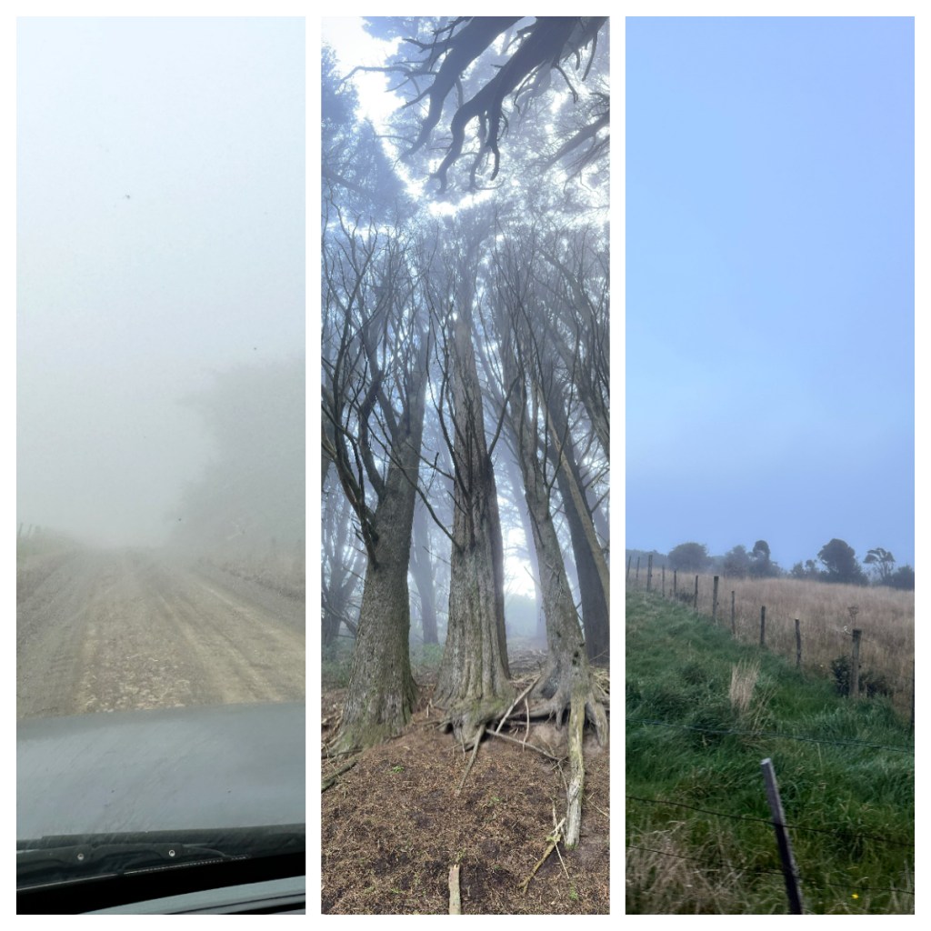
We crossed over to the other side of the peninsula for a somewhat wild beach walk (avoiding the large sea lion relaxing on the beach), before heading back up to hills – this time into the clouds of the Sandymount Recreation Reserve, through a creepy but very cool forest (really only creepy because of the cloud) and out to what is apparently a lovely view – of course we could see nothing lol.

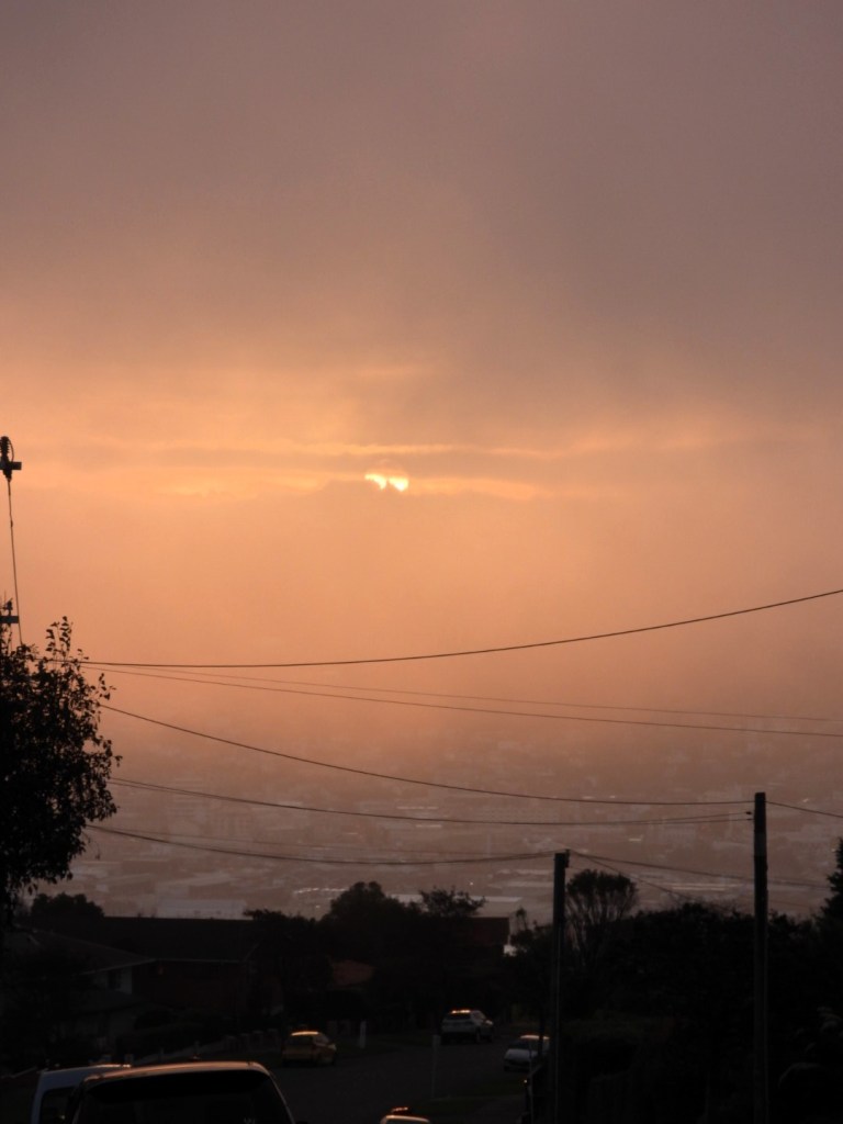
Our brilliant day out ended with an incredible golden sunset as soon as we got out of the mist.  We were so lucky to be able to spend the day with Rod and we were grateful for the knowledge and enthusiasm he has for his home and that he shared with us.

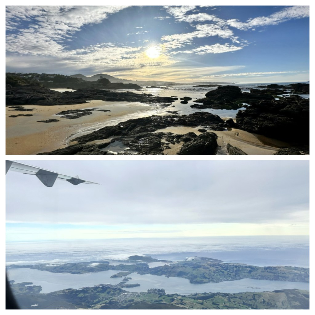
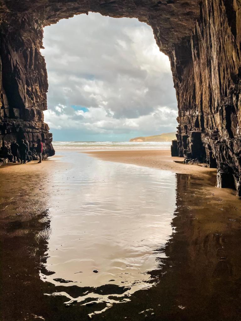
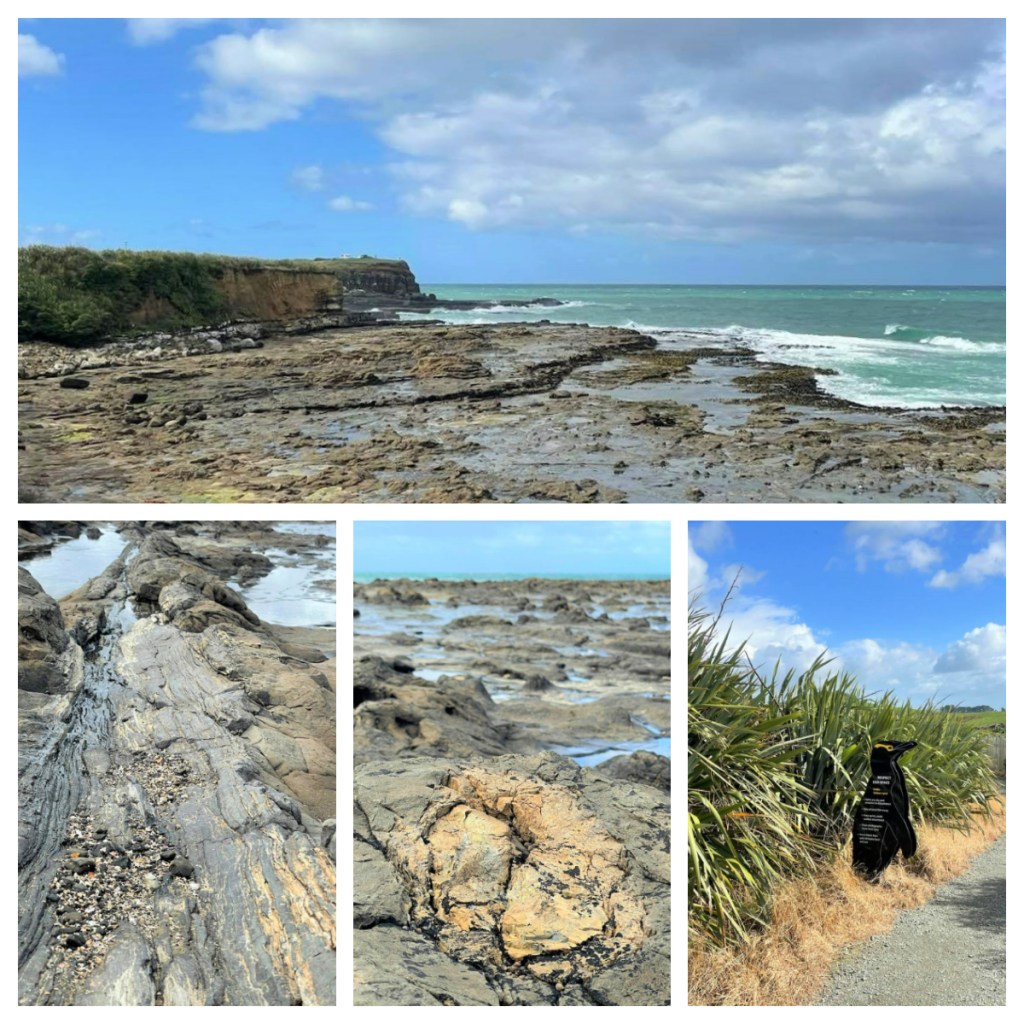
Our final morning found us back down at Brighton Beach where we explored the rock pools around the coastline before heading to the airport for a final view of the peninsula from the plane home.

What a fabulous weekend full of wildlife.  Dunedin is definitely a city with lots of hidden gems (and some less hidden) and stunning wild beaches if you are willing to search them out.

Cruising the Catlins (and Dunedin)

April 2021

For a long time I have been itching to head south.  Not quite as far south as Stewart Island but south to Dunedin and beyond to the Catlins, an area that covers the south east corner of the South Island.  I finally made it during the Easter break (which in New Zealand includes the Friday and the Monday), and better yet, I had managed to persuade my partner to come with me – winning all around lol.

We left Christchurch just after midday on Thursday, hoping to avoid the worst of the Easter weekend traffic.  Our plan worked and despite the multitude of trucks and campervans we had to pass, we arrived into Dunedin around 5pm – just in time to join the city rush hour traffic!  Fortunately we did not have to far to go to our ocean front hotel, right on the esplanade of St Clair – the seaside suburb of the city. 

We didn’t have an ocean front room (to expensive) but our room was lovely and we could see the sea from our balcony 👍🏻.  The tide was right in and somewhat wild but despite that there were a number of surfers braving the waves.  I wasn’t aware when booking the hotel, but apparently, St Clair Beach is a very popular with surfers, having New Zealand’s most consistent surf break and this weekend, they were hosting the South Island Surfing Championships! 

After settling in to the room, we made the short walk to the local shops to get some food for our drive tomorrow  and fish and chips and wine for our dinner – pure class 😂 and we enjoyed a quiet night in, in preparation of our early start the next day for our Catlins day trip.

I had spent many hours mapping and planning our day (yes, I am that person) and had an itinerary down to the 5 minute intervals 🥴, including tracking weather and tides (which is a must for some of our stops) lol.  As we left the city in the still almost darkness (it was almost 8am) it was raining! I prayed the weather websites I had consulted had it right and that it would clear up.

First stop was a petrol station to stock up on coffee, breakfast and fuel to make sure we were ready for a day on the road with virtually no shops and little phone reception – it was still overcast and raining, not boding well for our first viewpoint 🥴

We left the city on State Highway 1, the longest and most significant road in New Zealand running the length of both islands.  Not surprisingly it is a good road and in this area, runs through picturesque farm land.  We tuned off the main road to head towards our first stop at Nugget Point.

Nugget Point gets its name from the gold nugget shaped rocks (some imagination is needed to see this shape) just of the headland.   From the car park area, it is just a short, relatively easy walk up to the lighthouse, which was built in 1869 and the viewing platform over the ‘nuggets’.   

Thankfully the sky had cleared and although it was not sunny, it was still beautiful with the sun breaking through the clouds on to the sea.   It was windy though and I could not stay on the exposed part of the viewing platform for too long with fear of being blown off lol!  There is a small sign near the track which describes Nugget Point as the “meeting place of rock and waves and wind and tide” – I think that sums it up nicely.

Back on the picturesque road again and the rain started again.  Of course, rain + sun = 🌈👍🏻.

Now there are many waterfalls in the Catlins, and if you have more time, you could spend an entire day visiting waterfalls alone.  Our one day whistle stop tour means we had to choose one, and we chose Purakaunui Falls. 

The falls were only a short 10 minute walk from the carpark, through a native podocarp and beech forest filled with beautiful bird song and just as we reached the falls, the clouds parted and blue sky appeared above the waterfall for the perfect picture 😁.   The waterfall is 20 metres tall and cascades over 3 tiers.  Apparently, it is one of New Zealand’s most photographed waterfalls and even appears on a postage stamp (if you remember those things lol).

It may be worth noting that there is no phone reception in much of this area, so we were relying on the offline maps.me app to get around and we were initially concerned when it directed us along an unsealed road … but never fear, we finally made it out on the main road and we were soon at our next stop at the Lost Gypsy caravan were we had a quick break to caffeinate again 😂and grab an amazing freshly baked hot cross bun.   The caravan itself (and ‘museum’ in the surrounding area) is a weird collection of ‘automata and curios’ (one person’s junk is another person’s treasure) which definitely worth exploring if you have the time.

Back on the road and we had a quick stop at the Florence Hill look out for a view over the perfectly curved Tautuku Beach and out to the Southern Ocean before continuing on a few kilometres to the car park for Cathedral Caves.  We paid our small fee for the car park (more of a donation towards the maintance etc.) and headed down the track through the bush towards the beach.

The caves are only accessible 3 hours per day around low tide so planning was essential to make sure we were here at the right time.  It is also closed during the winter months.  It took us around 10 minutes down the bush lined track and 10 minutes along a beautiful wide wind swept beach – thankfully the sun was out again and it was not too cold.  I loved the bush lined beach.

There were a few people around, but not too many and we managed to avoid the larger family group which would have ruined all my photos 😂. 

The caves themselves have been gouged out of the Jurassic sandstone cliffs by the waves over tens of thousands of years and it is worth taking a torch (or ensuring your phone has a torch on it) if you want to explore the back of the caves.  They are up to 30 metres in height, resembling cathedrals (with some imagination).

It only took 12 minutes to walk/trot back up from the beach to the car park – my weekly hill walks must be paying off 👍🏻.

Just as we got back to the car park, it started to rain … the heaviest rain we had had during the day.  In fact, come to think of it, it seemed to rain every time we were in the car lol.

Our final stop was Curio Bay.  The home the endangered yellow eyed penguins and an incredible petrified forest.  Unfortunately, it was the wrong time of the day to see the penguins as they typically come in from their day at sea near dusk.  Of course, to see the petrified forest, we needed to be there around low tide and they did not correspond. 

The petrified forest dates back to the Jurassic period and the tree fossils you can see today, are approximately 170 million years old.  It was incredible that you can still see the rings of the trees in the ‘stone’.  The trees are the ancestors of Kauri and Matai, and were alive when New Zealand was part of Gondwanaland … if only those trees could talk.  It was a bit windy, but the sun was shining and the contrast of colours between the sky, the sea and the rocks was stunning. 

Just a short walk from Curio Day is Porpoise Bay.  You can probably guess that it is common to see Hectors dolphins in the bay.  We found a spot overlooking the bay to park up for lunch but unfortunately there were no dolphins today.  Before our long drive back to Dunedin, we took a  quick look at the view point over Curio Bay – guess what, it started raining and the wind picked up again, just as I was trying to take photos of birds in the distance but the wind was blowing me around on the exposed headland.   Again that amazing combination of sun and rain resulted in a  rainbow into sea 🌈.

We had an uneventful 2.5 hour drive back to Dunedin (if you don’t count the massive flock of sheep slowly making their way down the road) and the surf competition was still going (it started early in the morning).  We watched it for a little while before enjoying a well earned meal at Spirit House, an Asian fusion restaurant just a few minutes from our hotel – I highly recommend it if you are in the area. 

The next morning we had planned to have a relaxed morning and go for a walk but I woke to see red reflected in the windows of the houses across from us – that was it, I was dressed and out of there in a minute and boy was it worth it, what a beautiful sunrise.  (Not quite the pyjama clad dash I did in Stewart Island – at least this time I had clothes on 👍🏻 lol).

It was a lovely walk around to the Sir Leonard Wright lookout.   The walk took us along St Clair beach, through parks and a little along an ocean front road and then back along the beach – 8 km in total.  It was a great start to the day.

We headed back to the room to shower and change before driving into the city.  I bought a 50c map from the Information Centre and did a little self-guided heritage walk.  Unfortunately, the map didn’t give much information and had pretty poor photos showing the buildings, but it did give me some structure to my roaming so I guess it was worth the 50c?? lol

Dunedin’s history dates back to the arrival of Māori in around 1100AD.  Little evidence is left of their time here, in a place they called Ōtepoti, but it is considered that they survived on seal and moa.  Almost 600 years later, in 1770, Capitan Cook arrived in the area, quickly followed by European sealers and whalers decimating the local wildlife populations.   

The 1800’s brought the gold rush and a Scottish settlement, that turned in to New Zealand’s first city in 1865.  It was also the largest and richest city at the time.   The new settlers tried to replicate Edinburgh and many of the buildings from that time give the city the character it has today.  The name Dunedin come from the Scottish Gaelic name for Edinburgh – Dùn Èideann.   Apparently the ornate Victorian and Edwardian buildings are regarded the best collect of such architecture in the Southern Hemisphere.  Dunedin is also home of New Zealand’s first university – Otago, which was founded in 1869.

My walk ended up at the at the First Church, built in 1873 – the last time I was here photographing the church was 8 years ago, in the snow!!! This time I was fortunate to have some sunshine 👍🏻

From the city, I drove out to the peninsula to Larnch Castle – a mock castle with beautiful views and stunning gardens with plants from all around the world.  Unlike the map I had in town, the entrance fee (you can pay to just look around the gardens or the gardens and castle) to the castle provides you with a brochure that has lots of information about the castle and grounds.

Despite all the “Scottishness”, the castle has no real Scottish roots and Larnch was actually born in Australia and lived most of his life there or in New Zealand.   (At that time, these settlers still considered themselves British despite never setting foot in the mother country.)

Apparently, it is New Zealand’s only ‘castle” and was built by European mast craftsmen in 1871 by William Larnch for his wife Eliza.  No expense was spared.  Unfortunately, over the years the castle and grounds was left and both were in poor condition when purchased by the Barker family in 1967.   They have spent the subsequent decades restoring both the castle and gardens to their former glory (and beyond the case of the gardens) and the entrance fees allows them to continue this work.

The final thing on my list for the day was a walk to Tunnel Beach, a beach just outside of the city.  OMG, the path down was so steep and I was already dreading the walk back up just a few minutes in to the walk down!  This is another beach that you can only access 2 hours either side of low tide.  On this day, low tide was 4.30pm and the track and its nearby on road parking was already busy at 3pm!   

After the steep path down, I reached the tunnel which was narrow and dark (it is a tunnel after all  🥴) but it was all worth it when I made it to the to the beautiful beach surrounded by cliffs

By the time I got back to our hotel, I had most definitely earned pizza for dinner!

Our final morning and it was 19c at 6.30am so I was up early again for a final walk along the sea front and beach.  The sunrise was not as nice as the day before but was so warm and beautiful and surfers were already out warming up for their competition.

Sadly it was then time to get packed and head north, not without a short stop for lunch at the Fishwife at Moeraki village (yes, it is near the Moeraki Boulders).  They have great chips and are amazing for fresh Crays (if you like that kind of thing lol).

Its worth noting that Dunedin has so much more to do than just the mostly outdoorsy things I did.  It has a great museum, brewery tours, albatross and penguin colonies, wildlife boat cruises – definitely something for everyone!