December 2020

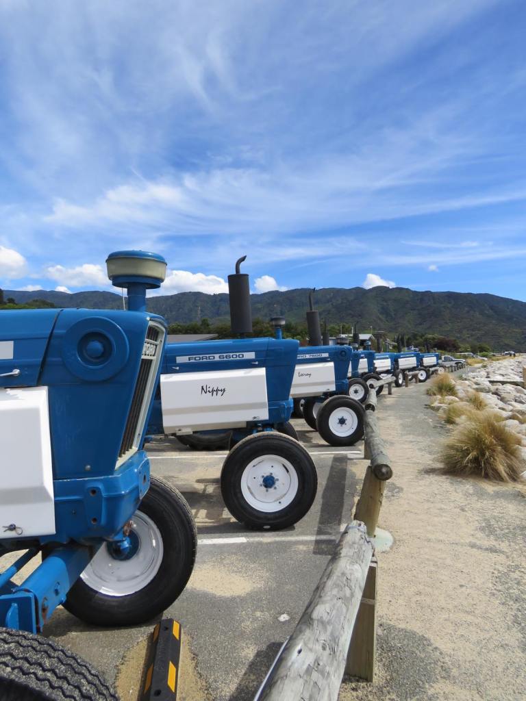
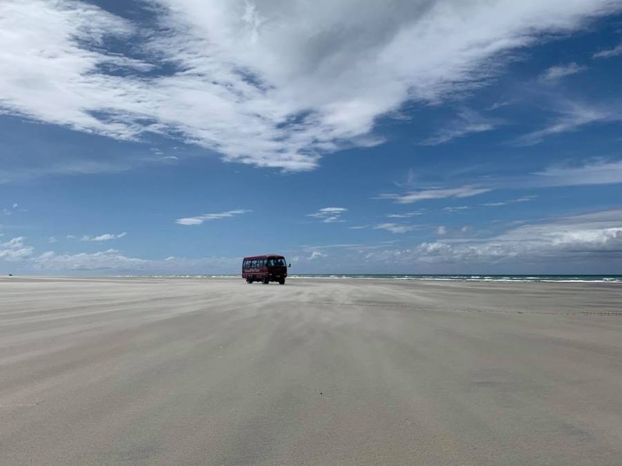
Our ride for the afternoon was a 4WD bus operated by Farewell Spit Eco tours. They have been operating tours to the spit for over 70 years, and are the only company licensed to do so. You are not allowed to drive on the spit, so the only way you can see it all is to take their tour – and it was definitely worth it.
Despite the lack of international tourists, they were operating 3 buses on this day, so they are clearly still doing good business with kiwis exploring their own backyard. Charles, a strapping Dutchman (who had lived in NZ for many years) was our guide for the day. He described himself as guide, driver, photographer and part time dairy farmer from Motueka lol.
As we headed west out of Collingwood, Charles told us all about the area and interesting bits and pieces about what we were passing. We started with a brief lesson on Mt Burnet, New Zealand’s only dolomite mine (who knew!). Dolomite is a hardened limestone and has a high magnesium content and is used in fertiliser and cattle supplements (to combat magnesium deficiencies). It is also used to purify steel.
If we blinked, we would have missed the tiny town of Pākawau, another relic of the coal mining industry in the region, dating back to 1840. Today it is home to the Westhaven Littleneck clam beds and processing factory. The clams are wild caught, stored in a pool to ensure they are not full of sand before being heat treated and snap frozen – they are then shipped all over the world.
Like Pākawau, Pūponga was also fairly easy to miss. At the height of the coal mining, the town was home to over 500 people as well as being the main port in the Golden Bay area. Today just a handful of people live there. The old wharf, once the longest in the Southern Hemisphere at 1km long, is long gone except for a few wooden pillars. The coal was taken down the pier by a small train – a 6 tonne diesel powered train (affectionately known as Donald) would take coal to the coal barges sitting in the man-made channels.
When no longer in use, ‘Donald’ the Locomotive (who had arrived in New Zealand from Scotland in 1901) was abandoned in the water and left to rust away until he was rescued in recent years by members of the Blenheim Riverside Railway Society who spent thousands of hours restoring him to his former glory.
From ‘Port’ Pūponga we travelled inland, across the top end of the island towards out first spot at Cape Farewell, the northern most tip of the South Island. We passed the site of a large Maori Pā (a hill fort) where there had been numerous big battles until the infamous chief Te Rauparaha arrived on one of his many invasions, destroyed the Pā and killed everyone!

Cape Farewell was the last point of New Zealand that Captain Cook and his crew saw when they departed in 1770 (well thought out place names strike again!). We always consider the South Island being directly south of the North Island, when in fact they overlap quiet significantly and this point of the South Island is actually in line with Palmerston North in the North Island!
After an early attempt to drill for oil, which thankfully failed, much of the land in the area now provides a buffer to Farewell Split – this land today is partially farmed as well as allowing forest regeneration.
We had time for a brief walk around the cliff tops and take in the view, thankfully there were no mosquitos or sand flies … because it was too windy 🥴😬.
As we got back onto the bus and travelled towards the spit, Charles told us that there can be 14,000 black swans on farewell spit in season, self-populated from Australia in 1840s. Apparently New Zealand use to have its own species of swan which was extinct before Europeans arrived – as with most of New Zealand’s extinct birds, it was much bigger and heavier than the modern day swans from Australia. I can only imagine how amazing it must have been to have Moas, Haast Eagles and giant swans wandering around.
At around 30km long, Farewell Spit is the longest sand spit in New Zealand (growing annually) and today it is a nature reserve of international importance due to the bird sanctuary and wetlands. The public can only access the first 4km (by foot) unless on a tour with Farewell Spit Eco tours (or part of DoC or Maritime NZ). In fact, its status of international importance means it is more tightly managed than national parks with a few of the rules being that you can not smoke, nor can you remove anything from the Spit (though I think I had a fair amount of Spit sand in my shoes by the end of the day).
At the beginning of the Spit is Triangle Flats, according to Charles this was the site of large Maori battles and numerous tools, weapons and parts of large wakas (canoes) have been found in and around the area. Apparently, the settlements here were not large, but both Abel Tasman and James Cook wrote about being approached by many waka filled with men (not particularly welcoming) – names such as Murderers Bay tells the story. (Apparently, it was all just a big misunderstanding -the local iwi performed a haka (basically a war dance) and blew a conch shell and the Europeans thought it was a greeting rather than a warning and replied with a trumpet fanfare – a clear declaration of war!) It is though that the Ngāti Tūmatakōkiri were killed off in an invasion by another tribe in the early 1800s.
Back on the Spit and we discussed how tidal the area is (the tides dictate what time the tours go) – being 2,000 hectares at high tide and 10,000 at low tide which is part of what makes it an important feeding ground for birds. In fact, the region has a higher biomass than a rain forest with over 90 species of birds, crabs, insects etc.
The base of the Spit used to be farmed, as well as being a popular area for hunting of birds until it became a nature reserve in 1938. It is not only a Ramsar Site – a list of Wetlands of International importance which provides a framework for international cooperation for the conservation of such sites but also a Flyway Reserve Network Site, a network of wetlands with significant importance for migratory shorebirds.

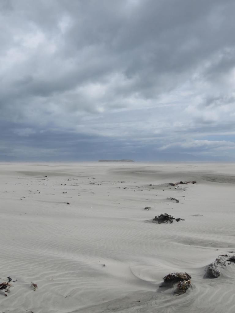
We crossed over the Spit from the sheltered wetland southern side to the sandy, exposed northern side where Charles had to get out from time to time to check the sand conditions before driving on to the sand. It was beautiful with kilometres of white sandy beaches and on this side, we are facing north, straight towards Mt Taranaki (if we could see) it.
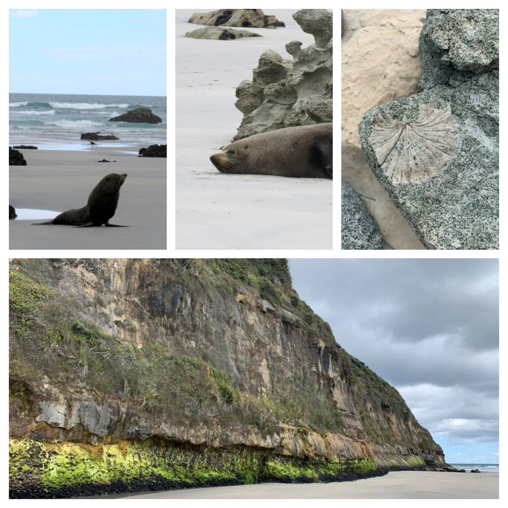
Our first stop was right on the base of the Spit at Fossil Point, which holds fossils from an old riverbed from the Cretaceous period (a mere 40 million years ago). Fossil hunting was only interrupted by the random seals camouflaged as they lay around by the rocks. The weather had started to turn a little and it had started to spit so we jumped back on the bus and heading further down the beach, past the public access area and beyond. 👍🏻👍🏻
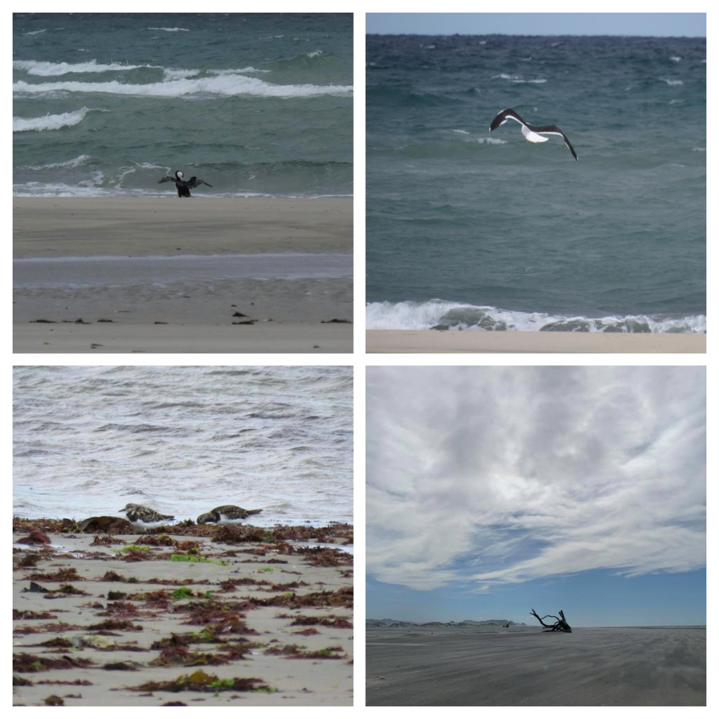
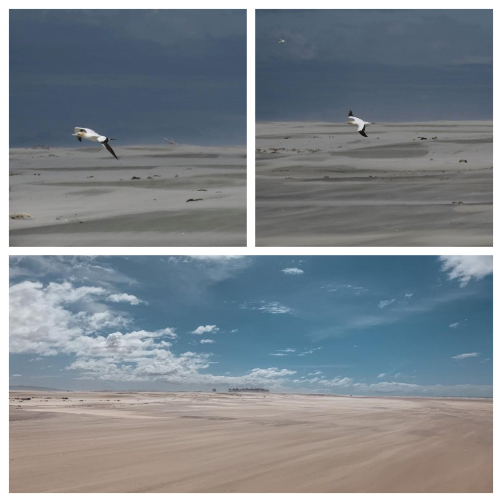
As we drove slowly down the Spit, Charles pointed out just a few of the birds we spotted, including Godwits (Charles was really excited to see them.) Did you know that Godwits have the longest migratory flight of any flapping bird, taking 9 days from Alaska to NZ non-stop, losing half their body weight during the journey? Legend says that a Godwit sat on the shoulder of legendry Maori voyager Kupe, guiding him to Aotearoa.
We also saw dotterels, variable oyster catchers, black back gulls and Caspian terns (the largest tern in the world) hanging amongst white fronted terns who are almost identical except for size (Caspian tern being almost twice the size of the other). The White fronted terns have only just started breeding again on the spit 👍🏻 Unfortunately, there are no photos as we didn’t stop and there was rain on the windows of the bus. 😢
According to Charles, variable oyster catches have the fastest growing beak in the bird world – 0.4mm a day!! They are also show resource polymorphism – their beak can change shape depending on the food source. They can be long and sharp for ‘stabbing’ food, or short and stout for shovelling. Sounds to me like Charles Darwin should have done a study on Farewell Spit as well as in the Galapagos Islands!
Charles was clearly very passionate about the history and wildlife of the area that he enthusiastically educated us about on the drive.
We passed a massive tree stump which was washed up in a flood in 2010. On the stump was 2 pied shags – the story goes that they arrived on the stump, as there never used to be pied shags on the Spit before the arrival of the stump!

The Spit is currently growing, getting longer and wider. Some think it will eventually attach itself to another island or piece of land as it continues to grow. It is clear how much it has grown when we got to the lighthouse compound – which use to be at the end of the spit and is now a number of kilometres inland! However, it is highly likely that some of the sand will blow away again! Only time will tell.
Towards the end of the Spit, there was no vegetation – nearer the base of the Spit, Maram grass had been planted over the years to stop the erosion of the dunes (they move roughly 30 metres per year). That said, it is believed that the part of the spit was once covered in forest and moa bones have been found in nearby Maori middens.
Despite Abel Tasman clearly mapping the Spit, lots of ships have beached on it (Captain Cook did not see it at all due to poor weather), so in 1870, a 30m high lighthouse was built on the end of it, in a compound with 4 houses. (As I previously mentioned, when built, the lighthouse was on the end of the Spit!)
As nothing would grow in the sandy ground, with no fresh water, all suppliers for the lighthouse keepers and their families have to brought down the Spit by horse and they were always digging the house out of the moving sands. It was apparently the least desirable lighthouse posting in the country!
In 1890, one of the lighthouse keepers started getting soil from town every couple of weeks and planted a windbreak of macrocarpa trees that we still see around the compound today. This protected the compound from the wind and sand and enabled the families based there to start grow some of their own produce.
In 1897, the wooden lighthouse was replaced with a steel lighthouse, which was converted to electric in the 1930s. The electricity was only for the lighthouse and the lighthouse keepers and their families were not allowed to use it till 1957. The last lighthouse keeper left in 1984 (from what use to take 3 keepers to maintain), with the original electric light being replaced in 1999.

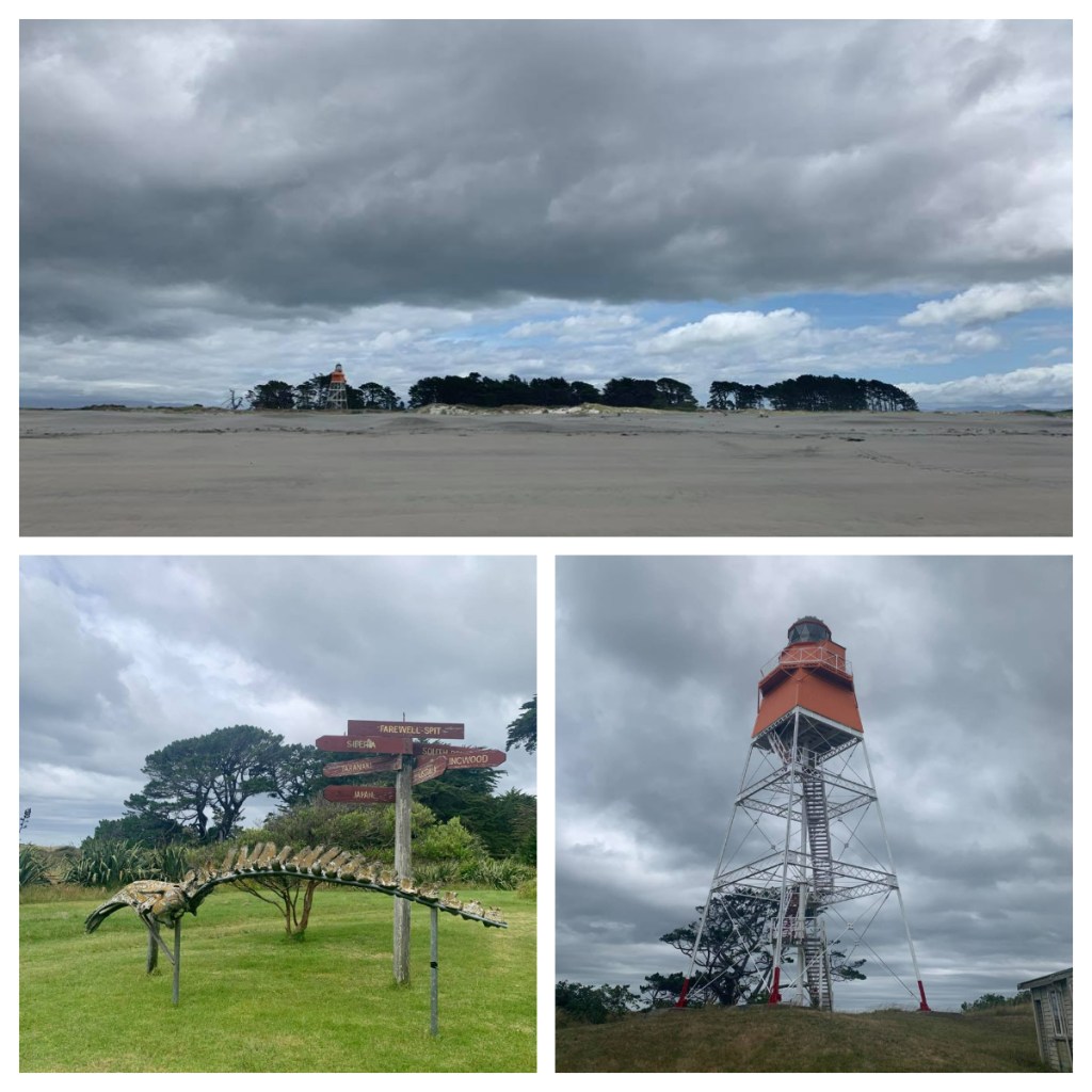
Anything orange on today’s lighthouse is from the original lighthouse and the feet are painted red – why you ask? Apparently, it was in support of the Team New Zealand in the Americas Cup champaign – Sir Peter Blake started a traditional of red socks in 1995 in support of the team.
After taking a break for afternoon tea in one of the old houses, we were back on the bus and back down to the beach.
In the distance, we saw what I thought was a dog running across the beach, it was in fact a seal (which makes far more sense). I have never seen a seal run so fast, when it reached a small area of water, it skidded across on its belly before jumping back on its flippers and continuing to run. We think it was chasing another one we had seen nearby – males are very territorial!
A little further down the Spit is a large Gannet colony housing over 10,000 birds. It is in fact the only gannet colony at sea level (they are normally on high rocks over the sea). Farewell Spit Eco tours actually run another tour specifically to see the Gannets but as we have a few minutes to spare Charles decided to do a sneaky drive down the Spit to see some of the Gannets flying around and the colony in the distance …. the wind had picked up and this open end of the spit was incredibly windswept. The sand blasted us as we stepped out of the bus but at least the sun was shining, and I was happy to have the opportunity to see them.
Our final stop on the Spit was at the sand dunes and the highest point of the island, where we had some time to walk up the dunes (or run in my young energetic nephew’s case)! It was great fun (and my nephew’s favourite part of the day) and I enjoyed the amazing patterns in the wet sand.
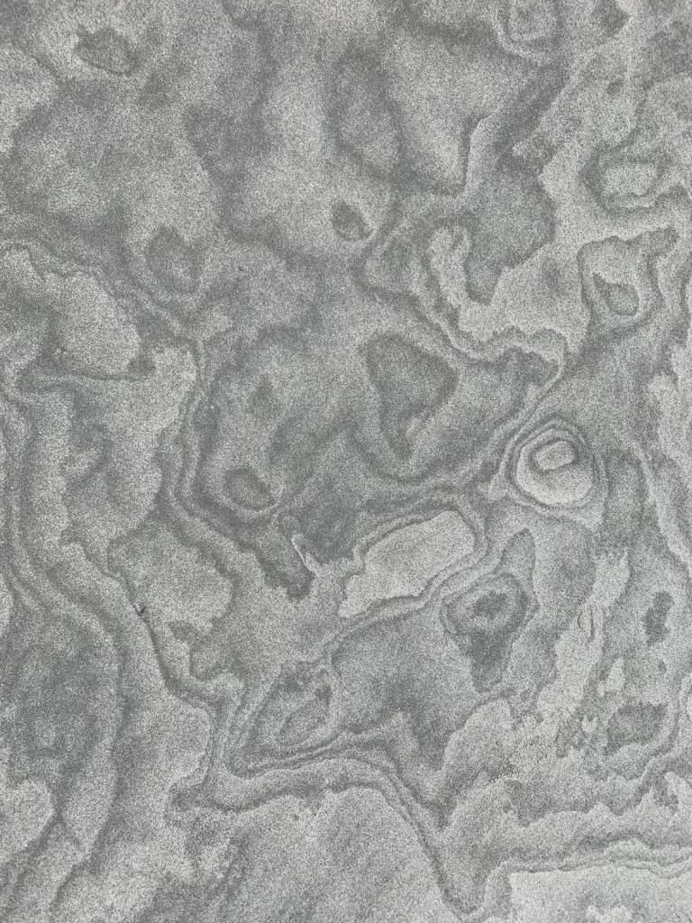

The wind continued as we drove back down the Spit, and the surface sand was now being blown along – it looked like we were driving through a river of sand with currents running through it.
It had been a long day, but I highly recommended the tour.