April 2022
This trip was to be a trip of two parts – starting with 5 days on Aotea Great Barrier Island (not to be mistaken for the reef which is over 2000 kilometres away! (Buckle in as it a bit of a long one lol)
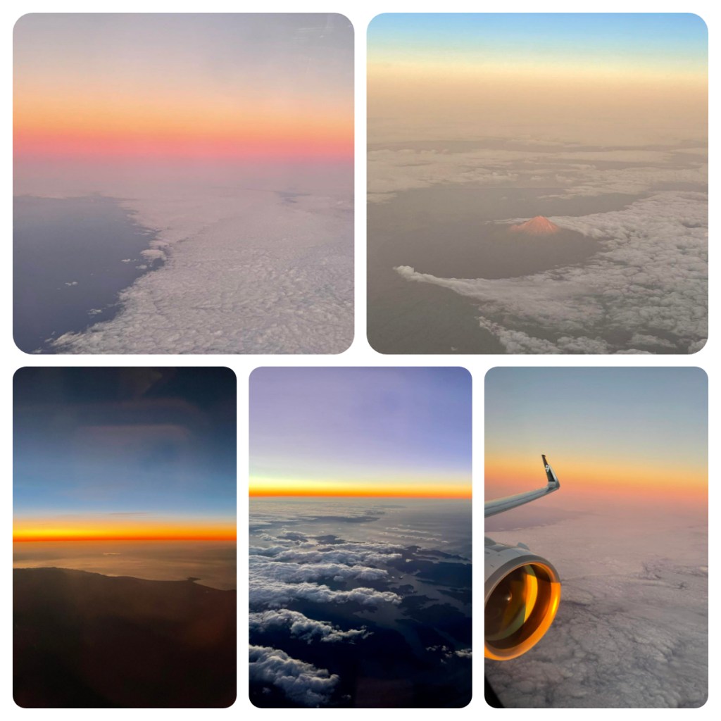
It started with a crazy early flight but it was on a big plane with a drinks service – I hadn’t seen either for a while. The benefit of a flight at this time was a stunning sunrise and I had photo overload before I got off my first flight 🤦🏻♀️.
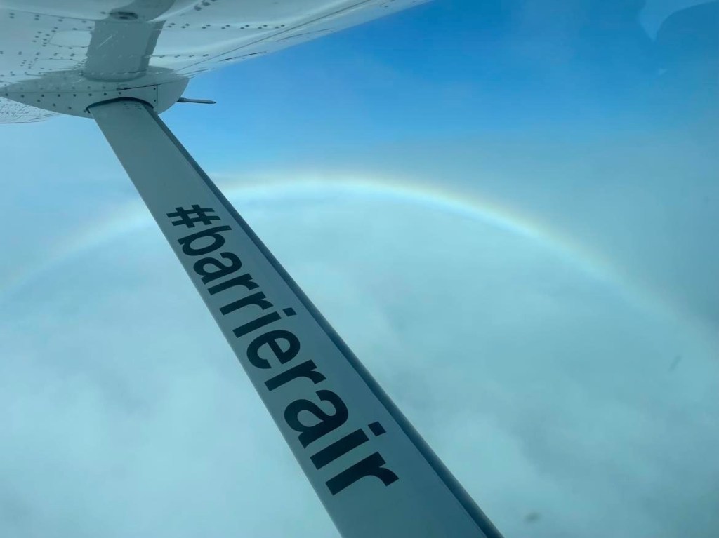
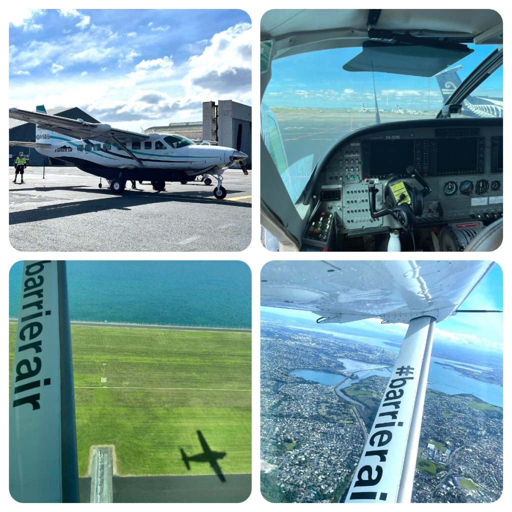
After a 3 hour wait at Auckland airport I was thrilled to be boarding the 12 seater Cessna Caravan, in seat 1A right behind the pilot, for the 30 minute flight over the city and out over the Hauraki Gulf. The clouds started to roll in as we neared Aotea/Great Barrier Island so it a little bumpy on the way down to the small airfield.
Great Barrier Island is the 6th largest island in New Zealand at 285 square kilometres and sits around 100 kilometres north east of Auckland on the outer edge of the Hauraki Gulf. The island was first settled by the early Polynesian settlers, including the first of those great travellers – Kupe. He named the island Okupe (which remains the name of one of the settlements on the island today).

Captain Cook arrived as part of his 1768-1771 expedition, naming the island Great Barrier Island due to the shelter it provides to the Hauraki Gulf. In the 1800’s it was a hub for “boom and bust” industries – kauri forestry, mining (cooper, silver and gold) and whaling. Apparently, descendants of some of these early European settlers still live in on the island today.
Around 1000 people live on the completely “off the grid” island, with many more “commuting” between their houses on the mainland and their island holiday homes.

Within about 30 minutes of landing I had picked up by bag, walked the couple of minutes to the car rental office and was ready to hit the road (there is no public transport so you either need a car, or be ready to hitch hike your way around). I made a short stop at Medlands Beach, just by the airport, a pretty but exposed east coast surf beach. It is a beautiful long beach worthy of a walk, before I tackled my first Great Barrier Island hill, over to the settlement of Tryphena where I was staying.
When I picked up the rental car, the guy at the office warned me about the roads and stressed to stay on the left hand side. Many of the island roads are narrow and windy and when you take a blind corner only to come face to face with someone travelling at speed on your side of the road, it is rarely going to end well! Thankfully I never found myself in this situation.
Tryphena is one of the main settlements on the island. Made up of golden sandy bays (well at least when the tide is out), which apparently are great for swimming and although I was not tempted, I did see a few people taking a dip. My accommodation at Manuka Lodge was simple but everything I needed, including a lovely view over Mulberry Grove (one of the 3 bays). Despite being a little overcast it was still warm and so peaceful.
I walked just a few minutes from my lodge down to the waterfront and did a little bird spotting as the sun started to set. I love that there are lots of signs around the road, warning drivers of Pateke crossing the road. Pateke, or Brown Teal are small endemic dabbling ducks, once common place but now endangered. I use to breed them for release to the wild during my time at the Otorahanga Kiwi House and I was excited to see them in the wild as they are very cute. I spotted my first one quickly, though it was hanging out with a couple of mallards (apparently they interbreed which is problematic for the dwindling population).
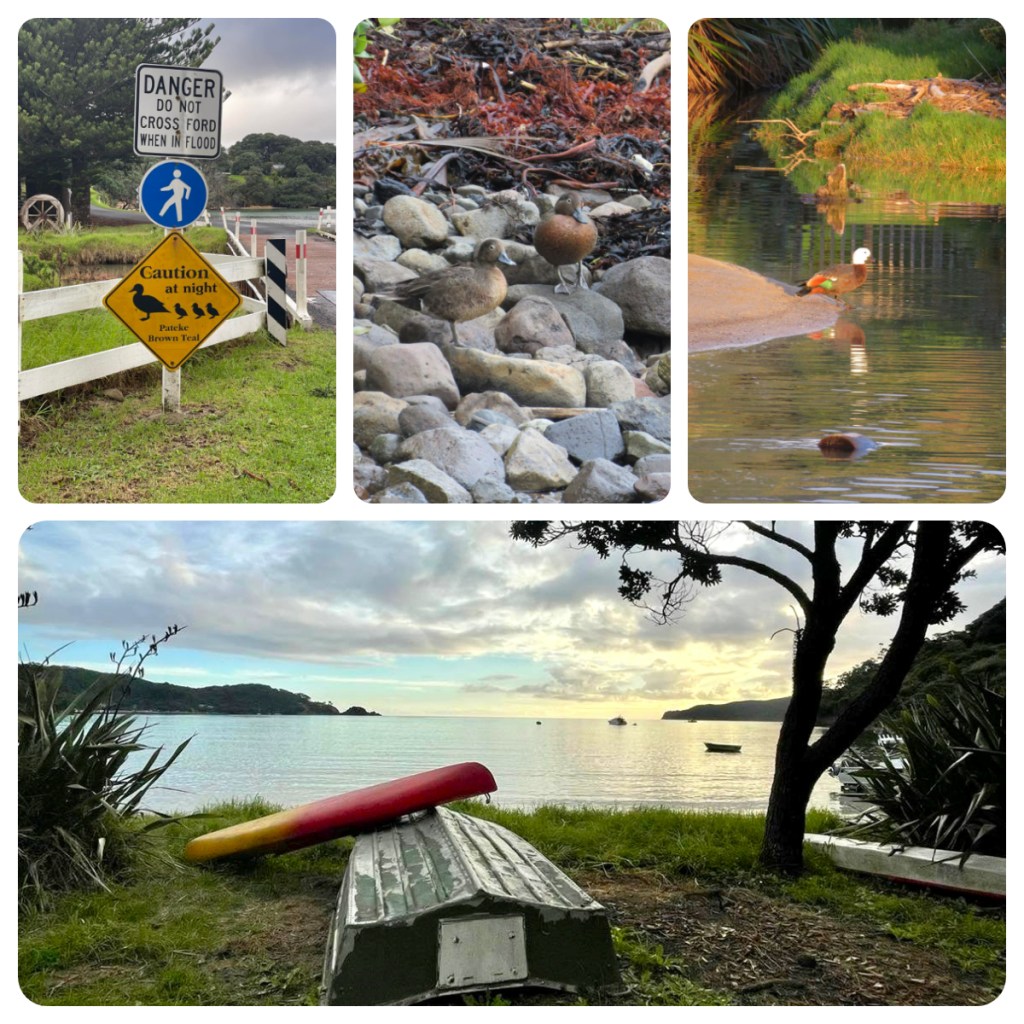
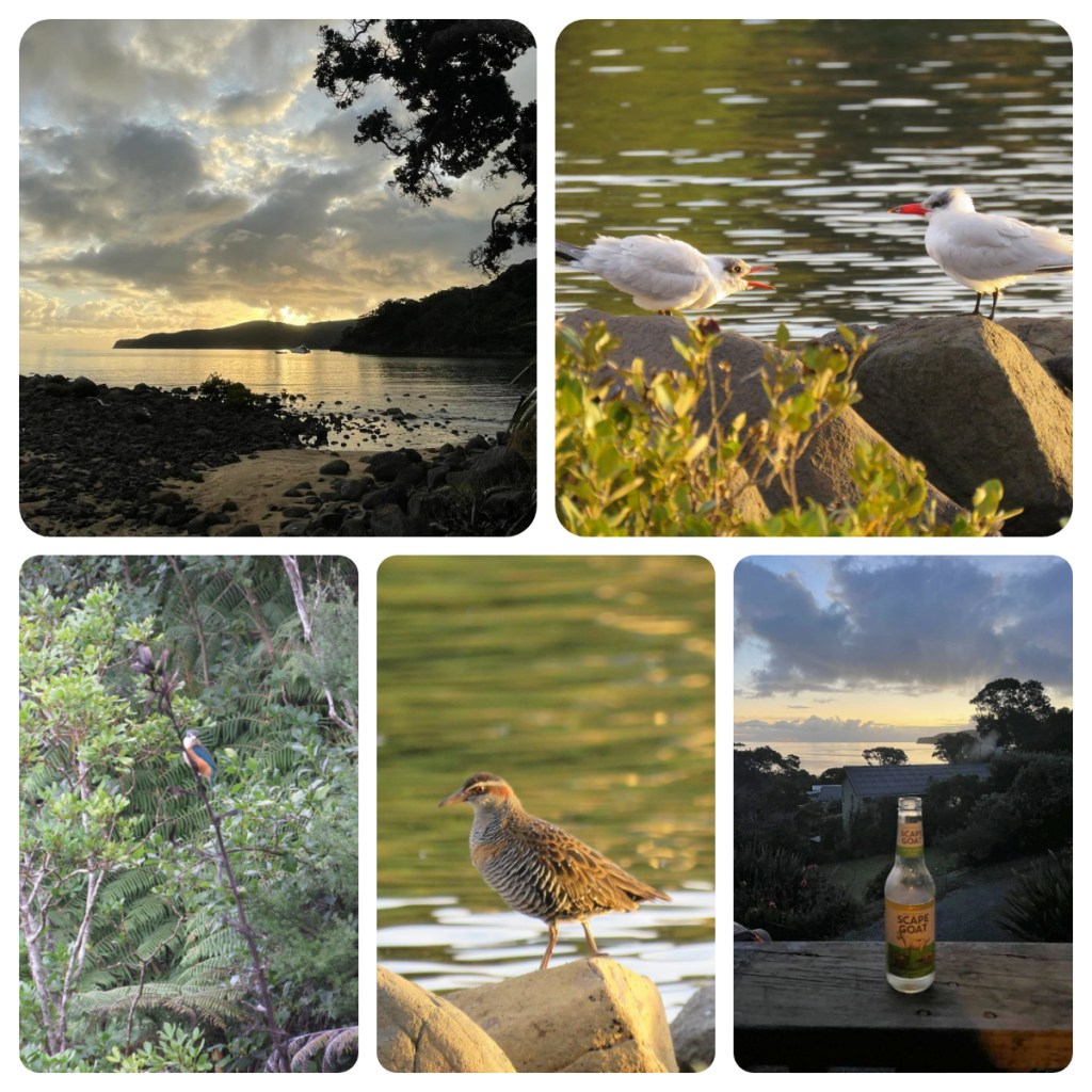
I spotted Kingfishers, fantails flitting around presumably catching insects (insects that I could not see and that I hoped where not biting me 🥴), terns (white fronted I think), Banded rails, Paradise Shell ducks – all these birds warmed my geeky bird spotting heart and I enjoyed the sunset with them.
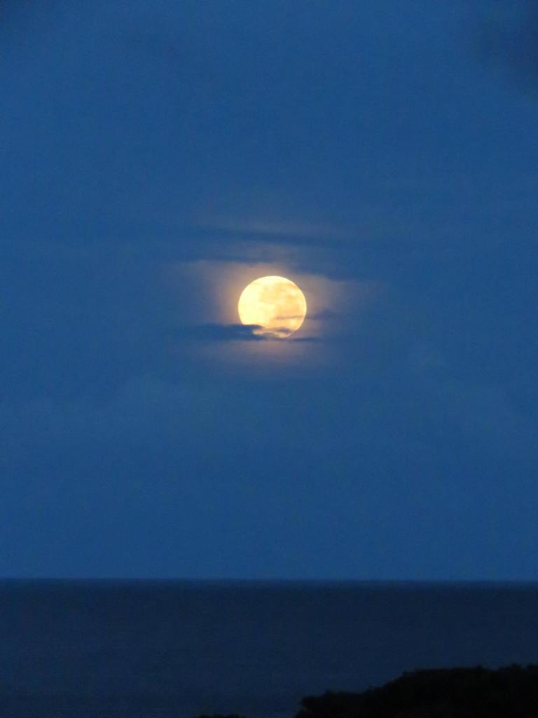
Back in my room after sunset and the sound of kaka filled the air – so many and so loud! The next morning they dominated the dawn chorus (not that you can call kakas screeching ‘song’) and I watched an incredible moon set across the bay from the comfort of my balcony.
The main activity for all Great Barrier getaways is the “great” outdoors and I was keen to get out and explore. The forecast was not good and the promised rain was threatening but at the warmth continued.
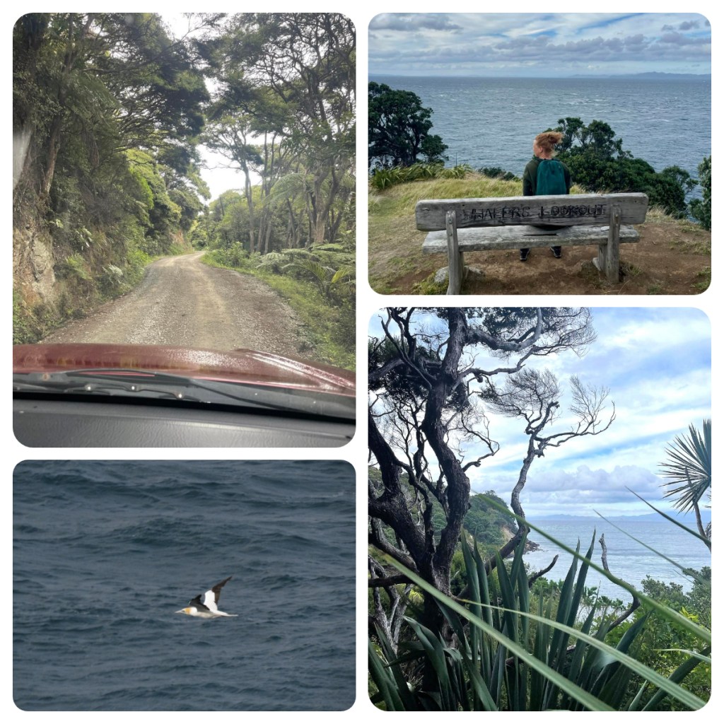
I am lucky enough to have a friend (who I met on a trip a couple of years ago) who was almost a ‘local’ and I drove up the gravel road to catch up her at their house – I learn over the next few days that many roads on the island turn in gravel/dirt roads at some point!
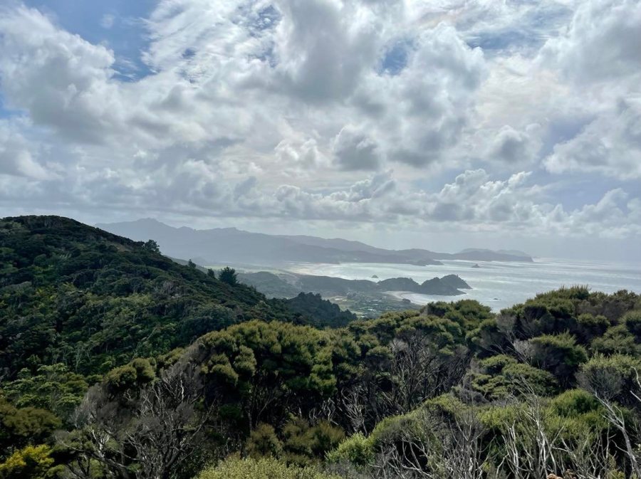
We walked down to Whalers Lookout at the southern end of the island. From here there is an amazing view over the Coville Channel and back to the Coromandel and not surprisingly it was once a spot where whalers of the 1950s/60s would spot whales. It was beautiful but we had to take care not to be blown off the end in the gale force winds. At least the Gannets were making the most of the winds, soaring high. Surviving the winds we went back to her place for tea and freshly baked scones which were perfect.
Refreshed, I was keen to get to see as much I could before the rain set in. First stop was a short walk to Station Rock. This is one of the highest points at the southern end of the island and from here you get amazing views to both sides of the and down it’s length.
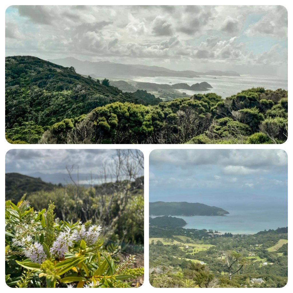
From here I headed down to some of the main spots on the eastern side of the island, firstly the so called Mermaid pools. Supposedly picture perfect rock pools, perfect for swimming … in my reality it was blowing a gale and the sea was rough, coming over the rocks. Not exactly like the pictures lol.
I then drove back along Medlands beach, eying up some of the lovely ‘Bachs’ in the area before grabbing an amazing burger from Swallow Burgers, one of the little food trucks near the airport. The burger was huge, way too big when I was to head back to my friend’s place for dinner. It was a great evening of new friends and a home caught dinner of local fish, crayfish and venison. It was easy to forget about the gales and rain outside.

The rain and wind had not let up by the next morning, but I wasn’t going to stay in the room so I got all my wet weather together and jumped into car and drove to Whangaparapara, a small settlement further north on the western side of the island, but which requires you to cross to the eastern side and drive north, before being able to cross back again. About half way along the road, it became unsealed and I was a little nervous in rain but got there in one piece.
I took shelter from the rain, in a small shed which was basically the local information centre. Whangaparapara was once the industrial centre of the island – for mining, timber milling and whaling. It was actually home to the largest mill in the southern hemisphere in the early 1900’s when it not only processed timber from the island but from Northland and the Coromandel as well.
The shed also has lots of photos of the whaling industry that operated here until the 1960’s. These days it is just a picturesque holiday spot for boaties and campers alike. I can imagine it is stunning when the sun is out 🥴 (I think that will be the theme of the next couple of days.)
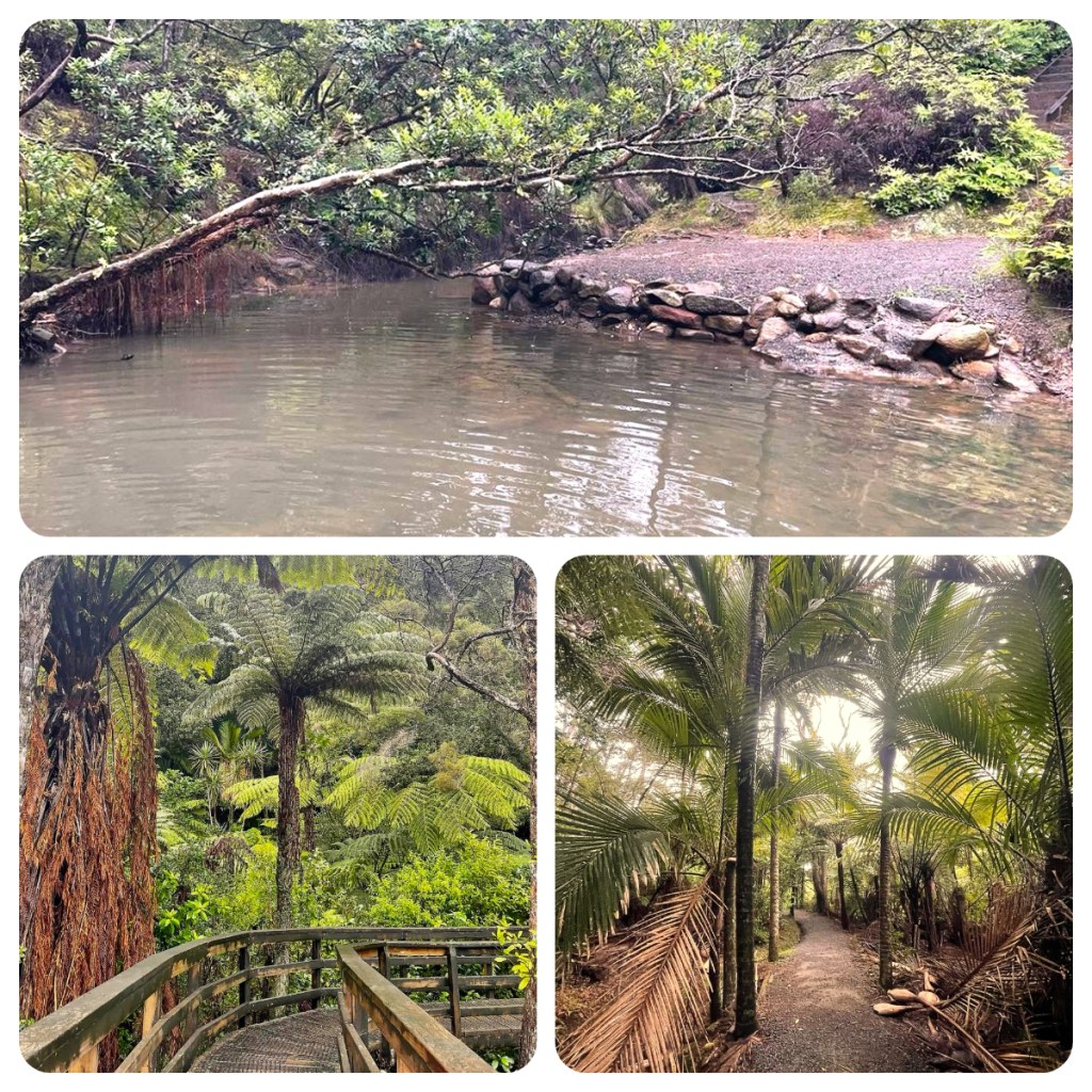
It was now time to don the waterproofs for a short walk down the tramline track (used by the Kauri milling industry) to Kauri Falls, a small but perfectly formed waterfall. What little Kauri that survived the timber industry is now threatened by Kauri dieback disease. A fungus like pathogen that kills Kauri trees that is spread through soil movement, that includes soil on footwear. For this reason, as you enter and exit separate areas of the island, there are footwear cleaning stations where you scrub, wash and disinfect your shoes to avoid spreading soil from one area to the other.

Back in the car and back over the hill, my next stop was one of the most popular on the island, the Kaitoke Hot pools. Natural, undeveloped hot pools that vary in temperature, water volume and quality from day to day. The pools are about a lovely 30 minute stroll from the road along a well maintained track and passed the Kaitoke wetlands (which forms part of the famous Aotea Track).
There are no changing rooms anywhere near the pools, so I made a quick roadside change (there is a small porta loo by the road but the road was quiet and it was easier just to change behind the car) but as it turns out, I needn’t have bothered. There were a couple of large groups at the hot springs (who had just finished the long walk) so I decided just to soak my feet in the warm water – a real natural beauty. There are other smaller pools but I had passed a small group on the way in who had said the others were not that warm so I did not bother explore any further.

Back on the sealed road, the rain was still coming down so I decided to visit some of the island’s few indoor attractions. Firstly the Aotea Community Art Gallery and Grays Homestead Museum, then the quirky Milk, Honey & Grain museum a quirky old building crammed with artifacts from the islands past. Finally headed back over the hill to Tryphena to visit the Elephant Gallery in Puriri Bay, which sells a number of unique arts and crafts from various talented islanders.
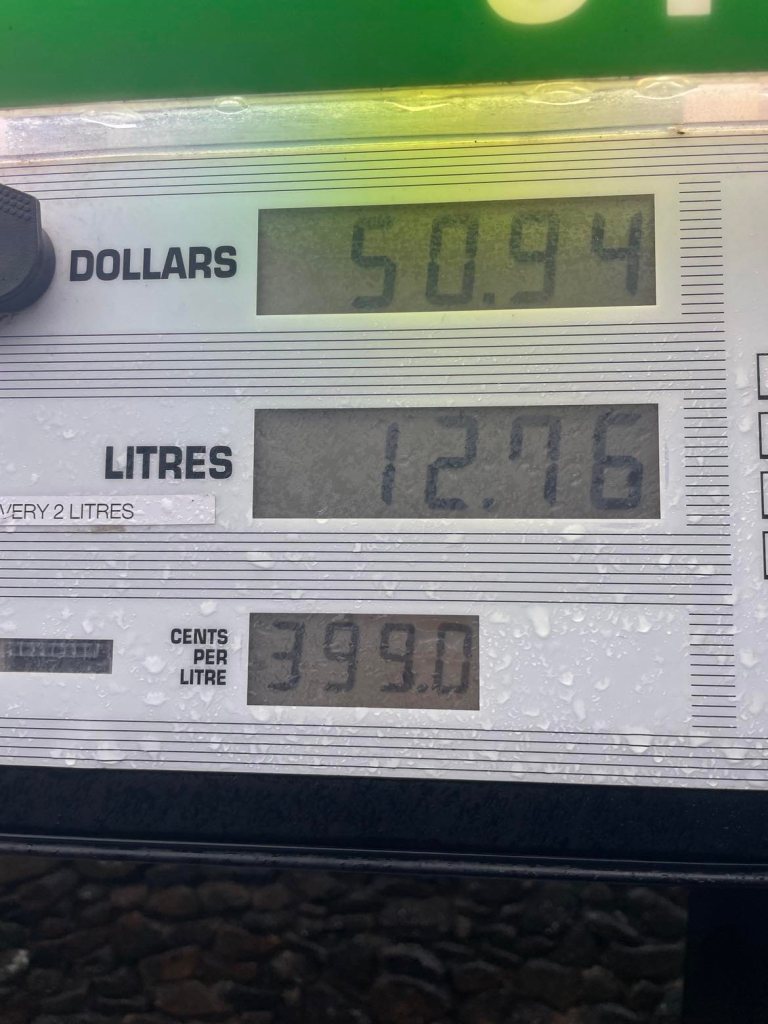
My final full down day on the island dawned and the weather forecast the same – rain, some heavy downpours and winds. But I was not going to let that stop me and I headed out again – stopped to get some fuel before my drive, $3.99 a litre 🤯- my mind was literally blown but there was very little option, so I just put a few litres and hit the road.
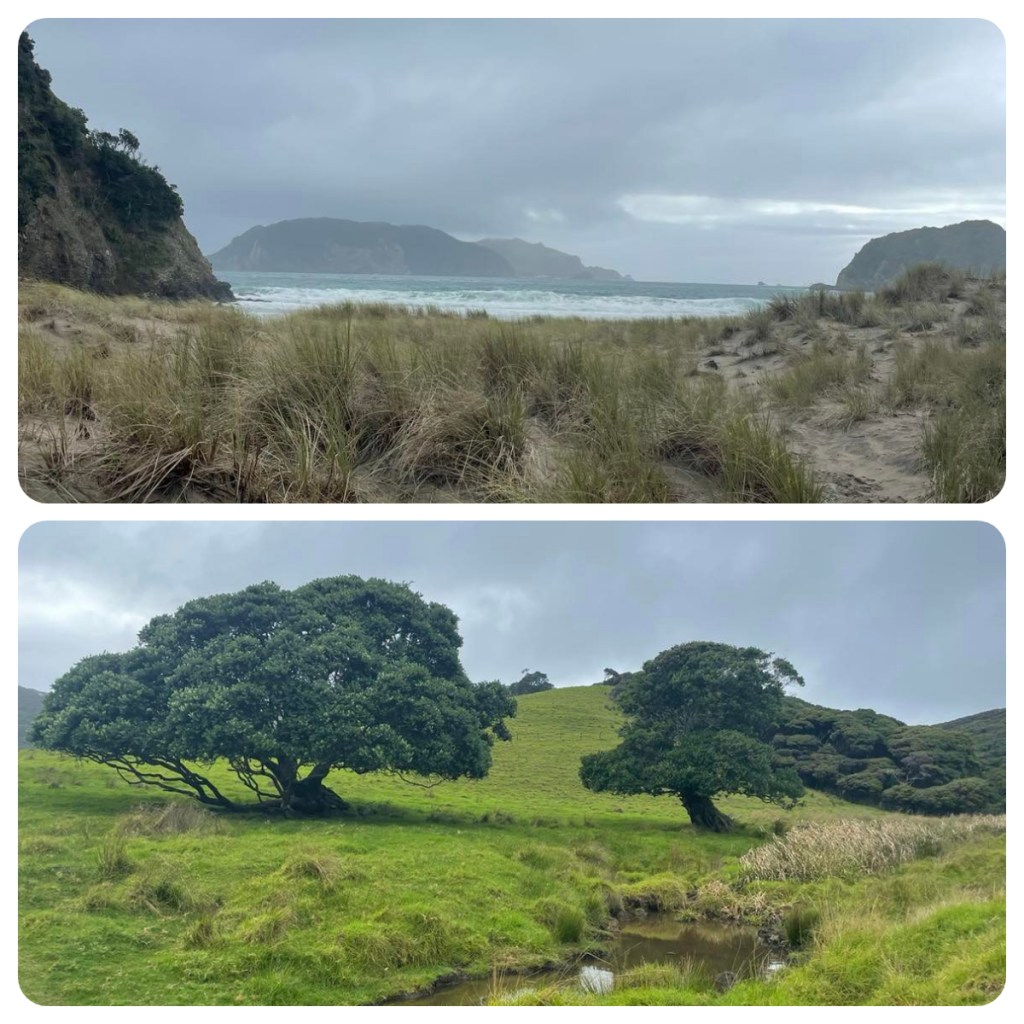
My plan for the day was to head to Port Fitzroy, to the north of the island with some stops on the way. My first detour was on a side road to Harataonga Bay, of course it was a narrow winding dirt road and I started questioning my life choices half way down but had committed to it and there was no way to turn around. I made it down to the campground and took a short walk over farmland to beach. Not too much to see in the weather conditions so I was quickly back in the car and back up the winding road.
As I went further north the mist came down – or I went up, and I decided to leave my stops till the way back – thinking it can’t get any worse lol.
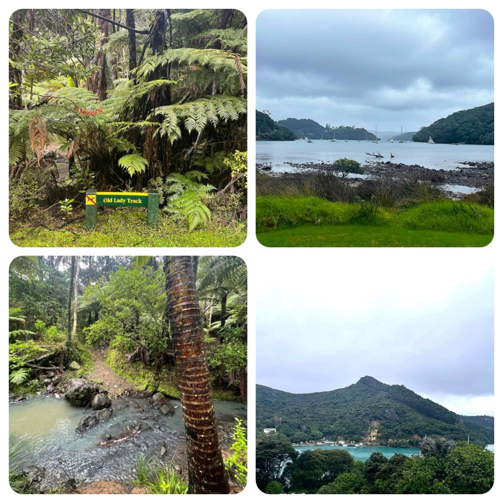
I arrived in Port Fitzroy and it was lovely. A beautiful harbour surrounded by bush clad hills and perfect blue water – just imagine how perfect it would be if the sun was shining 🤯. I decided to do a short walk and spotted one on the map call the Old Lady Track which sounded perfect except I was thwarted in the first few metres by a stream crossing I did not want to do 😂. Instead I headed in to the predator proof fenced area of Glenfern Sanctuary and did a short walk. It started raining again just as I set off so decided against doing the full 2 hour loop.

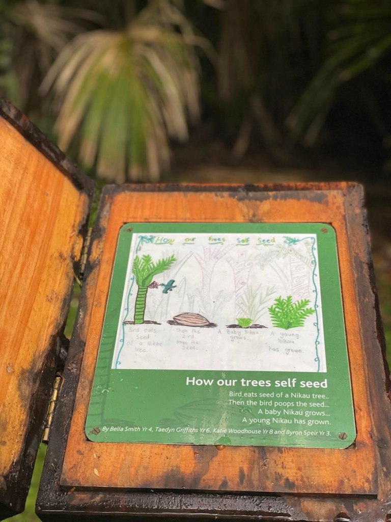
My next stop was in the small town of Okiwi and the lovely little Okiwi Park. It is a more formal park with picnic tables and cute information boards created by children at the nearby school. It was so peaceful with a babbling brook and bird song (I think I heard kakariki) and I could have stay for hours if it was not pouring with rain.


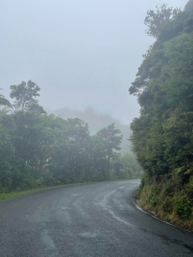
You know when I said I did not think the weather could get any worse … I was wrong. It was raining pretty continuously now 🥴 and the mist appeared to be even lower. So completely kitted out in my wet weather gear, I set off on the walk to the Windy Canyon, one of the most popular walks on the island. I had only planned to walk to the look out, but it was not actually marked (or I missed it in the mist) so the stairs of death I ascended were unnecessary. Thankfully I checked my maps.me before I went too far and saw that I had already passed it. Admittedly it as not the “Instagram” views but it was still pretty spectacular
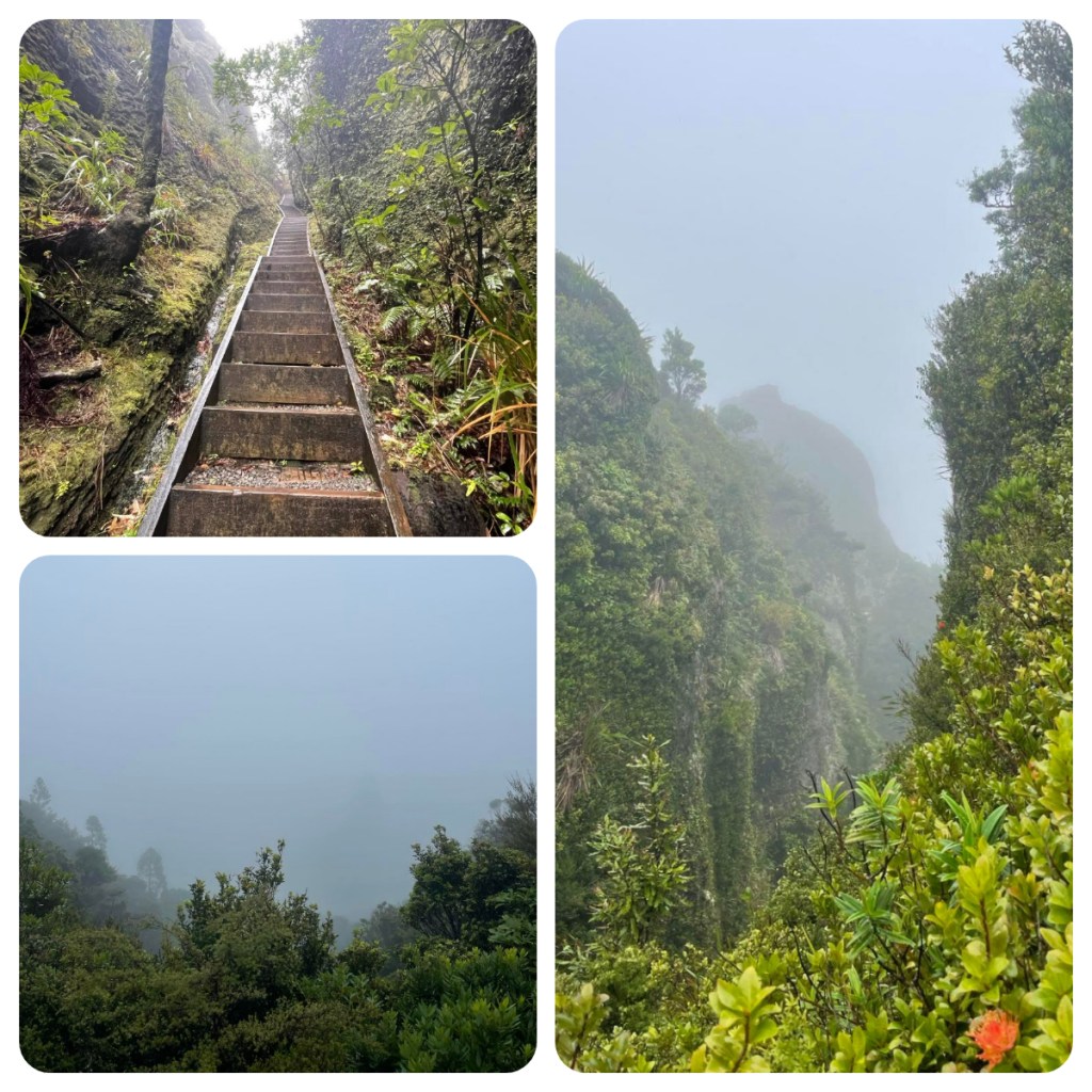
Lessons I learnt from this walk – my raincoat is not waterproof in the slightest!! I won’t name names, but it was not cheap (but is not new and this probably its first intensive test). But my Salewa walking shoes were amazingly waterproof and kept my toes dry 🎉.
On my last night I finally made it down to my ‘local’ for dinner – the local Irish pub (there is one everywhere) – the Currach Irish pub. It was even run by an Irish woman and clearly is the place to be as there were more cars parked outside than I think I have seen the whole time I have been here lol. I hadn’t booked a table and with the rain outside, the small pub was packed so I had a quick dinner and got out before the people who had reserved the tables arrived.
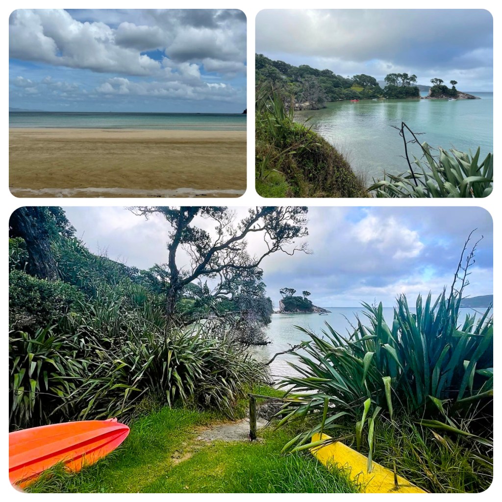
On my final morning it was not sunny but it was not raining so set out for a walk around the three Tryphena bays – Mulberry Grove (where I am staying), Gooseberry Flat and Pah Beach. There was a lovely walkway around the crystal clear turquoise sea front path and over the small hills in between the bays. I spotted a few more Pateke, settling in for the day (they are nocturnal) and watched a couple of black variable oyster catchers bullying a pied (black and white one). They are very territorial, and I am sure they were not picking on it because it was different – I am sure that is just a terrible human trait!!

It was sadly time to finish packing and headed back over the hill for the last time. Thankfully the fuel price on the east side of the island was a bargin at $3.85/ltr and I had to fill the car for drop off and make the short walk to the airfield. When I arrived, there was a power cut, so check ins were done manually with no boarding passes – there are only 14 people on plane so no real problem 😂)
Despite the rain, it was a wonderful little off the grid get away and yet another place I want to come back to – perhaps when the sun was shining and when the Pohutukawa are flowering ❤️👍🏻