East Cape Escape – Part 4:  Ōpōtiki to Te Araroa

November 2021

Despite not having an early start planned, true to form I was up early so decided to go for a walk to explore Ōpōtiki and stretch my legs before I got back in the car for the day’s driving.

Ōpōtiki is the gateway to State Highway 35, which takes you around the East Cape of the North Island and had a large Māori population before Europeans arrived – it is thought to be the location of some of the earliest Māori arrivals.  It was also home to a number of bloody battles in the Māori tribal wars.  So much so, when European missionaries made an initial attempt to reach the town in 1821 they went straight back to Tauranga when they walked in to the “carnage of a just-concluded battle”. 

The missionaries  returned in 1839 and from 1840 to the 1860’s they struggled to continue to “spread the word” as the hostiles continued.   European whalers and traders also became active along this part of the coast around the same time, but it was not until after the fighting (of the New Zealand Land Wars) ceased in the 1860’s that European settlement truly started in Ōpōtiki, initially as a military settlement.

As part of their discharge, the European soldiers were given 50+ acres of land (which was not really their land to give away) depending on their rank.  The land proved fertile and the town became the Government centre in the Bay of Plenty.  Today Ōpōtiki is a relatively quiet town with a population of approximately 5,000.

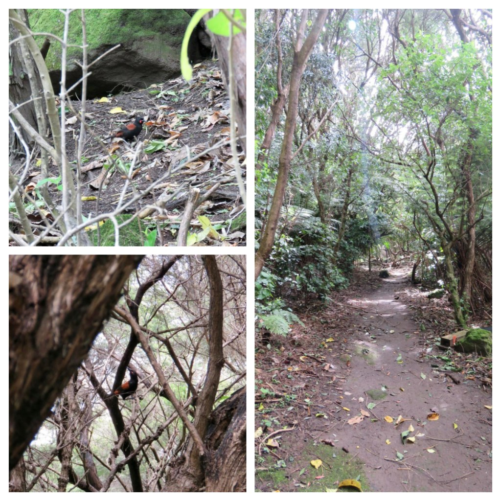
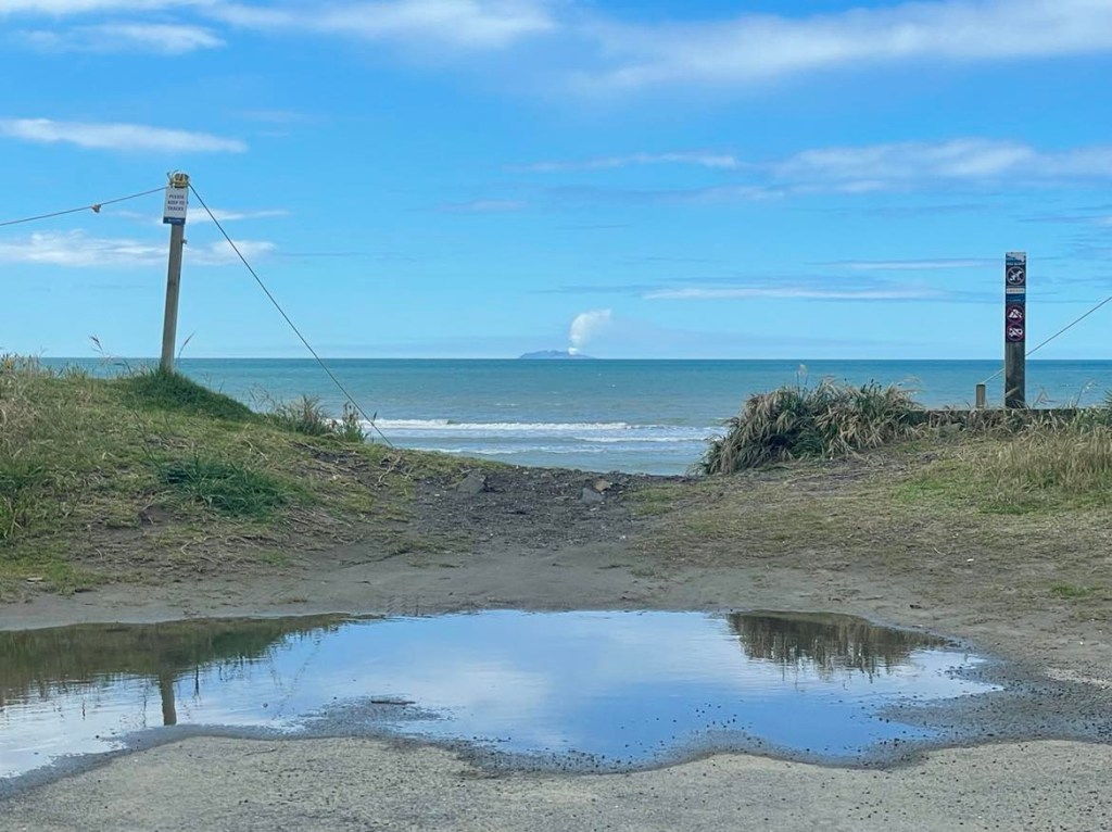
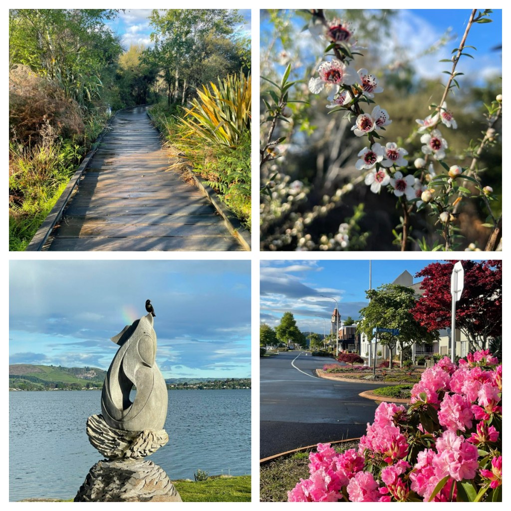
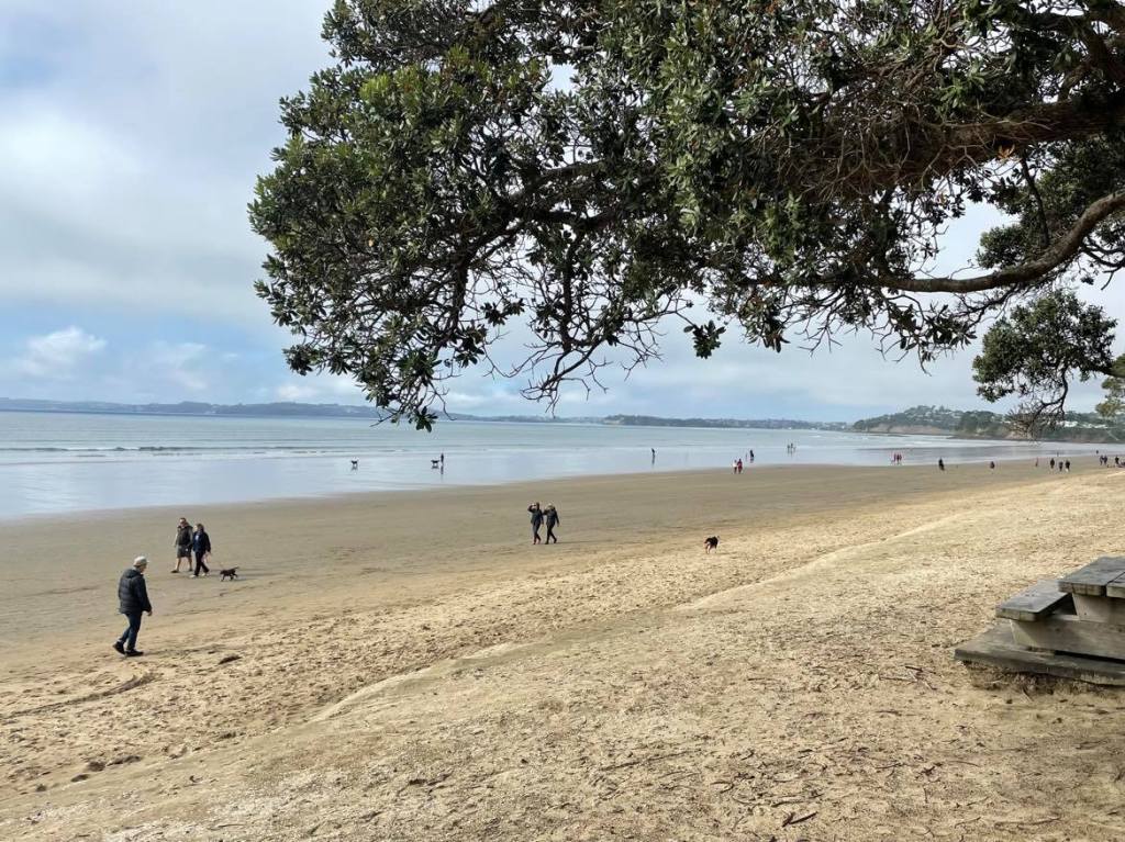
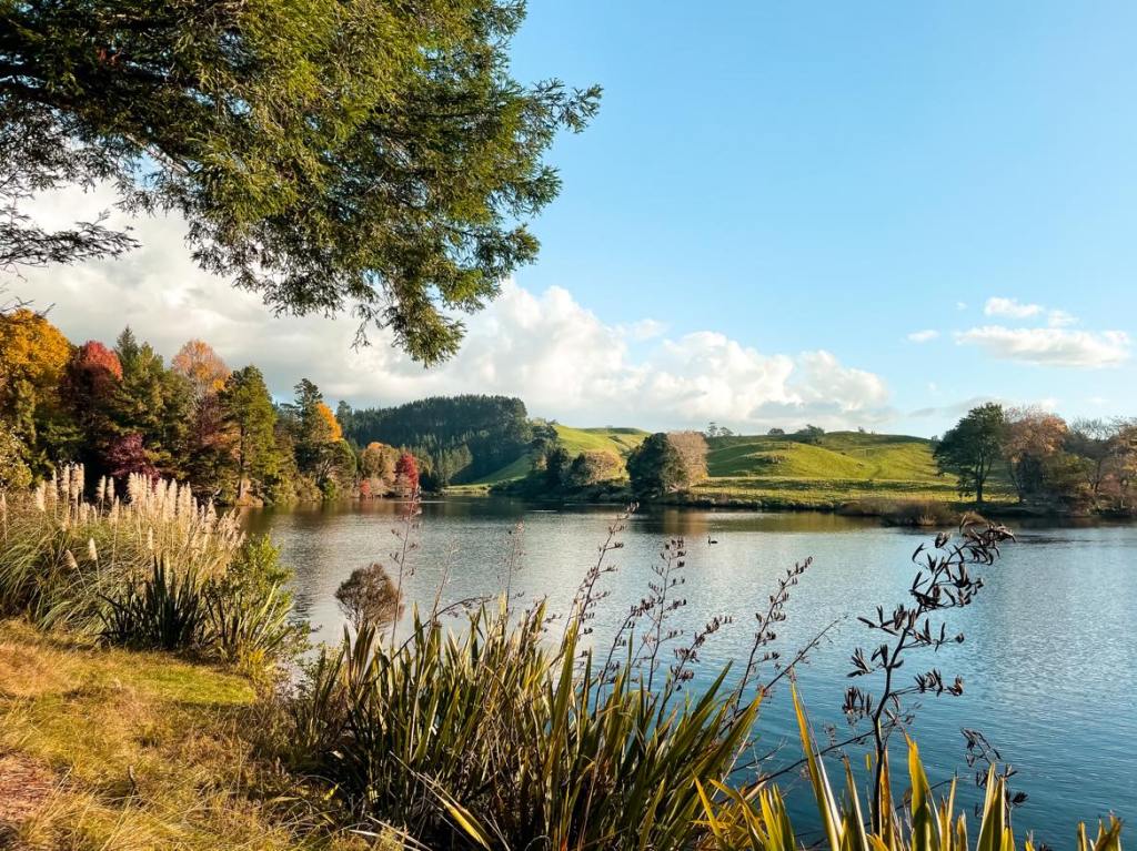
My early morning walk really just consisted of a ‘wander’ – I completely lost my sense of direction as I strolled down quiet beautiful tree lined street (not sure what they were but they were bursting with fragrant flowers).  From here I found the Otara River and followed the pathway along it.  Past slides and rope swings (it must be fun in the summer) with beautiful views back to the Urewera ranges in the distance.  There are also a number of bike trails in the area as part of the Motu Trails.

As always I got a little distracted with the little things.  Flax flowers just coming into bloom and already surrounded by busy bees with full pollen sacs.  And let’s not forget the cool bollards.

Back on the main road, there were lots of bordered up shops 🥲sadly it is a normal sign in small town New Zealand these days.  On the flip side, many of the historic buildings have been well maintained giving you an insight in to the history of what was a busy town – hard to imagine it given the quiet streets I was walking around (ok – it was still 7.30am on a Monday morning).  Definitely no other ‘tourists’ around and people must have thought I was mad taking all my photos. 😂  I loved the street art by local school children which brightened up the town.

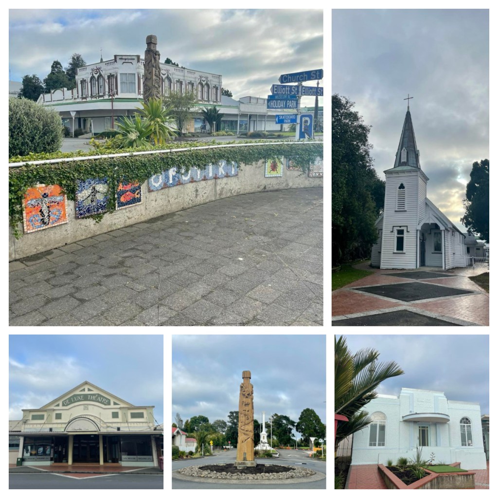
I happened across the Ōpōtiki Museum just as they opened so decided to take a look around.  Like most small town museums it was packed full of ‘stuff’ – match boxes, saddlery, tractors, stuffed animals, machinery, dolls …..  Not an exhibit but I was intrigued by a sign requesting patrons to ‘please remove stiletto shoes to protect varnished floor’ – just how many people turn up in stiletto heels around here??

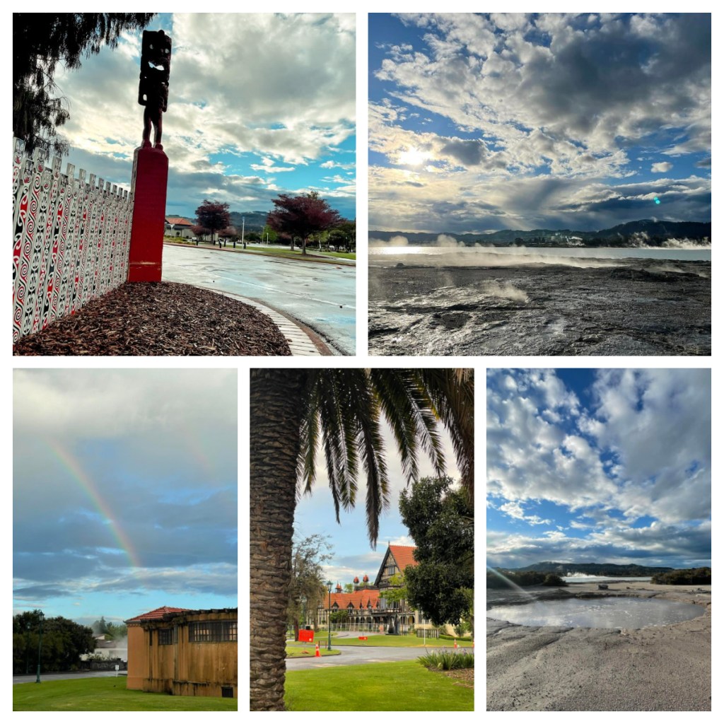
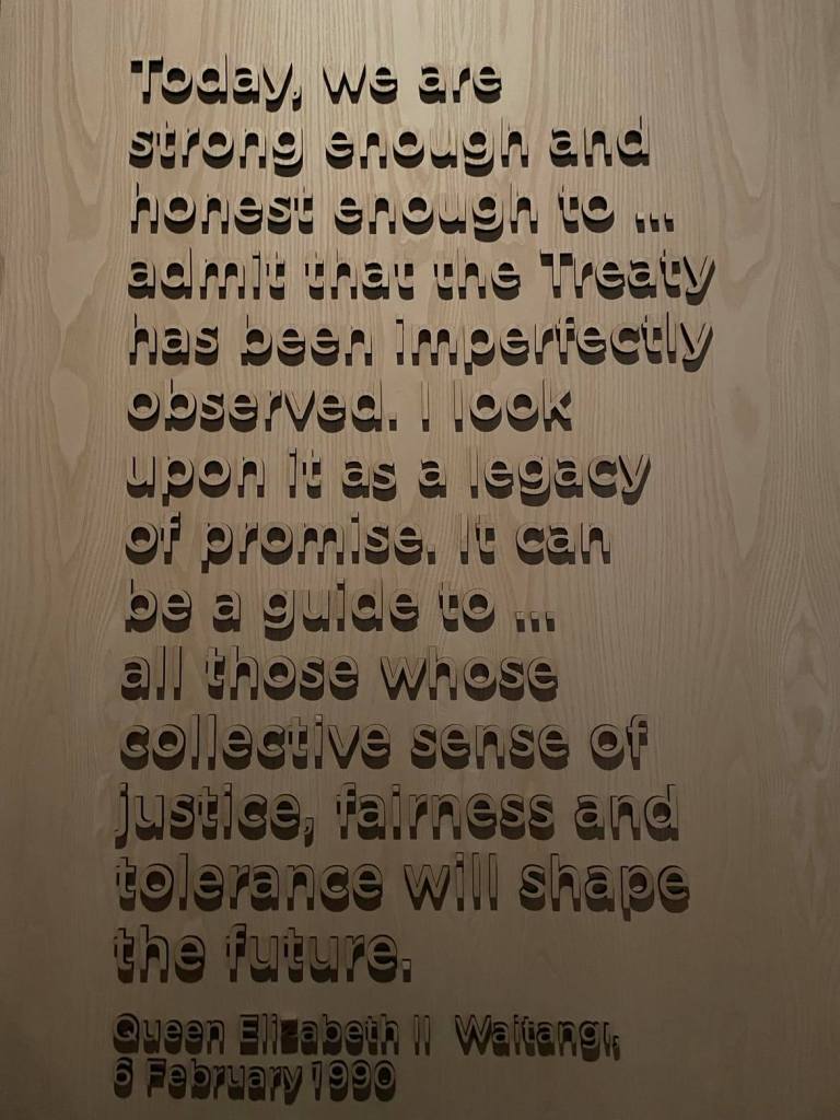
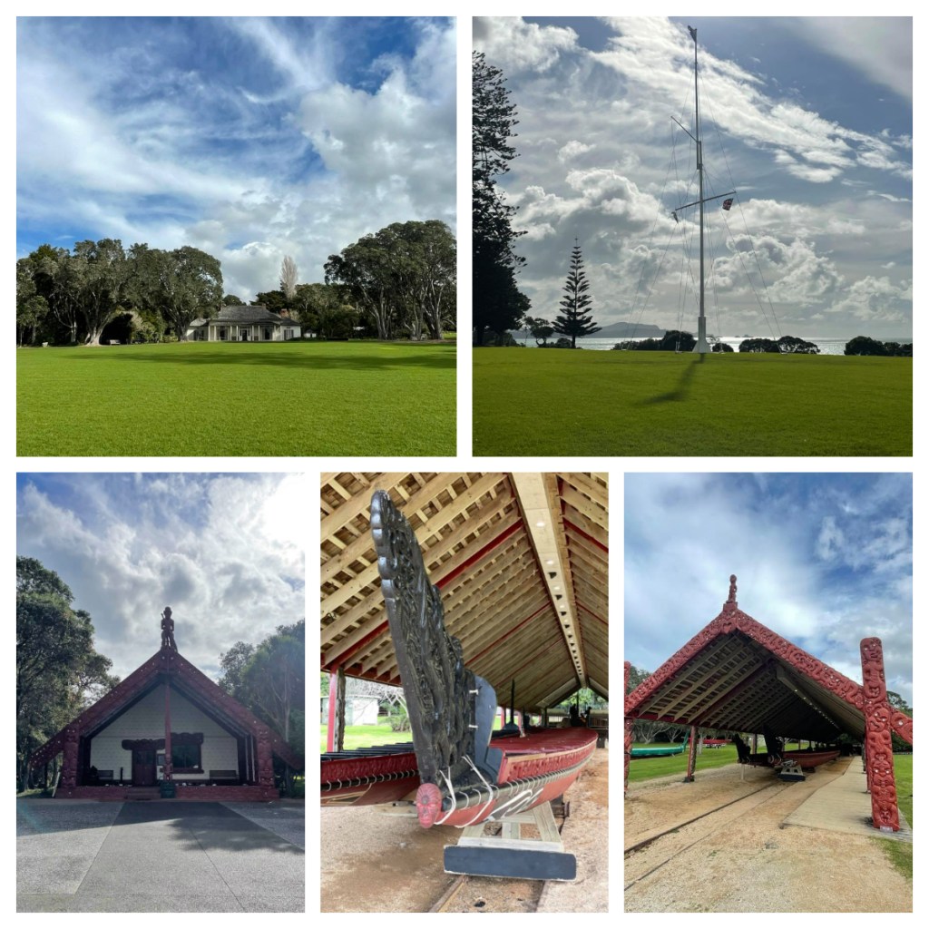
Despite all the ‘stuff’ on the ground floor, the other 2 floors (yes there were 2 whole floors and a mezzanine) has some really interesting information about the history of the town – both Māori and European, as well as information about the journey of the Treaty of Waitangi in the region in May 1840.  (For more on the Treaty of Waitangi, check out my blog from July 2021 Now to the North(land).  They also have a great collection of old photos depicting historical town life.

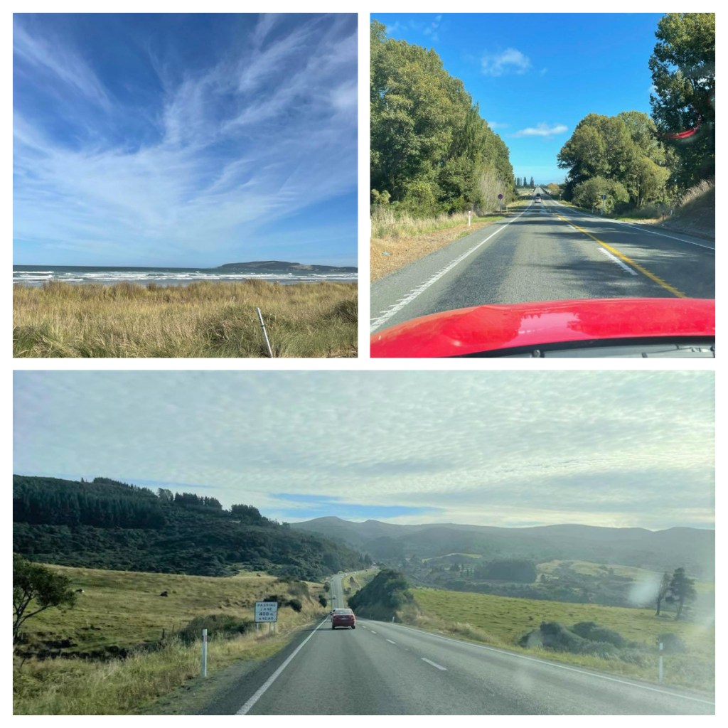
After some breakfast I was ready to hit the road and I set off down the Pacific Coast Highway towards my next stop – approximately 150km or just over 2 hours away.  I had a list of places to stop and sites to see and some were more successful with than others lol.  My first stop was supposed to be at Torere Beach to see a carved Māori gateway at the entrance to school.  Unfortunately there were road works right outside the school, and it was clearly playtime and the children were all outside – I did not want to appear to be some kind of stalker so I drove straight past.

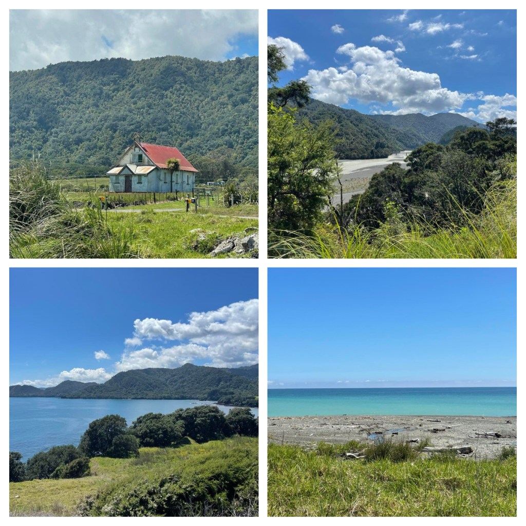
The road was beautiful and lined with large pohutakawa (yep – I was still 1-2 weeks early for them to all be in flower).  I would definitely have a lot more photos if I was not driving or if there were more places to pull over and stop (one of the problems of solo road trips).

My first proper stop was at the small town of Raukokore at its beautiful white stone church – Christ Church.  The church was designed by Scottish man, Duncan Stirling in 1894 and went on to marry a local chief in the church on 1896 and build other churches and buildings around the East Cape.

A Macadamia farm I had hoped to visit was not open so I headed straight to my planned lunch stop at Waihua Bay – ‘world famous in New Zealand’ for being the location for the filming of the 2010 movie Boy, and the home town of its director and actor Taika Waititi (who is actually world famous for his work on Thor movies amongst others).  Interestingly he was actually born in Raukokore – my previous stop.

Just like in the movie, the ‘boys’ were out hanging in front of the General Store which had been featured in the movie, so I didn’t want to take a photo 🥴 .  Instead I had some lunch and a short walk along the water front, which was beautiful before driving the last stretch of driving for the day. Thankfully the ‘boys’ left before I did so I got my shot lol.

As a child, we had had a family holiday travelling along this coast and I had fond memories of staying at the Holiday Park in Te Araroa, so had decided to stay there on this trip – talk about a nostalgia failure!  The place was run down, they were completely unprepared for me and I didn’t feel particularly comfortable.

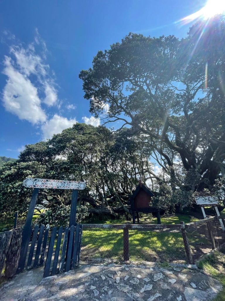
As they were not ready for me, I said I would go down to ‘town’ to get some supplies and then I would come back.  What I was actually doing was going to ‘town’ to consider my options which were actually very limited!  I took a quick break from worrying about where I would spend the night to see what is supposedly the oldest pohutakawa tree in the country – Te Waha-o-Rerekohu which is approximately 600 years old.   

Te Araroa has a population of approximately 600 people, so it was not surprising there was no other accommodation to be found.  I needed to stay in the area and the only place anywhere near was a motel, back towards Hicks Bay so I backtracked and got a room there.  It ended up being a much more expensive night than planned but worth it to be comfortable.  When I called the other place to say I wasn’t staying, they apologised for not being ready and offered to refund me – I said not to bother as it was only fair for them to keep it as I ‘cancelled’ very late – and it was pretty cheap and everyone in tourism is doing it tough these days.

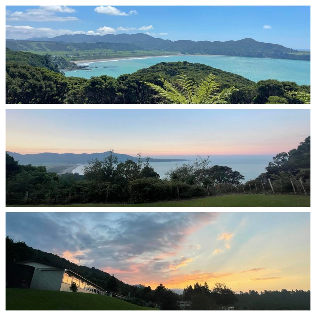
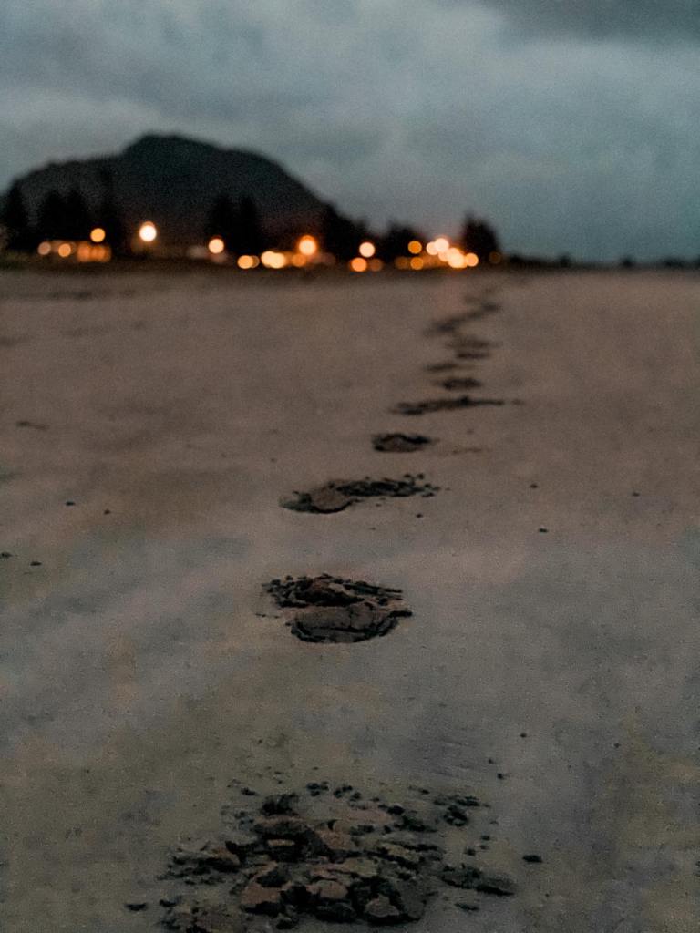
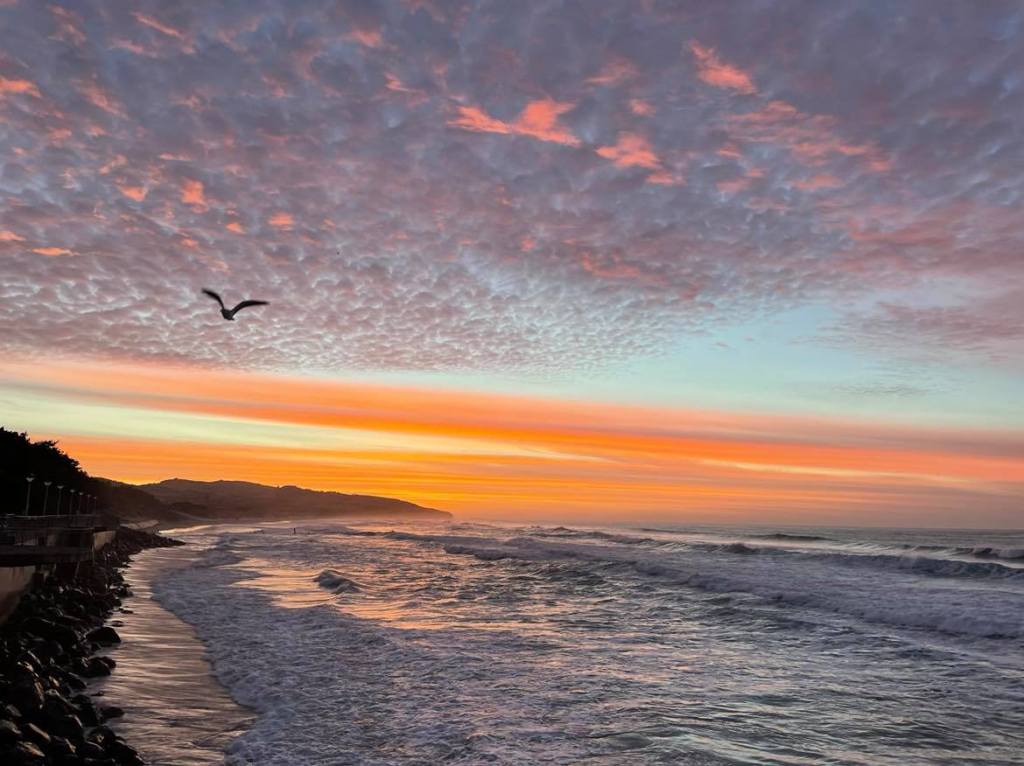
My new room was on the hill overlooking Hicks Bay which was lovely but the room was hot with the sun streaming in so I sat on the deck by the reception with a cold cider enjoying the breeze and relaxed for the rest of the late afternoon.  It was not quite the evening beach vibes I had been anticipating but there was a beautiful sunset nevertheless and I had a good sleep in a comfy room 👍🏻

My lesson for the day was learnt – don’t set your expectations too high when trying to relive a past memory!!

East Cape Escape – Part 3: Flora, fauna and sauna

November 2021

This morning I was off on the road trip part of my road trip (lol) around the Tairāwhiti region – first stop was Whakatane via a lovely road around lakes and through small towns.  But my one and only reason for coming to Whakatane was to do a day trip to Moutohorā or Whale Island. 

Moutohorā is one of the most restricted pest free sanctuaries in New Zealand.  It is situated just 9km of the coast of Whakatane, not far from Whakaari/White Island which is now world famous for its eruption in December 2019 which killed 22 people.  It is just over 1.4km2 and is the remnant of an eroded volcano.  There are still geothermal areas on the island today (which is one of the highlights of the visit).

There is evidence of early Māori and European settlements, including an unsuccessful whaling station (catching only one whale 🥴), mining of sulphur (which was too poor quality) and then rock for construction of the Whakatane Harbour wall (in 1915). 

In 1965 the island was declared a wildlife refuge and once goats were cleared, a planting programme planted 12,000 native trees and grasses.  Today the island is free of not only goats, but rats, cats and rabbits (there were apparently up to ½ million and were used by Cray fisherman for bait) and is a safe haven for 190 native species. 

Because of its pest free status, bio security checks are an important part of the boating process for all passengers.  In the “Biosecurity Caravan” we had to empty our bags to ensure there were no pests, followed by checks of our shoes for soil and seeds and finally we walked through a tray of disinfectant before boarding the boat. 

It was a beautiful warm day, already 18c and sunny before we set off out through the heads at the mouth of the Whakatane River and passed The Lady on the Rock statue on top of Turuturu Rock.  The statue commemorates the bravery of Wairaka, the daughter of Toroa, the captain of the first waka to arrive in Whakatāne after a long and dangerous journey from Hawaiki (their ancestral homeland).  As the men went ashore, the canoe started to draft back out to sea and Wairaka grabbed the paddle to bring the waka back to shore (it was forbidden for women to handle a canoe!)  She cried our “Kia Whakatāne au I ahau” – I will act the part of a man – hence the name of the city.

I was travelling with White Island Tours – the only way you can visit the island (unless you work for the Department of Conservation).  Not surprisingly, they are the main company that used to run the tours to Whakaari White Island prior to the eruption and were on the island at the time, losing staff members.  One of our guides had been on the island earlier in the morning – as the volcano quietly smoking away in the distance, I can’t imagine what is must have been like to have been on the water the day it erupted … or to continue to see it every day!

After a quick 15 minute boat ride, we landed on Moutohorā.  There is no wharf or jetty so need to be prepared to get wet feed as you wade ashore.  Unfortunately we were about 1-2 weeks too early for the full bloom of the Pohutukawa tress which covered the islands.  Luckily there were a handful that bloomed early and where already surrounded by beautiful tuis👍🏻.

The island is a wonderful haven for New Zealand’s wildlife and it was not long before our guide pointed out a juvenile common gecko (in a purpose built ‘gecko hotel’ – really just a small, covered area, which is easy to lift to spy on the current guests).  Did you know that New Zealand geckos, unlike other reptiles around the world, give birth to live young rather than eggs.  It is believed to be an adaption to adjust to the colder climates.  They are not only slow breeding, but they are also long lived – living up to 50 years.

The air was full of bird song, but even louder was the hum of bees around the flowering kanuka.  I am not sure I have ever heard so many bees. 

As we walked through the island (the guides in bare feet lol 🥴) we passed (or were passed by) North Island Saddlebacks – remember I met their South Island cousins on Stewart Island back in 2020.  Here the juveniles are born with their ‘saddle’ markings as opposed to the South Islands one who do not develop it until they are older.

The highlight of the day for me (although the whole day was a highlight) was seeing my first Tuatara in the wild 🙌🏻🙌🏻🙌🏻.  Tuatara are endemic to New Zealand and are the only survivors of an ancient lineage of reptiles whose ancestors lived along side dinosaurs, over 220 million years ago.

They used to live throughout the country, but populations were decimated by rats etc. and today are now only found in predator proof fenced sanctuaries and offshore islands.   They are active mainly at night but also come out during the day to bask in the sun.  To avoid being eaten by adults, juveniles tend to feed during the day!! 

Females can lay 6-8 eggs per year and are buried to keep warm and as with some other reptiles, the egg temperature can determine the sex of the young.  Once hatched they have to fend for themselves and if they survive ‘childhood’ they can live between 80-100 years.  

Did I mention just how excited I was to see them??  I had seen them before in wildlife parks (in fact I used to work at a park where we breed them), but never in their natural habitat.  It was really a thrill for me.

Kiwis have been introduced to the island, but they have not breed well, no one really knows why but it is possible they are competing for burrows with grey faced petrels that also nest in burrows on the ground.   We actually passed the bodies of a couple of petrels along the way – apparently, they are terrible at landing, often using trees/bushes to break their fall, sometimes this does not work for them!

After a walk around some of the tracks we stopped by the hut for some lunch (it used to be possible to stay the night but now it is only used for rangers).  I only had snacks rather than lunch so was finished quickly and took the opportunity to hang around by the flowering Pohutukawa’s (right by the toilet lol) watching the tuis attracted by the flowers.  I was also lucky enough to spot some of the resident Kakariki (a green parrot) but not close enough to get a photo.

From lunch we took one of the tracks around the side of the island and down to Sulphur Bay – not surprisingly the remaining geothermal area on the island.  There were once pools in the area, but they were buried by a landslide, but you can still see the steam vents and you can definitely smell the sulphur.

The geothermal activity makes this an incredible ‘hot water beach’, you can actually see the sand bubbling in some areas it is so hot – it actually felt like I scalded my feet at one point 🥴.   The idea is to dig a hole in the sand, the perfect depth so you get right temperature water in your self made hot pool – too shallow and it was way too hot, too deep and it was too cold!   There are hot water beaches in other parts of the country, but it is rare that you find one which you can have all to yourself.

It was beautiful sitting on the beach in the sun, soaking my feet in the hot water while watching isolatied rain showers across the mainland.  What a way to spend the day.

As we headed back towards the boat, which was waiting for us at another beach, there was word of a whale sighting so instead of heading back to town, we headed out to sea.  It was already 1.45pm and they had said we would be back by 1.30pm – no one was complaining though.   On our impromptu boat trip, we saw diving petrels and penguins in the water 👍🏻 but sadly no whales today.  It was great to see the island from the sea as well, with its interesting rock formations and NZ fur seals lazying around the shore line.

We finally arrived back back in Whakatane over an hour late – what an amazing trip which I highly recommend.

Back on the mainland it was time to hit the road as I still had some driving to do before my stop for the night.   I could not pass up the opportunity to stop at what is apparently New Zealand’s favourite beach, Ohope Beach.  It was pretty impressive with 11 kilometres of beautiful sand beach, despite being a little windswept today.  The Ohope spit itself is approximately 6 kilometres long and only 300m wide at its narrowest, making it very easy to walk from the beach on one side to the Ohiwa estuary on the other.

I was starving by this point, so stopped to have some lunch at the General Store, overlooking the estuary.  Unfortunately it really only had fried food (which becomes a theme for the trip) so fried food it was!

I’d been lucky to avoid the rain so far, but it finally came down as I was driving my last leg for the day.  Despite the rain it was a lovely 35 minute drive around the estuary and through small rural villages to my stop for the night at Opotiki. 

East Cape Escape – Part 2: Hot water hunting

October 2021

From the Waimangu Volcanic Area, I had about 30 minutes to race back towards town to Te Puia, just on the outskirts of the city to visit some more hot water!  In my rush, I parked in the wrong car park (it seems that they have two and I had parked in the overflow one for when they are busy … they were not busy🤦🏻‍♀️), thankfully it was only a few minutes’ walk to the entrance.  In fact, they were so quiet, I was greeted ‘Kia Ora Elaine’ as I walked in the door ❤️.

Straight off their website “Te Puia is home to the largest active geyser in the Southern Hemisphere, Pōhutu, as well as the New Zealand Māori Arts and Crafts Institute – training the next generation of young artists for over 54 years.”   I chose to join one of their guided experiences which took me through the park including the New Zealand Māori Arts & Crafts Institute and the Kiwi Conservation Centre.

I was joined by 3 others from Wellington, and we started in the Marae (Māori meeting house & courtyard) where Kahu, our local guide explained the intricacies and of the meanings of parts of the marae and the beautiful carvings inside it.  Kahu also told us of the hardships Covid has caused on tourist attractions such as this – pre-covid, Te Puia was averaging 7,000 visitors a day (their record was 100,000 visitors in one day)!  Today, they had around 30!  As much as I am enjoying the New Zealand tourist attractions in peace and quiet, it’s hard to imagine the impact the lack of tourists has had on tourism operators and their staff.

Light rain started just as we got inside the meeting house (it had been threatening most of the morning) which was perfect timing and Kahu took the time to tell us stories of the local’s iwi or tribes.  He also explained how the building represents the body of an ancestor e.g., the rafters are the rib cage.  This particular marae was built in 1970 and student carvers from around the country carved an ancestor from their area so each part of the building has a different design.  The building took 10 years to complete as the carvers had to keep going out to get additional work to pay for it!

From here we walked up towards the Arts & Crafts Institute, through a pathway flanked by 8 carved figures.  All important in the Māori legends of creation.  The most famous, or perhaps now world ‘infamous’ thanks to the movie Moana, is Maui- the trickster who is credited with the creation of New Zealand (the South Island being his canoe and the North Island the fish he caught with his infamous hook taken from his grandmother’s jawbone)!

The New Zealand Māori Arts & Crafts Institute is the home of the national school of carving (bone, pounamu (green stone) and wood) and weaving and is tasked with preserving, promoting and perpetuating Māori.  Young Māori from all around the country apply (or are normally nominated by their Iwi) to train at the Institute and can spend 2-3 years training. 

We started in the carving area and the tutors explained to us the process of the training and the carving itself.  There was a lot of information but some particular notes that stuck with me were:

  • Bone carvers start training on stone before moving on to whale bone (gifted by local Iwi or tribes from stranded whales) and green stone.  7.5 out of 10 on the ‘most hardness scale’ 😂 is greenstone.
  • The Hei Tiki, which is a common site on Maraes and in tourist shops represent the first man 
  • The wood they were carving was a 1,700 year old Totara log found in a swamp!! 
  • The Carving school follows the old traditions and admits men only … other carving schools accept women but not this one
  • The students in the weaving school spend their first months learning about the patterns and the stories they tell as well as the products they use to weave e.g., flax before starting to weave.   They also learn how to harvest the flax and collect feathers.
  • As with the carving school, the weaving school try to do things as traditionally as possible, even down to scrapping the flax with muscle shells.

The final stop on this part of the tour was the Āhua Gallery – where some of the works made in the schools are on display and for sale.  Many beautiful and very, very, very expensive items.

From here we headed down to the Kiwi Conservation Centre nocturnal house where they have 3 resident kiwis.  The conservation centre is part of the national breeding for release programme but unfortunately the Kiwi ‘keeper’ was not availability to tell us about them, and Kahu, who I had told previously I had worked at another Kiwi conservation centre in a previous life, asked me to tell the others a bit about the kiwi and the conservation programme – sadly he did not offer me a discount for the work I did lol

And finally, we reached the main attraction – the geothermal area.   Te Puia has 60 hectares of native bush, geyser and mud pools and is home to the largest geyser in the Southern Hemisphere – the Pōhutu geyser.  Apparently when they are not many people in the grounds, the children from the local village swim in the warm streams (not the 140C parts of course) but they can not do it when people are around as there are signs everywhere saying don’t go near the water lol. Kahu had to call ahead to say we were coming!

The landscape here was crazy, just how I would imagine the moon looks like but with steam everywhere.  Bubbling mud and water exploding from the ground.  To round off the tour, we got to enjoy delicious steam pudding which had been cooked in an ‘oven’ in the steam. 

Unfortunately, my free time exploring the area was cut short as the rain that had been threatening all day finally arrived and it arrived hard just as the tour ended!  Despite the abrupt ending, the tour was so worth it and Kahu our guide was awesome.  Highly recommended.

To make up for getting soaked running back to the far away carpark to my car, I drove a short distance out of town to the “Secret Spot” (a woman I had chatted with on the morning boat tour, told me about it).  It turned out it was no secret lol but was a lovely Spa with private hot tubs for hire.  They also have small tubs to soak your feet for free – well, the price of a drink, and after the almost 20,000 steps 😂 I had walked during the day it was lovely place to enjoy a drink.  The rain has eased up, but the thunder was still rolling in the distance.

My final stop on my whistle stop tour of Rotorua was the Redwood Treetop walk in the Whakarewarewa Forest, just outside of the city.  You can do this during the day, but I choose to go at night (I believe you can get a combined ticket if you have the time to do both).   Given the very few people I had seen at the sites during the day, I was surprised by how busy it was, but I managed to weave my way around some of the slower people on the narrow swing bridges.  I was not wowed by it, but it was nice, and the lights/lanterns were cool (designed by world-renowned designer and sustainability champion David Trubridge).  Perhaps it would be better to go during the day when you can read the signs and learn more about the area. 

Next stop …. the coast.

East Cape Escape – Part 1: Volcanic Valleys (Rotorua)

October 2021

As my last trip ended up with a hospital stay – this one started with one. After a late night dash to take my father in – he was admitted around 3am and so I managed to get home for a few hours’ sleep before I had to get up for a morning of work before I headed off.  FYI he is now recovering well and insisted I still go on my trip, as my brother also lives in Christchurch and would be around for him.

So, I was completely exhausted when I got to the airport!  With the resurgence of covid in New Zealand and 2 trips north and a trip to Australia already cancelled I had been on tender hooks whether this trip would ever happen, but I was finally on my way. I had spent a fair amount of time planning this trip, and I had an action packed itinerary written up (matched against a costing spreadsheet 😂🥴) so I hoped I would get it all done. 

The Air New Zealand Koru lounge is a bit different in our covid world, no more helping yourself to food or drinks (someone has to serve you) – first world problems I know. Thankfully Air New Zealand have yet again extended status tiers for another year, so I get another year of the luxury of the lounge before travelling so definitely need to make the most of it 👍🏻🥴

After beautiful views taking off, there was cloud cover most of the way so I could catch a few minutes sleep on the 90 minute flight (small plane = longer flight time) without feeling like I was missing out on the views 🥴, and we arrived in Rotorua to low cloud and a little rain.

It was quick and easy to pick up my rental car from Rad cars and soon I was on my way to the city. After about 10 minutes, I started to smell an odd smell and thought it might be something to do with the car (it was my first time driving a hybrid so wasn’t sure what was normal) … but then I remembered where I was … Rotorua – the hub of geothermal activity and a city that permanently smells of sulphur i.e., rotten eggs!  The city is part of the Taupo Volcanic Zone that extends from Whakaari/White Island off the east coast of the Bay of Plenty, to Mt Ruapehu in the south (both active volcanos).  The steaming vents, bubbling mud pools and spouting geysers are all around the city and have been drawing visitors from around the world since the early 1800s.

I made my way into the city (only a 15 minutes’ drive) and checked in to my accommodation -Rock Solid Backpackers.  Back in backpackers again, but at least this time I had my own ensuite room so it actually was not that cheap but after the sleepless night of the day before I was struggling to stay away so I would have slept anyway!

I took a quick walk to a nearby supermarket and a nostalgic dinner at Cobb & Co I was soon back in my room and ready to sleep.  (Cobb & Co is named after the Cobb & Co stagecoaches of the 1860s. The restaurants opened in the 1970s and where definitely a treat during my childhood.  Most seemed to have closed but I am pleased to see they are having a revival and I have just discovered that one has just opened in Christchurch – you know where I will be lol)

On the first morning of my holiday I woke to rain – It was forecast so I was ready for it.  As always, I was awake early so decided to take a morning stroll down to lake front and the rain stopped just as I stepped outside so that was a win. 

I had a route worked out but was stumped at every turn due to track and road closures. So, I kept wandering towards the lake, taking any road/track I could through the Government Gardens and passed the beautiful Tudor style museum building (which was closed for earthquake damage repairs).   My wandering was helped by a beautiful rainbow over the city.

My wandering paid off and I found a way to the lake but had missed the lookout point at sulphur point noted on google maps, so I back tracked a little and I found the track I wanted (I actually think it was linked to where I saw the track closed sign – whoops).  Finally, I got the views I had been looking for.   The sulphur smell was strong first thing after the rain.  The sound of boiling water/mud and seagulls, the steam, the smell and the sun rising across the lake hit all the senses. 

I wish photos or videos had smell so you could truly experience it with me 😂 According to the sign “the smells of Sulphur Bay and Lake Rotorua are from sulphurous gases belched from the depths of the earth.  The sounds are of gases and steam bubbling and roaring to the surface through narrow vents and pools.”

I was intrigued by a pool named “Cameron’s Laughing Gas Pool”.  Apparently, the mix of hydrogen sulphide and carbon dioxide rising from the pools have the same effect as laughing gas.  It was an early public bathing sight and apparently some bathers would end up laughing uncontrollably, others would pass out!!  It is probably not a bad thing that you cannot get that close anymore.

The site actually holds a lot of history – the site of a large battle between warring iwi (Ngati Tangaroamihi and Ngati Tama) and when gifted to the Crown by the Te Arawa Iwi in 1880, an area for sanatoriums, railways, hospitals, basically the establishment of a town.  They also used to mine the sulphur and in 1916, a ton of sulphur was worth GBP28 on the London market!

By this point I needed my sunglasses and not a raincoat and umbrella I had with me, but I decided to continue around the lake track as it was still not even 7.30 (and I had already taken so many photos and I had not even left the centre of town 🥴).  It was definitely the right decision as it was lovely track around the lake and back through wetlands with a boardwalk through beautiful flowering Kanuka and Manuka.

PSA – don’t forget insect repellent! I have thought about putting it on but when I left my room, but I was only going for a short walk in the rain!   Lesson learnt – always be prepared 😂. Oh, and I also forgot my mask and wallet – thank goodness for payWave and hoodies that you can zip up you’re your mouth and nose so I could get coffee on my way back to my room.

There is so much to do and see in and around Rotorua, but as I only had one day, I had chosen to visit a couple of geothermal regions just out of town.  First up was the Waimangu Volcanic Valley. Just 20 minutes’ drive from the city through some beautiful rolling farmland and punga lined country roads

In 1886, Mt Tarawera erupted, ripping a 17km rift in the earth, creating what is now the Waimangu Volcanic Valley.  The eruption was heard as far south as Christchurch and as far north as Northland! The area was given its name when in the early 1900s a huge geyser erupted in valley, throwing black water, steam and rocks up to 450m in the air – Waimangu is translated from Māori to Black Water.  Further steam blasts in 1917 again reshaped the valley, re-excavating Echo Crater and destroying a nearby hotel. 

The first part of the visit a 4km walk down through the rift valley.  Today it is so beautiful and peaceful, filled with birdsong, I can only image the eruptions of the passes that created what we see today (though the steam vents help with fill in that picture lol).

I had 2 hours to walk through the area and I thought that would be way longer than needed for the 4km walk, but there was so much to see, and such great information provided via the leaflet they give and the great interactive app that provides more information and interactive images showing how the area looked pre eruptions.

The most recent eruption happened in Frying Pan Lake in the Echo Crater and was called the Trinity Terrace Eruption.  In February 1973, a small eruption sprayed mud over 100m in the air.  Thankfully it took place in the middle of the night, and only lasted 15 minutes.

I should probably note that before the 1917 Frying Pan Flat eruption, people could walk over the area that is now Frying Pan Lake!  I was very interested to learn that the bubbling water is not actually boiling – which I always thought was the case.  It is actually carbon dioxide and Hydrogen sulphide gas bubbling up through the acidic lake water that makes it look like it is boiling.

The second part of the experience was a boat trip across Lake Rotomahana – there was only 4 of us so plenty of room to spread out and enjoy the trip mask free.  Prior to the 1886 Tarawera eruption, the area that now forms Lake Rotomahana had been home to two smaller lakes – Lake Rotomahana and Lake Rotomakariri and was the birthplace of New Zealand tourism. 

Pre 1886 Lake Rotomahana was home to the world famous Pink and White Terraces, once considered the 8th wonder of the world.  Tourists from around the world made the long journey to enjoy the natural hot pools in the silica terraces.  Using the interactive app, you could see an image of the terraces as we sailed over their former site.  I imagine they were similar to the silica terraces I visited in Pamukkale in Turkey many years ago.

The lake is also now a bird wildlife sanctuary so there were lots of birds including ducklings and cygnets. 

If you notice the golden colour around some of the vents, it is a phenomenon where blue green algae turn gold to protect itself from the UV in the sunlight, oddly nothing to do with heat or gases in the geothermal steam or water!

Back on dry land, we were shuttled back to the beginning on a bus (which you could hop on at 3 places through the walk).  It was definitely worth the visit and their app was cool, but they should definitely advertise it more and warn people it uses lot of battery, especially if you are using your phone as camera too.

It was a great morning, but I had no time to sit still, I had to quickly be on the move to my next activity ….

Now to the North(land)

July 2021

Now, I am a planner!! I enjoy nothing better than researching trips, pulling together spreadsheets of options and costs – I feel no shame about my need to plan lol.  Unfortunately, sometimes the best laid plans do not pan out and you just need to roll with it – this was one of those trips 🥴. After last year’s birthday trip took us through the snowy mountains to the West Coast of the South Island (remember the snow chain debacle 🤦🏻‍♀️), this year we headed north in the hope of some winter sun … 

Most people (including me), consider Auckland as ‘the north’ of New Zealand, but in fact there is another 400+km (5-6 hours driving) north of the city.  On this trip we were heading in to Northland, going about 3 hours north of Auckland to Paihia in the beautiful Bay of Islands.

Often considered the birthplace of modern New Zealand, the Bay of Islands is where the first European settlers arrived and is home to Waitangi, the site of the signing of the Treaty of Waitangi (more about that later).  And as the name suggests, there are 144 islands in the bay and the sub-tropical climate makes it a popular holiday destination.

It was a beautiful crisp morning for our departure from Christchurch, making for a beautiful flight with perfect photo opportunities.  In stark contrast, Auckland was hidden in fog, which delayed our landing by about 10 minutes but we were soon down, bags in hand and picked up by Snap rentals to get our car and hit the road. 

Despite being a Saturday morning, there was so much traffic driving through the city 🤦🏻‍♀️.  Thankfully we were driving north out of the city where the traffic was not so bad, but I just can’t understand why so many people where driving into the city on a Saturday morning???? 

Our Paihia Airbnb host had given us some tips and had recommended taking a short detour along the scenic, coastal route north, taking us through the small town of Orewa where we took a quick pit stop to grab a coffee and admire the moody but beautiful beach. 

Back on the northern part of the Hibiscus Coast Highway (the same road I took last year from Auckland west to Thames), it was not long before we arrived at Otuihau Whangarei Falls, just outside of Whangarei.    The falls are 26.3 metres high, falling over basalt cliffs and there is a beautiful easy walk around the falls. 

Much to my partners annoyance (lol) I was determined to have one more stop on our drive north, at the small quirky town of Kawakawa to see the public toilets.  Yes, you read that right, I wanted to stop to see the public toilets! 

The Hundertwasser Toilets are the most photographed toilets in New Zealand and are considered to be an international work of art (one of the few toilet blocks with that honour – not surprising I guess).   The toilets were designed by Austrian architect and artist Friedensreich Hundertwasser who lived in the area.  They were built in 1999 using recycled materials from the community and even including a living tree.  It would have been rude not to use the facilities whilst I checked them out lol.

Finally we arrived in Paihia – our destination for this trip.  Our Airbnb apartment was lovely. A short walk to town and a great view out to the sea.  We arrived late in the afternoon so we walked down in to town for some dinner and drinks.  It was a beautiful night with a full moon and the wharf and lights looking lovely.

After a quick early morning sunrise run/walk along the water front, it was not without trepidation we set off for our boat cruise to the famous Hole in the Rock.  It was already pretty windy and the sea looked a little choppy, even in the harbour, but we had bought discounted tickets earlier in the week and this day was the only option.

The trepidation was well founded – we boarded the boat which was already bouncing around in the protected harbour – and the first announcement they made was …. “It’s going to be really rough out there and we probably won’t make it to the Hole in the Rock!!  Get off now if you are not up for that!” So we got off  and thankfully received a full refund.  Instead of the boat trip, we decided to walk the 30 minutes along the waterfront to the Waitangi Treaty Grounds.

As I mentioned earlier, the Bay of Islands is considered the birth place of modern New Zealand.  Firstly due to the fact that this is where the earliest European settlers settled and because it is where the Te Tiriti o Waitangi (or Treaty of Waitangi) was signed in 1840 – for that reason, the Waitangi Treaty Grounds is one of the most symbolically important places in New Zealand. 

The site was home to the first British government representative, James Busby, but prior to the European settlers arriving, it was an important seasonal gathering site for the local Ngāpuhi iwi.  In fact, in one of the earliest recorded land agreements between Māori and the settlers, they allowed the Church Missonary Society to hold 50 acres of the current Waitangi site.

Not surprisingly, the Treaty was as controversial at the time as it has been in more recent years and ‘vigorous discussion’ took place at the Treaty grounds prior to signing by the local Māori leaders.  It was eventually signed and taken around the country for other leaders to sign, making New Zealand the first Pacific island nation to be under European control.

In 1990, Queen Elizabeth the II said of the Treaty ” Today, we are strong enough and honest enough to admit that the Treaty has been imperfectly observed. Look upon it as a legacy of promise. It can be a guide to … all those whose collective sense of justice, fairness and tolerance will shape the future.”

Today, it is the site of the annual Treaty of Waitangi anniversary events, and is a popular tourist attraction.  It has a great museum which explains the history of the early settlers, both Māori and European, as well as shedding some light on the complexities of the Treaty itself.

From here, you can spend hours wandering around the beautiful grounds, exploring Treaty House (which was the original residence of the Busby family) and the Te Whare Runanga, the beautifully carved meeting house.  If you time it right you can enjoy a performance from the local Kapa Haka group – unfortunately we did not time it right as a performance was already part way through.

The flagstaff on the large lawn, looking out to sea, marks the spot where the Treaty was fist signed on 6 February 1840.  The current flagstaff was erected in 1934 and flies the 3 official flags that New Zealand has had since 1834 – the flag of the United Tribes of New Zealand (the first flag), the Union Jack (the national flag from 1840) and today’s New Zealand flag which dates back to 1902.

Don’t miss the walk down to the small beach to see Ngātokimatawhaorua, the world’s largest ceremonial war canoe.  The 35m canoe and it 76 paddlers is launched each year on Waitangi Day as part of the days events.

It was lovely walk back to Paihia, this time along the beach as the tide was out (when the tide is in, the water is right up against the sea wall) and we headed to one of the many great food options in town – CBK (Craft Bar Kitchen) right on the water front was our choice for lunch before a relaxing afternoon – we are on holiday after all lol.

After a night of rain, the sunrise the next morning was beautiful and hazy – it really felt and looked like the tropics and I often struggle to believe that this is even New Zealand?  I made the most of it by heading out for another morning walk /run. Despite feeling so energised first thing in the morning, it did not last long and so decided to take it easy for the rest of the day.  We took a relaxing walk to town and caught the ferry, the 15 minutes across the bay to Russell.

Russell stared life as a small coastal seasonal Māori village, with a number of important Pas on the surrounding hills guarding the approach.  When the Europeans arrived, the used the area as a shore station for shipping. 

As the town grew, it was nicknamed the “Hell hole of the Pacific” due to the nature of it’s settlers – an unsavoury mixture of deserting sailors, escaped convicts, prostitutes and grog sellers. Captain Cook had spread the word about the “most noble anchorage” and it became a popular hub for whalers stopping in for suppliers from the local Māori and European settlers. Many of the buildings in the town still date back to the early 1800s. For European buildings in New Zealand, that is pretty much as old as it gets. One of the most famous buildings is the Duke of Marlborough pub whose tag line is “refreshing rascals and reprobates since 1827” (though the building has burnt down and has been rebuilt twice since then).

Russell was considered of such importance, it was named the first capital of New Zealand in 1840. In 1841 the capital was moved to Auckland but even today, the sleepy little town it still retains it glory as the first capital lol.

The weather was not great and it was raining on and off so we did not stay long before heading back across the bay to Paihia for the rest of the afternoon.  Thankfully it was not cold – not sure it gets cold in this far north (I may need to consider a move lol).

On what was supposed to be our final full day in Paihia, our plans started to completely unravel!  As I was still not feeling well we decided to leave Paihia a day early so we did not have to make the drive early the following morning.  But, before heading to Auckland we took a quick detour to the town of Kerikeri (the largest town in Northland), where there were a number of things I wanted to see.

First stop was Rainbow Falls or Waianiwaniwa, a 27 metre single drop waterfall.  It is only a short walk from the car park to the viewing platform and not surprisingly, it is well known for it’s rainbows in the spray from the water, and yes, there was a rainbow.  Our next stop was a medical centre, as I was feeling even worse by this stage!!  Unfortunately, they could not see me and told us to go to Whangarei Hospital – 1 hour away!!  Thankfully it was on the way to Auckland so we skipped all the other sites and headed south

I was seen quickly at the very efficient hospital and the strong painkillers they gave me helped me survived the rest of the drive to Auckland and home to Christchurch – I was disappointed that we did not get to do all that was planned … but in hindsight it was lucky we got away at all! (Thankfully there were a lot of rainbows and a lovely sunset on the journey to keep my spirits up.)

(Footnote:  They day after we got home I was admitted to hospital and ended staying there for a week (though I am fully recovered now).  So not only were we lucky we got away, but perhaps even more so, lucky we got home!!!)

Wintering in Wanaka

June 2021

A few days before we were to start our road trip south, the region had a 1 in 100 year rainfall, causing severe flooding and damage to many bridges and roads. At one point the roads south were all closed with a number of bridges damaged – to get from Temuka to Christchurch, normally a 2 hour drive, was taking 13.5 hrs … taking the scenic route through the mountains, up the west coast and then back across the mountains!

Thankfully road crews had opened most of the roads by Friday when we left, though some of roads had severe damage – that said, the snow that fell on the mountains in the same storm made for a beautiful views (despite starting off in the fog).  Truly Mother Nature at her best .  (Sorry, not sorry for all the photos lol).

The drive to Wanaka takes around 5.5 hours and we had planned to stop around halfway in Fairlie for lunch at the ‘world famous in New Zealand’ Fairlie Pies … unfortunately it seemed that everyone else seemed to have the same idea and there was a long queue out the door!  We are not fans of queuing, so we pushed on to Tekapo where we bought Fairlie Pies in the supermarket 😂.   The lakes and the snow covered mountains were looking beautiful and it is such a stunning drive.

As usual, I was keen for an early night after settling into our accommodation, and then up early for a morning run.  It is definitely my favourite time of day, and it was so beautiful to run around the lake, with hardly anyone around.  Of course it also meant we got “that Wanaka tree” to ourselves for a few minutes.  As this was a trip with friends, I did not have much planned and didn’t expect to get out and about and do my normal exploring, but I certainly intended to find a good balance.   Rain being forecast for most of the weekend was not going to stop me lol.

After a day spent with friends, I was keen to head out early again to visit some of the sights in the area.  First stop was the famous Cardrona Hotel.  I drove the 20 minutes to the hotel through the morning fog which had cleared a little by the time I arrived.  It was earlier enough that there was hardly anyone around, but not too earlier that coffee was not available😂

The Cardrona area was settled in the 1860s as people flocked to the area to find their futures and fortunes in the gold in the nearby hills.  The Cardrona Hotel was established in 1863, to service the booming the population and it is one of New Zealand’s oldest hotels.

By the late 1890’s most of the prospectors had moved on in the hope of more lucrative areas and the town dwindled to just a few farmers and many of the buildings were moved down the room to Wanaka (which was called Pembroke at the time). 

Today of course, Cardonna is famous for its ski field, and what better than a few drinks in the old Cardonna hotel after a long day on the slopes. 

My next stop was to be the Blue Pools in Mt Aspiring National Park.  From Wanaka, it is about an hour drive around Lake Wanaka and its neighbouring Lake Hawea.  The roads are narrow, winding and one way in some cases, but beautiful views, a little moody and gloomy but still beautiful.

From the car park it was about an easy 30 minute walk through a mature beech and podocarp forest and given the threat of rain, there were not a lot of other people around.   The forest walk was lovely and as always, I got distracted by fantails 😂, but there was no standing still for too long because of the sandflies 😬😬 – they were pretty savage!  The light rain also was become a little heavier, so I picked up the pace to my destination, the Blue Pools.

Not surprisingly, the pools get their name from the colour of their water, the result of light refraction on the clear, snow fed and icy cold water.  It was beautiful, but the Jet boats hooning up and down the river definitely disturbed the peace and bird song!  I guess they are fun if you are on them, a just a little bit annoying if you are not!

I had hoped to do one of the long walks around Wanaka, in particular Roy’s Peak, but the weather forecast was really not great so on our last morning we decided to do one of the short walks around the town – Mt Iron.  A 4.5 km loop, up a hill on the outskirts of the town which gives beautiful 360 degree views around the area. 

We were early enough to avoid the crowds (the walk is very popular with locals), and it was nice to stretch our legs before the drive home.  Next time I will make it up Roy’s Peak!!!

Not to be outdone, the drive home was equally as stunning as the drive down.  In fact, I am not sure any road trip in New Zealand can disappoint – regardless of the weather.

Bopping around the BOP (Bay of Plenty lol)

May 2021

It was a beautiful crisp day in Christchurch for my flight to Tauranga.  A typical blue bird day – blue skies, cold and perfect for views of the mountains after their first winter dump of snow the day before.  I will never get bored of the views flying around NZ – over the Southern Alps, passed Mt Taranaki, and over the North Island central plains volcanos, one of which we flew directly over and down into Tauranga in the Bay of Plenty (the BOP in the title of this blog).

It was a quick 10 minute taxi ride to my motel just across the beach in the world famous (or perhaps world famous New Zealand lol) Mt Maunganui (or ‘the mount’ as it affectionately referred to).  I had met my roommate for the trip in the Air New Zealand Koru Lounge at Christchurch airport and we settled into our motel room before I took a quick walk across to the beach to see the lovely colours of sunset.  (We are on the east coast so just colours, no actually sunset, but I was excited for the sunrise.)

We decided to have an early dinner so walked the short distance to Maunganui Road where there were plenty of takeaway options and a lovely view of the Mt – despite it being cold, the town really had a tropical feel to it.  We had a busy few days ahead so we were grateful for an early night to top up the energy.

This trip was a group trip arranged by Debbie from Women’s Adventures NZ (www.womensadventuresnz.com).  She specialises in active, small group trips around New Zealand, a number of which, like this one, are focused around cycling.  I was the only person in the group who had not been on one of her tours before, most of the others had been on multiple trips and were already booked on others in the future!

I was up early and excited for my sunrise walk up the mount, which sadly didn’t happen 🤦🏻‍♀️.  I ran the 1.8 km from the motel to the base of the mount in the dark, only to be told that it was closed for the day 🥴.  Apparently, they were ‘spraying’ I could not go up or around it!  So, I ran back and then walked along the beach as the sun rose which was still beautiful – oh so beautiful.

I was back to the motel in time for coffee before our pickup at 8.30am for our ride up the coast to Waihi where we would meet the rest of the group and collect our rental bikes.  From Waihi, we drove to Paeroa where after getting our bikes set up, we headed off on the Hauraki Rail Trail.

The Hauraki Rail Trail has a total of 197km of trails in 5 segments and we were going to do the small part from Paeroa and Waihi – only around 25km).  It was a beautiful, easy trail through farmland, bush, over bridges and through tunnels.  Although I had an ebike, but the trail was so easy I didn’t actually need to use the ‘e’ part of the ebike very often. 

We actually cycled right past where I had stayed in November last year (near Waikino) and stopped at Owharoa Fall and then again at the remains of Victoria Battery.  Built in 1897, the battery was built to process the ore from Martha Mine in Waihi (something else I saw in my November visit).  When built, it was the largest industrial complex in the country and the largest crushing plant in Australasia.  Although there is still a lot to see, it is hard to image how big it was in its prime.

Our next stop was for a well earned lunch at the lovely Waikino Railway café.  Did you know you can still catch the Goldfields Heritage train from Waihi to Waikino?  It would make a lovely day trip into the gorge if you don’t fancy the cycle.

The last 8 km of our cycle took us back to Waihi along a beautiful part of the track – passed lush green fields, fat cows, babbling rivers (do rivers babble or just brooks 🤔), small patches of bush and great tracks.   Despite only a doing a small part of the rail trail, it was so worth it. From Waihi we drove back to Mt Maunganui, annoyingly get stuck in the Friday afternoon Tauranga city traffic but made it back in time to freshen up before we headed out for an early dinner in the city and another early night before another energetic day. 

Day 2 and I had a lie in as I knew it was forecast for rain so no plan for early morning exercise.  That said, the rain had actually stopped by the time we got up and it was much warmer than the day before! 

After a communal breakfast, we headed off for today’s activities … though we had a bit of a false start!  We had walked down to the local backpackers to get the rental bikes for the day and turned out they did not have the ones we booked 🤦🏻‍♀️.  It was also quite windy, so it was decided to change plans and do a walk today rather than cycling.  So, it was back to the motel for people to change from cycling to walking gear (all the same gear for me 😂) and then more discussion about what we would do before finally hitting the road to the Summerhill Recreation Park for a walk.  As it turned out, it was lucky we changed plan, as the area where were going to walk was to be closed the next day for a trail run! 

It was a lovely walk through farmland with a great view out to the coast and back to Mt Maunganui.  I was especially excited to see Kaka fly past – it is just amazing to see our beautiful native birds in the wild.  From the farmland, it was a cruisy stroll to the trig point though it was pretty windy at the top and we had to take care not to be blown! 

It was all a bit disorganised trying to work out a different route back through the forest, but we finally found it and it made a nice change from the easy farm trails we took up.  Back at the car park we had the sandwiches we had made for lunch in the lovely sheltered picnic area, with an even better view.

Our next step was at Kaiate (Te Rekekawau) Falls – where we had another beautiful walk to see the amazing full waterfalls.  The walk was all down hill to the bottom of the Falls, so it was a bit of a hike back up but not too bad and it was a good excuse to stop and take in the lovely view back to Mt Maunganui from the track (it seems that everywhere we go, there is a view back to the Mount). 

The final stop for the day was at McLaren Falls Park – 190 hectares of park land, just 10 minutes’ drive from Tauranga.  We arrived just in time to grab a quick coffee (and the most amazing coconut cake) at the Falls Café before they closed and then had some time to walk some of the lovely tracks around the lake admiring the remaining autumn colours in the surrounding trees.

Although I love the organised parts of a group trip and all the things that would be hard to do on my own, I sometimes really dislike the ‘faffing’ that goes along with group travel. I had hoped to join a fun run in the late afternoon and the schedule had plenty of time for it – but all the faffing that went on meant we were back too late for me to do it!! I tend to travel in two modes – organised and on a mission to see as much as I can, or no plan and chill and see where the day takes me. I seem to need something in between for trips like this!

On the way out of the park we stopped for a few minutes at the actual McLearn Falls, just outside the park.  The sun was setting already, and it was getting colder so it really was a quick stop this time!

After all the faffing of the day, I decided to miss the ‘fine dining’ dinner and have so time I my own (and save some money) – winning all round lol.

Finally, on Sunday morning I got up the Mt – and all my hill training certainly paid off.  I think it was easier than the Bridal Path (my regular Christchurch walk), although the stairs were a bit of a killer as I was not used to them 😂.  It was a lovely walk through bush, with the birds waking up and views back down the coast as the sky lightened.  Sun rise was precisely on time – 7.09 👍🏻.  There were beautiful views from the top back down to Papamoa and on the other side over the mouth to Matakana.  It was well worth the early start. 

This morning was our second attempt to do one of our planned cycling trails, so we walked back down to the local backpackers to the get bikes.  As it turned out we ended up on the same old school bikes we saw the day before 🤦🏻‍♀️ – 3 gears, back pedal brake – thankfully the route was supposed to be mostly flat, so we decided to go ahead anyway.  Finally, after lots more faffing we finally hit the road.

The route started with 5km through Mt Maunganui and over the Harbour bridge and onwards to cycle around the Waikareao Estuary.  This was an off road track with some boardwalks that took us through (or should I say over) wetland and mangroves, through bush and along the edge of the estuary.  

After a refueling break (ok – coffee and cake) at Sulphur Point, we then took the seafront trail along to Matua.  Another lovely, easy track and in the sunshine, I almost worked up a sweat.  It really was a beautiful ride and a lovely day all around.  We had our sandwich lunch in the park at the end of trail before tackling the ride back to the Mt.


Because I had not done enough exercise for the day (lol) I decided to walk around the Mt when we’d dropped off the bikes.  It was another beautiful walk and a different perspective on the surrounding area, just as the sun had started to go down.

After such a busy day, I was definitely ready for a soak in the Mount Hot Salt Water Pools.  The hot pools are a bit of an institution in the area since the 1950s when the hot salt water springs were discovered by a water diviner who was trying to find fresh water for the rapidly growing town.  The pool development was built in the 60s and has had significant refurbishment since then – it was a great way to end the day as the sun went down.

Monday morning dawned, my last morning at the Mt, and despite the rain forecast it had not started and the sea was so loud – it was clearly calling me, so I headed out for a final beach walk. It was overcast and moody but not cold and still beautiful in its own way.  After a quick breakfast, I packed up my bag and we headed off just as the rain started 😬

The plan for the morning was to do some more cycling and we drove through the city and over the Wairoa River Bridge, where we were going to pick up our rented bikes.  By this point the rain was coming down – hard!!!  The rain radar looked like a big front coming was coming in and it was only going to get worst, so it was decided that we would cancel the bikes. 

Plan B was to drive to Omokoroa Point (where we were going to cycle to) and as it was still pouring with rain when we got there, we quickly ran in to the cafe for more coffee and food … lol

After about 45 minutes the rain had cleared up some so went for a walk on part of the track we would have cycled – I must admit the cycling has been fun but I enjoyed the walking so you can take in more of the surroundings and take more photos 👍🏻.  And it turned in to a beautiful morning and there were wonderful little things along the walk – a mussel library, a dog library (full of dog toys to borrow), little fairy houses in the tree, swings from trees – all things we would have missed if we had whizzed past on the bikes.

I think I have said this too many times – but it was just beautiful and a great way to finish the trip.  Sadly, it was over too soon, and I was back at the airport for my trip home.

Wellington walks …

(April 2021)

This was a fairly last minute trip to Wellington to meet up with some old school friends (most of whom I had not seen since I finished school) but of course I could not miss the opportunity to get a little exploring in. 

I was focused on walking and after doing some investigation, I discovered that Wellington has lots of great walks not far from the city.  It seemed fate that my accommodation (a private room in the YHA as I could not face a dorm or the extortionate price of the hotels in the city) looked out at the Mt Victoria lookout, so it seemed only right that as soon as I arrived, I changed and headed out. 

I am grateful to say it appeared more daunting than it was, clearly my weekly hill walks are paying off.   There were a few steep parts but in general it was a fair steady walk up to the lookout for a lovely view over the city.  I went back down another way and ended with a lovely walk along Oriental Parade – along the sea front and little man made beach. 

The next day I had decided to catch a ferry across the harbour to Days Bay.  The area was initially the fortified Maori village of Otuamotoro, before being settled by George Day in 1841.  It soon became a day trip and weekend resort for Wellingtonians and a wharf was built in 1895.

I was already starting to regret the idea as I was sitting waiting for the ferry, coffee in hand as an icy wind blasted around the corner and I was praying the crossing would not be too rough. 🥴 It was a pretty choppy crossing (took around 35 minutes in total) but rugged up in all my layers I was ok as long as I sat outside 🥴.   I should note that it is mandatory now to wear masks on public transport – buses, trains, planes and of course ferries (always a pain for facial recognition on the phone 🥴) but despite that I was one of the few with a mask!

Most of the other passengers on the ferry got off at Matiu/Somes Island, the largest of 3 islands in Wellington Harbour.  It has various walks with a great combination of wildlife, history and views but I didn’t really have time to explore this, and Days Bay so carried on.  The sea got rougher on the last part of the journey, and I was glad to reach Days Bay – a cute little seaside village. 

I had planned what I had thought would be a nice easy walk in the East Harbour Regional Park, part of a network of 5 regional parks established to provide outdoor recreation opportunities.  Of course, the area has been popular with walkers long before the formation of the regional park – right back to the late 1800’s.   It turned out, my easy walk through the mature beech and rata forest was more of a serious hike with some scrambling up the steepest parts and at times I was worried I would not make it back to the wharf in time for my planned ferry!  Thankfully I did but was absolutely shattered and it was worth it for the lovely views from the walk and back towards the city.

Back on the ‘barf’ boat, (my personal name for it) and I was surprised to see that it had a bar on it (remember it was only doing a 35 minute journey) and a group of young people bought a bottle of sparkling wine and planned to drink it out of champagne flutes – they went to the top deck so I have no idea how successful they were in the very choppy seas 🥴 

After a wonderful night catching up with old friends, I could not resist one last walk – this time up to the beautiful Wellington Botanic Gardens – it was a bit of a hike up the hill to start but then lovely walks and views from the gardens themselves.  I loved the way they indicate the tracks with lovely insets in the pathways – I did the kowhai track for the views – past observatory’s old and new and gun emplacements.

I barely made a dent in the 25 hectares of gardens and pathways (some established 150 years ago) before it was time to catch the cable car back down.  Another icon of Wellington dating back to 1902, most people probably would have caught the cable car up, but I am a glutton for punishment these days 😂!  But catching it down meant I was back in the city in 5 minutes 👍🏻

It was great to see Tuis and Kereru in the trees around the gardens.  The nearby native sanctuary of Zealandia has done wonders for the Wellington native bird populations.  What a stunning morning for it.

Now to plan some more walks for my next visit.

Cruising the Catlins (and Dunedin)

April 2021

For a long time I have been itching to head south.  Not quite as far south as Stewart Island but south to Dunedin and beyond to the Catlins, an area that covers the south east corner of the South Island.  I finally made it during the Easter break (which in New Zealand includes the Friday and the Monday), and better yet, I had managed to persuade my partner to come with me – winning all around lol.

We left Christchurch just after midday on Thursday, hoping to avoid the worst of the Easter weekend traffic.  Our plan worked and despite the multitude of trucks and campervans we had to pass, we arrived into Dunedin around 5pm – just in time to join the city rush hour traffic!  Fortunately we did not have to far to go to our ocean front hotel, right on the esplanade of St Clair – the seaside suburb of the city. 

We didn’t have an ocean front room (to expensive) but our room was lovely and we could see the sea from our balcony 👍🏻.  The tide was right in and somewhat wild but despite that there were a number of surfers braving the waves.  I wasn’t aware when booking the hotel, but apparently, St Clair Beach is a very popular with surfers, having New Zealand’s most consistent surf break and this weekend, they were hosting the South Island Surfing Championships! 

After settling in to the room, we made the short walk to the local shops to get some food for our drive tomorrow  and fish and chips and wine for our dinner – pure class 😂 and we enjoyed a quiet night in, in preparation of our early start the next day for our Catlins day trip.

I had spent many hours mapping and planning our day (yes, I am that person) and had an itinerary down to the 5 minute intervals 🥴, including tracking weather and tides (which is a must for some of our stops) lol.  As we left the city in the still almost darkness (it was almost 8am) it was raining! I prayed the weather websites I had consulted had it right and that it would clear up.

First stop was a petrol station to stock up on coffee, breakfast and fuel to make sure we were ready for a day on the road with virtually no shops and little phone reception – it was still overcast and raining, not boding well for our first viewpoint 🥴

We left the city on State Highway 1, the longest and most significant road in New Zealand running the length of both islands.  Not surprisingly it is a good road and in this area, runs through picturesque farm land.  We tuned off the main road to head towards our first stop at Nugget Point.

Nugget Point gets its name from the gold nugget shaped rocks (some imagination is needed to see this shape) just of the headland.   From the car park area, it is just a short, relatively easy walk up to the lighthouse, which was built in 1869 and the viewing platform over the ‘nuggets’.   

Thankfully the sky had cleared and although it was not sunny, it was still beautiful with the sun breaking through the clouds on to the sea.   It was windy though and I could not stay on the exposed part of the viewing platform for too long with fear of being blown off lol!  There is a small sign near the track which describes Nugget Point as the “meeting place of rock and waves and wind and tide” – I think that sums it up nicely.

Back on the picturesque road again and the rain started again.  Of course, rain + sun = 🌈👍🏻.

Now there are many waterfalls in the Catlins, and if you have more time, you could spend an entire day visiting waterfalls alone.  Our one day whistle stop tour means we had to choose one, and we chose Purakaunui Falls. 

The falls were only a short 10 minute walk from the carpark, through a native podocarp and beech forest filled with beautiful bird song and just as we reached the falls, the clouds parted and blue sky appeared above the waterfall for the perfect picture 😁.   The waterfall is 20 metres tall and cascades over 3 tiers.  Apparently, it is one of New Zealand’s most photographed waterfalls and even appears on a postage stamp (if you remember those things lol).

It may be worth noting that there is no phone reception in much of this area, so we were relying on the offline maps.me app to get around and we were initially concerned when it directed us along an unsealed road … but never fear, we finally made it out on the main road and we were soon at our next stop at the Lost Gypsy caravan were we had a quick break to caffeinate again 😂and grab an amazing freshly baked hot cross bun.   The caravan itself (and ‘museum’ in the surrounding area) is a weird collection of ‘automata and curios’ (one person’s junk is another person’s treasure) which definitely worth exploring if you have the time.

Back on the road and we had a quick stop at the Florence Hill look out for a view over the perfectly curved Tautuku Beach and out to the Southern Ocean before continuing on a few kilometres to the car park for Cathedral Caves.  We paid our small fee for the car park (more of a donation towards the maintance etc.) and headed down the track through the bush towards the beach.

The caves are only accessible 3 hours per day around low tide so planning was essential to make sure we were here at the right time.  It is also closed during the winter months.  It took us around 10 minutes down the bush lined track and 10 minutes along a beautiful wide wind swept beach – thankfully the sun was out again and it was not too cold.  I loved the bush lined beach.

There were a few people around, but not too many and we managed to avoid the larger family group which would have ruined all my photos 😂. 

The caves themselves have been gouged out of the Jurassic sandstone cliffs by the waves over tens of thousands of years and it is worth taking a torch (or ensuring your phone has a torch on it) if you want to explore the back of the caves.  They are up to 30 metres in height, resembling cathedrals (with some imagination).

It only took 12 minutes to walk/trot back up from the beach to the car park – my weekly hill walks must be paying off 👍🏻.

Just as we got back to the car park, it started to rain … the heaviest rain we had had during the day.  In fact, come to think of it, it seemed to rain every time we were in the car lol.

Our final stop was Curio Bay.  The home the endangered yellow eyed penguins and an incredible petrified forest.  Unfortunately, it was the wrong time of the day to see the penguins as they typically come in from their day at sea near dusk.  Of course, to see the petrified forest, we needed to be there around low tide and they did not correspond. 

The petrified forest dates back to the Jurassic period and the tree fossils you can see today, are approximately 170 million years old.  It was incredible that you can still see the rings of the trees in the ‘stone’.  The trees are the ancestors of Kauri and Matai, and were alive when New Zealand was part of Gondwanaland … if only those trees could talk.  It was a bit windy, but the sun was shining and the contrast of colours between the sky, the sea and the rocks was stunning. 

Just a short walk from Curio Day is Porpoise Bay.  You can probably guess that it is common to see Hectors dolphins in the bay.  We found a spot overlooking the bay to park up for lunch but unfortunately there were no dolphins today.  Before our long drive back to Dunedin, we took a  quick look at the view point over Curio Bay – guess what, it started raining and the wind picked up again, just as I was trying to take photos of birds in the distance but the wind was blowing me around on the exposed headland.   Again that amazing combination of sun and rain resulted in a  rainbow into sea 🌈.

We had an uneventful 2.5 hour drive back to Dunedin (if you don’t count the massive flock of sheep slowly making their way down the road) and the surf competition was still going (it started early in the morning).  We watched it for a little while before enjoying a well earned meal at Spirit House, an Asian fusion restaurant just a few minutes from our hotel – I highly recommend it if you are in the area. 

The next morning we had planned to have a relaxed morning and go for a walk but I woke to see red reflected in the windows of the houses across from us – that was it, I was dressed and out of there in a minute and boy was it worth it, what a beautiful sunrise.  (Not quite the pyjama clad dash I did in Stewart Island – at least this time I had clothes on 👍🏻 lol).

It was a lovely walk around to the Sir Leonard Wright lookout.   The walk took us along St Clair beach, through parks and a little along an ocean front road and then back along the beach – 8 km in total.  It was a great start to the day.

We headed back to the room to shower and change before driving into the city.  I bought a 50c map from the Information Centre and did a little self-guided heritage walk.  Unfortunately, the map didn’t give much information and had pretty poor photos showing the buildings, but it did give me some structure to my roaming so I guess it was worth the 50c?? lol

Dunedin’s history dates back to the arrival of Māori in around 1100AD.  Little evidence is left of their time here, in a place they called Ōtepoti, but it is considered that they survived on seal and moa.  Almost 600 years later, in 1770, Capitan Cook arrived in the area, quickly followed by European sealers and whalers decimating the local wildlife populations.   

The 1800’s brought the gold rush and a Scottish settlement, that turned in to New Zealand’s first city in 1865.  It was also the largest and richest city at the time.   The new settlers tried to replicate Edinburgh and many of the buildings from that time give the city the character it has today.  The name Dunedin come from the Scottish Gaelic name for Edinburgh – Dùn Èideann.   Apparently the ornate Victorian and Edwardian buildings are regarded the best collect of such architecture in the Southern Hemisphere.  Dunedin is also home of New Zealand’s first university – Otago, which was founded in 1869.

My walk ended up at the at the First Church, built in 1873 – the last time I was here photographing the church was 8 years ago, in the snow!!! This time I was fortunate to have some sunshine 👍🏻

From the city, I drove out to the peninsula to Larnch Castle – a mock castle with beautiful views and stunning gardens with plants from all around the world.  Unlike the map I had in town, the entrance fee (you can pay to just look around the gardens or the gardens and castle) to the castle provides you with a brochure that has lots of information about the castle and grounds.

Despite all the “Scottishness”, the castle has no real Scottish roots and Larnch was actually born in Australia and lived most of his life there or in New Zealand.   (At that time, these settlers still considered themselves British despite never setting foot in the mother country.)

Apparently, it is New Zealand’s only ‘castle” and was built by European mast craftsmen in 1871 by William Larnch for his wife Eliza.  No expense was spared.  Unfortunately, over the years the castle and grounds was left and both were in poor condition when purchased by the Barker family in 1967.   They have spent the subsequent decades restoring both the castle and gardens to their former glory (and beyond the case of the gardens) and the entrance fees allows them to continue this work.

The final thing on my list for the day was a walk to Tunnel Beach, a beach just outside of the city.  OMG, the path down was so steep and I was already dreading the walk back up just a few minutes in to the walk down!  This is another beach that you can only access 2 hours either side of low tide.  On this day, low tide was 4.30pm and the track and its nearby on road parking was already busy at 3pm!   

After the steep path down, I reached the tunnel which was narrow and dark (it is a tunnel after all  🥴) but it was all worth it when I made it to the to the beautiful beach surrounded by cliffs

By the time I got back to our hotel, I had most definitely earned pizza for dinner!

Our final morning and it was 19c at 6.30am so I was up early again for a final walk along the sea front and beach.  The sunrise was not as nice as the day before but was so warm and beautiful and surfers were already out warming up for their competition.

Sadly it was then time to get packed and head north, not without a short stop for lunch at the Fishwife at Moeraki village (yes, it is near the Moeraki Boulders).  They have great chips and are amazing for fresh Crays (if you like that kind of thing lol).

Its worth noting that Dunedin has so much more to do than just the mostly outdoorsy things I did.  It has a great museum, brewery tours, albatross and penguin colonies, wildlife boat cruises – definitely something for everyone!

Kiwi summers be like …

Picton – January 2021

FYI this is not a normal blog, much shorter (and perhaps sweeter lol) than normal but I decided it was worth writing even if only as a place holder for the photos!

Now, all good Kiwi summer holidays should have three things – a beach, a boat and a bach (“Pronounced ‘batch’, it is a term Kiwis commonly used for a holiday home. Often located by the sea, river, lake or forest, baches are all about kicking back. They offer the perfect range of accommodation to allow you to holiday like New Zealanders do.” – thanks www.newzealand.com for that thorough definition)!  Now I do not have any of these things, nor do I know people with a bach!  But thankfully, I do know people with boats and New Zealand has plenty of wonderful beaches which are free, so my kiwi summer is saved 😂.

I grew up with English parents so although we always had great summer camping holidays, we never had the boating/water skiing holidays that others had.  Luckily my brother now has a boat (as do some of his friends) and has family holidays like this and every now and then we join them and their friends for a few days. This year we were based in Waikawa – a small bay around from Picton at the start of the stunning Marlborough Sounds.

Picton is a small town and a gateway to both the Marlborough Sounds and the North Island via the Inter Island ferries that plough through the Cook Straight.  Incredibly the Marlborough Sounds boosts 1/5th of New Zealand’s coastline (from the map you can see how) and only 1% of the population lol.  Picton’s population is less than 5,000 which swells massively in the summer.  Sadly, it has been badly affected by the lack of tourists over the last year (it used to get over 40 cruise ships a year stop in its deep water harbour) but hopefully it will bounce back as the world returns to normal (fingers crossed).

No holiday in Picton or the Marlborough Sounds is complete with other the drive up the coast.  Though there are still road works and repairs going on from the massive earthquake that hit the area in 2016 (which closed much of the road for many months) it is still a stunning journey as you travel up the coast, along the beautiful turquoise Pacific Ocean (the photo does not do it justice) and then inland pass the vineyards, even with the intermittent rain.

Day 1 was the perfect day.  This involved getting in the boat (which our friends keep in the marina here) and heading out to find the perfect bush lined deserted bay to set up for the day which happened to be in Kaipakirikiri Bay (according to my trusty maps.me).  And the soundtrack to this perfect day … bird song and the perfectly clear water lapping the shores.

As relaxing as it may sounds, a fully day of sun and sea is exhausting lol.  Even more so for those riding the biscuit (not sure why it is called that, but it is basically an inflatable ring they you sit or lie on and get towed behind the boat) or water skiing – neither of which was me 😂.  I could not even ‘spot’ from the boat (too busy taking photos) without injury. The call is supposed to be ‘skier down’, not ‘spotter down’ 🥴.

After a perfect day on the beach, we tried out a spot of fishing on the way home, but the wind and swell had come up and we gave up after a few attempts.  (I also did not fish but spent my time taking photos of jelly fish lol.)

On our second and last day it was a much more moody morning, but we were out again and explored some of the hundreds of beautiful bays and inlets with bush down to the beach.  It was a bit to cold for water sports, so fishing was on the agenda – again unsuccessfully.

As the seas got rougher, we decided to stop off at the lovely Lochmara Lodge, one of the many small resorts in the Sounds, accessible only by boat.  Their marketing slogan is “Just like Fiji, but cooler…”  – so true lol.

It has 14 rooms and a waterfront café which was a lovely place to spend an hour or two over a beer or a coffee.  They also have an underwater observatory and 11 acres of land which I hope to get back to explore one day.

It is probably worth noting you can still enjoy the joy that is the Marlborough Sounds even if you don’t have access to a boat, as there are ferries/water taxis and also the post boat which you can jump on to move around the bays.

Returning to the mainland we headed back in to Picton for the afternoon, where they were having their annual Maritime Festival which, not surprisingly celebrates maritime history of the region.  Unfortunately, the weather was less than ideal, and it very soon turned into torrential, wind blown rain!  That was our cue to head to the pub!

Picton was original the site of a Māori Pa called Waitohi (Wai meaning water, and Tohi meaning a ritual given to warriors before battle).  When the British arrived, they realised how valuable the deep water harbour was, and ‘purchased’ the land from the local Māori who relocated their pa to Waikawa Bay (where I was staying).

And just like that it was time to head home.  That coastal route home did not disappoint.  After stopping briefly to check out the seals at Ohau Point we stopped again to watch a huge pod of dolphins just of the coast – 100s of them.  You know when the family is out for a nice Sunday walk and 2 of the kids are crazy – constant jumping and twisting 😂😂.  What a perfect end to the trip.